Chesterton in Porter County, Indiana — The American Midwest (Great Lakes)
Restoring Life to a Stream
Photographed by Daniel Barriball, April 21, 2025
1. Restoring Life to a Stream Marker
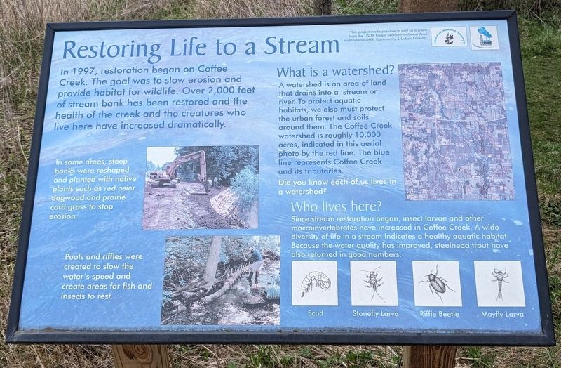
In 1997, restoration began on Coffee Creek. The goal was to slow erosion and provide habitat for wildlife. Over 2,000 feet of stream bank has been restored and the health of the creek and the creatures who live here have increased dramatically.
In some areas, steep banks were reshaped and planted with native plants such as red osier dogwood and prairie cord grass to stop erosion.
Pools and riffles were created to slow the water's speed and create areas for fish and insects to rest.
What is a watershed? A watershed is an area of land that drains into a stream or river. To protect aquatic habitats, we also must protect the urban forest and soils around them. The Coffee Creek watershed is roughly 10,000 acres, indicated in this aerial photo by the red line. The blue line represents Coffee Creek and its tributaries. Did you know each of us lives in a watershed?
Who lives here? Since stream restoration began, insect larvae and other macroinvertebrates have increased in Coffee Creek. A wide diversity of life in a stream indicates a healthy aquatic habitat. Because the water quality has improved, steelhead trout have
this page online
This project was made possible in part by a grant from the USDA Forest Service Northeast Area and Indiana DNR, Community and Urban Forestry.
Erected by Coffee Creek Watershed Conservancy.
Topics. This historical marker is listed in these topic lists: Environment • Parks & Recreational Areas • Waterways & Vessels. A significant historical year for this entry is 1997.
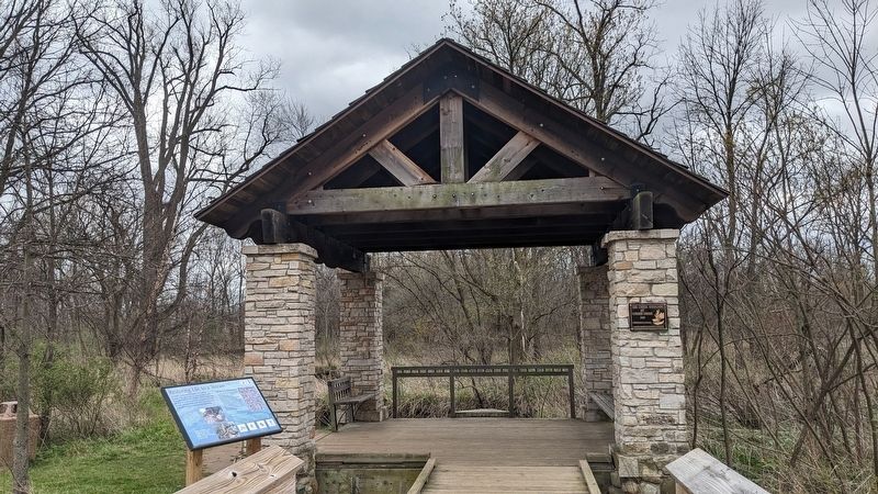
Location. 41° 34.984′ N, 87° 2.332′ W. Marker is in Chesterton, Indiana, in Porter County. It can be reached from Village Point north of Voyage Boulevard, on the right when traveling north. This marker is next to the Creek Overlook along the wooden boardwalk trail in the Coffee Creek Preserve. Touch for map. Marker is at or near this postal address: 2401 Village Point, Chesterton IN 46304, United States of America. Touch for directions.

Regionally, this marker is in Northwest Indiana, specifically on the Indiana Dunes and Lake Michigan Shore, and in the Calumet Region. It is also in the American Midwest and in the Corn Belt. Globally, it is in North America, on the
Photographed by Daniel Barriball, April 21, 2025
2. Restoring Life to a Stream Marker in context
Other nearby markers. At least 8 other markers are within 3 miles of this marker, measured as the crow flies: Mark Randall Taylor - Age 20 (approx. 1.6 miles away); Beirut Memorial Monument (approx. 1.6 miles away); Chesterton Veterans Memorial (approx. 1.7 miles away); Lustron Home (approx. 1.7 miles away); The Brown Mansion (approx. 2 miles away); Chesterton's Historic 100 Block Broadway (approx. 2.1 miles away); Chesterton Bandstand (approx. 2.1 miles away); In Grateful Remembrance of Mrs Rose Howe (approx. 2.6 miles away). Touch for a list and map of all markers in Chesterton.
Credits. This page was last revised on May 7, 2025. It was originally submitted on April 22, 2025, by Daniel Barriball of Chesterton, Indiana. This page has been viewed 111 times since then and 29 times this year. Photos: 1, 2. submitted on April 22, 2025, by Daniel Barriball of Chesterton, Indiana. • Devry Becker Jones was the editor who published this page.
