
Ivy Farm near Charlottesville in Albemarle County, Virginia — The American South (Mid-Atlantic)
Albemarle Barracks Burial Site
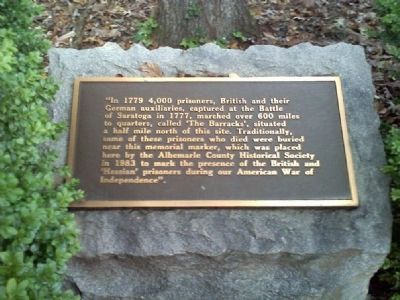
Photographed by Robert H. Moore, II, November 5, 2010
1. Albemarle Barracks Burial Site Marker
Erected 1983 by Albemarle County Historical Society.
Topics. This historical marker is listed in these topic lists: Cemeteries & Burial Sites • Colonial Era • War, US Revolutionary. A significant historical year for this entry is 1779.
Location. Marker has been reported missing. It was located near 38° 5.458′ N, 78° 31.421′ W. Marker was near Charlottesville, Virginia, in Albemarle County. It was in Ivy Farm. It was on Ivy Farm Road (County Route 1015), on the left when traveling east. Touch for map. Marker was at or near this postal address: 680 Ivy Farm Dr, Charlottesville VA 22901, United States of America. Touch for directions.

Regionally,
this page online
Other nearby markers. At least 8 other markers are within 3 miles of this location, measured as the crow flies: Convention Army The Barracks (approx. 0.3 miles away); The Origins of Ivy Creek Natural Area (approx. 1.7 miles away); Legacy of Hugh Carr / The Village of Hydraulic Mills (approx. 1.7 miles away); Six Miles of Trails (approx. 1.7 miles away); “The Albemarle 26” (approx. 1.7 miles away); Old Springs (approx. 1.7 miles away); Rio Hill 1864 Skirmish (approx. 2.8 miles away); Rio Hill (approx. 2.8 miles away). Touch for a list and map of all markers in Charlottesville.
Also see . . . Wikipedia entry for "Albemarle Barracks". (Submitted on November 5, 2010, by Robert H. Moore, II of Winchester, Virginia.)
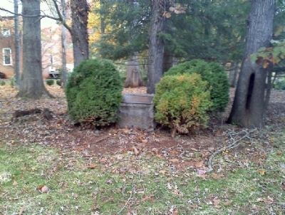
Photographed by Robert H. Moore, II, November 5, 2010
2. Albemarle Barracks Burial Site Marker
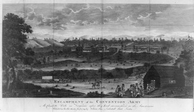
Photographed by Robert H. Moore, II, November 5, 2010
3. Albemarle Barracks
Encampment of the convention army at Charlottesville, Virginia. Sketch appeared in print in 1789.
Credits. This page was last revised on April 27, 2025. It was originally submitted on November 5, 2010, by Robert H. Moore, II of Winchester, Virginia. This page has been viewed 7,071 times since then and 260 times this year. Last updated on April 26, 2025, by Thomas Corwin of Fairfax, Virginia. Photos: 1, 2, 3. submitted on November 5, 2010, by Robert H. Moore, II of Winchester, Virginia. • Bernard Fisher was the editor who published this page.
