Near Moab in Grand County, Utah — The American Mountains (Southwest)
Utah Highway 279 Rock Art Site
Photographed by James Hulse, March 31, 2025
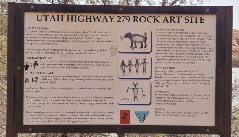
1. Utah Highway 279 Rock Art Site Marker
Prehistoric Native American rock art is found along the Colorado River and its tributary rivers, streams, and side canyons. The rock art is depicted in either pictograph (painted) or petroglyph (pecked, incised, chiseled) images. Anthropomorphic (human characteristic) and Zoomorphic (animal characteristic) images are commonly found.
Archaeologists believe that most of the rock art was created during Archaic (6,000-1000 B.C.) and Fremont (450-1300 A.D.) cultural periods.
Archaic Rock Art
Archaic rock art consists of petroglyphs and pictographs depicting anthropomorphs and zoomorphs. curvilinear lines, zigzags, wavy lines, concentric circles, and abstract symbols.
Fremont Rock Art
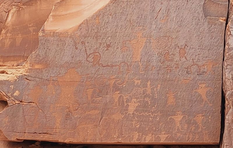
Fremont Indian rock art often depicts trapezoidal anthro-pomorphs with horns, bighorn sheep, dogs, hunting scenes with weapons, and abstract objects.
Archaic and Fremont Indian petroglyphs can sometimes be found on the same rock art panel.
Native American groups ascribe religious functions to some of the rock art panels and consider them to be sacred sites. Rock art has also been interpreted as depicting concepts of
this page online
These petroglyphs and pictographs are fragile and easily marred. Rock art should not be touched for any reason. The oils in human skin add to the breakdown of the rock surfaces. Please help preserve them for the enjoyment of others. Please do your part by only looking and taking photographs.
Things to Look for
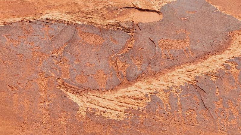
At the northern end of the panel: the round holes carved into the sandstone underneath the left side of the panel once held the roof poles of a structure which was excavated by archaeologists prior to road construction. The structure and rock art were easily accessible before the talus slopes were cleared away to make room for the road. Also look for the "paper doll like cut-outs" that are pictured in the middle of this sign. At the southern end of the panel: look for the large bear with hunters at its nose and over its back pictured in the top center of this sign.
Preservation
How can you help preserve this rock art? Simple! This rock art has lasted on its own for hundreds and in some cases thousands of years. Most of the damage has come from
Photographed by James Hulse, March 31, 2025
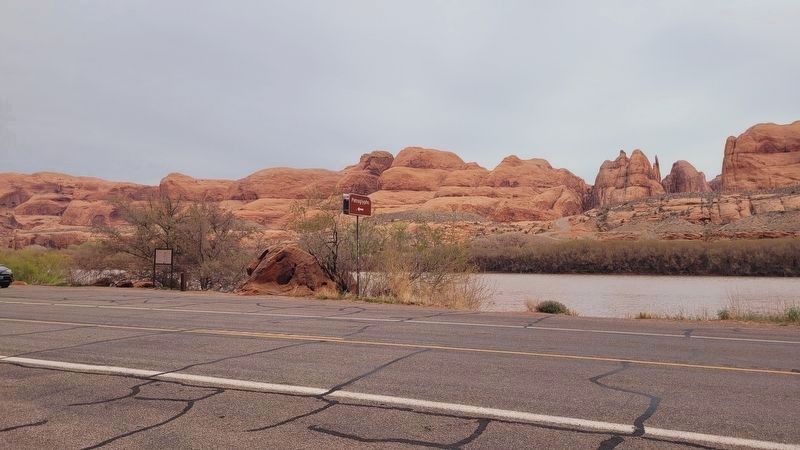
2. The view of the road and marker along the river
The marker is located at the left side in the photograph.
More Info
For more information on rock art in the area please visit the Moab Information Center at the corner of Center Street and Main Street in Moab. Thanks for visiting!
Safety
Highway 279 is very busy! Please Be Careful! Give Vehicles the Right of Way!
Erected by Canyonlands Natural History Association, U.S. Department of the Interior, Bureau of Land Management.
Topics. This historical marker is listed in these topic lists: Anthropology & Archaeology • Indigenous Peoples and Communities • Parks & Recreational Areas.
Location. 38° 32.666′ N, 109° 36.009′ W. Marker is near Moab, Utah, in Grand County. It is on Potash Road (State Road 279) 5 miles south of U.S. 191, on the left when traveling south. The marker and artwork are located along the road. Touch for map. Marker is in this post office area: Moab UT 84532, United States of America. Touch for directions.

Regionally, this marker is in Canyon Country. It is also in the American Mountain West, on the Colorado

Photographed by James Hulse, March 31, 2025
3. Rock Art along the road
Other nearby markers. At least 8 other markers are within 3 miles of this marker, measured as the crow flies: Tracks and Traces (approx. 0.9 miles away); Prowling Predators (approx. 0.9 miles away); Traces from an Ancient Desert Realm (approx. 0.9 miles away); Poison Spider Rock Art (approx. 0.9 miles away); Poison Spider Paleontology (approx. 0.9 miles away); Base Jumping in Moab (approx. 1.2 miles away); Birthing Panel (approx. 1.6 miles away); The Moab Skyway - High Hopes and Big Risks (approx. 2½ miles away). Touch for a list and map of all markers in Moab.
Photographed by James Hulse, March 31, 2025
4. Rock Art
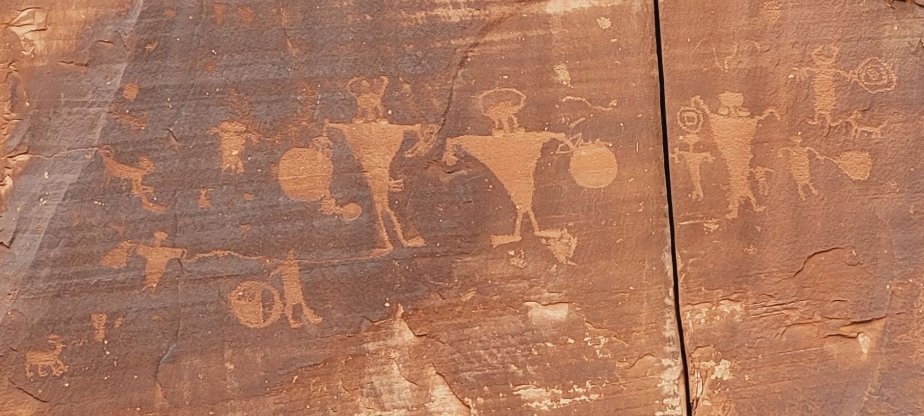
Photographed by James Hulse, March 31, 2025
5. Rock Art along the road

Photographed by James Hulse, March 31, 2025
6. "Paper doll like cut-outs" Rock Art
Credits. This page was last revised on April 29, 2025. It was originally submitted on April 29, 2025, by James Hulse of Medina, Texas. This page has been viewed 130 times since then and 27 times this year. Photos: 1, 2, 3, 4, 5, 6. submitted on April 29, 2025, by James Hulse of Medina, Texas.
