Newark in Licking County, Ohio — The American Midwest (Great Lakes)
Octagon Earthworks
Photographed by Christopher Busta-Peck, March 29, 2009
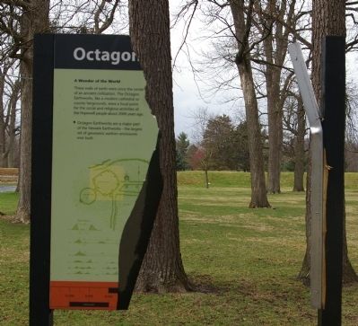
1. Octagon Earthworks Marker
A Wonder of the World
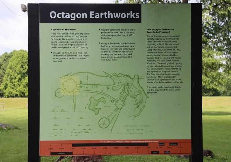
These walls were once the center of an ancient civilization. The Octagon Earthworks, like a modern cathedral or county fairgrounds, were a focal point for the social and religious activities of the Hopewell people about 2000 years ago.
• Octagon Earthworks are a major part of the Newark Earthworks - the largest set of geometric earthen enclosures ever built.
• Octagon Earthworks include a nearly perfect circle 1,050 feet in diameter, and an octagon more than 1,500 feet across.
• Octagon Earthworks may have been built as an astronomical observatory. Many of the walls and gateways are aligned to points on the horizon marking the key moonrises and moonsets in a complicated 18.6 year lunar cycle.
How Octagon Earthworks Came to be Preserved
The earthworks were preserved and partially restored by the Ohio State Militia (now the National Guard) beginning in 1892. The site served as their permanent encampment, Camp McKinley, until 1908. In 1910, the Newark Board of Trade began leasing the site to Moundbuilders Country Club for use as a golf course. According to a story in the Newark Advocate,
this page online
For a better understanding of this site visit the museum at the Great Circle Earthworks.
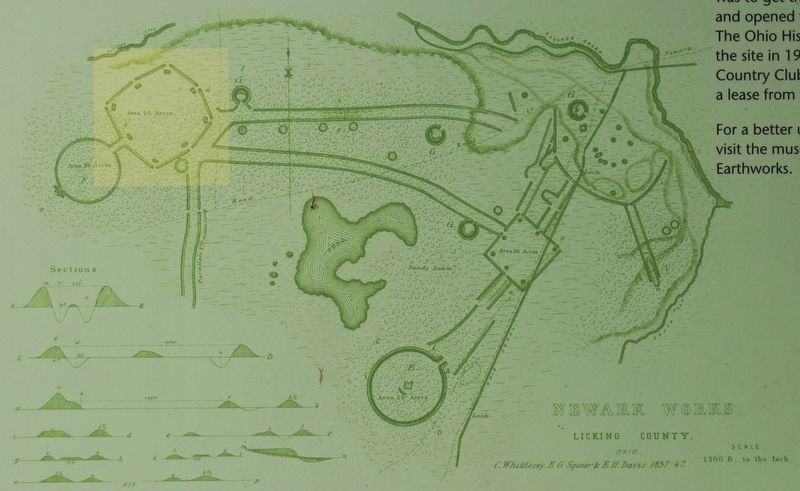
Newark Works
Licking County
Timeline of Ohio's prehistoric cultures highlighting the Hopewell culture.
Topics. This historical marker is listed in these topic lists: Air & Space • Anthropology & Archaeology • Indigenous Peoples and Communities • Man-Made Features. A significant historical year for this entry is 2000.
Location. This marker has been replaced by another marker nearby. It was located near 40° 3.159′ N, 82° 26.765′ W. Marker was in Newark, Ohio, in Licking County. It was on Moundbuilder's Road west of Parkview Road, on the right when traveling west. Marker is near the parking lot adjacent to Moundbuilders County Club. Touch for map. Marker was at or near this postal address: 125 N 33rd St, Newark OH 43055, United States of America.
Photographed by Dale K. Benington, June 11, 2022
2. Octagon Earthworks Marker

Regionally, this marker was in the Columbus Metropolitan Area. It was also in the American Midwest, in the Corn Belt, in Appalachia, and specifically in Northern Appalachia. Globally, it was in North America, the Western Hemisphere, the Western World, and the Anglosphere. Historically, it found itself in what was once the Haudenosaunee (Iroquois) Confederacy, the territory of the Mississippian Culture, and the Northwest Territory.
Other nearby markers. At least 8 other markers are within walking distance of this location: A different marker also named Octagon Earthworks (within shouting distance of this marker); Glenna J. Wallace (within shouting distance of this marker); Chief Glenna J. Wallace (within shouting distance of this marker); Astronomical Alignments (within shouting distance of this marker); Experience Ancient Brilliance (within shouting distance of this marker); The Earthworks (within shouting distance of this marker); a different marker also named The Builders (within shouting distance of this marker); a different marker also named History of the Site (within shouting distance of this
Photographed by Dale K. Benington, June 11, 2022
3. Octagon Earthworks Marker
Close-up view of the illustration that is shown on the marker, which is a map of Hopewell Earthwork complex, which is located in the Newark, Ohio area. The area of the Octagon Mound is highlighted on this map.
Other markers no longer nearby. The Circle (was within shouting distance of this marker but has been permanently removed); The Builders (was within shouting distance of this marker but has been permanently removed); The Octagon (was within shouting distance of this marker but has been permanently removed); History of the Site (was within shouting distance of this marker but has been permanently removed).
More about this marker. The original marker, which was photographed in this post in March of 2009, seems to have been replaced with the one photographed in June of 2022. The replaced marker is identical to the original marker, and is complete and undamaged.
Also see . . .
1. Moundbuilders Country Club. The club utilizes the mounds as part of their golf course. (Submitted on March 31, 2009, by Christopher Busta-Peck of Shaker Heights, Ohio.)
2. Newark Earthworks. Ohio History Connection website entry (Submitted on September 12, 2024, by Larry Gertner of New York, New York.)
Photographed by Christopher Busta-Peck, March 29, 2009
4. Octagon Earthworks
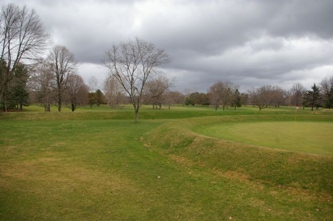
Photographed by Christopher Busta-Peck, March 29, 2009
5. Octagon Earthworks
Credits. This page was last revised on May 7, 2025. It was originally submitted on March 31, 2009, by Christopher Busta-Peck of Shaker Heights, Ohio. This page has been viewed 1,474 times since then and 32 times this year. Last updated on May 7, 2025, by Craig Doda of Napoleon, Ohio. Photos: 1. submitted on March 31, 2009, by Christopher Busta-Peck of Shaker Heights, Ohio. 2, 3. submitted on June 15, 2022, by Dale K. Benington of Toledo, Ohio. 4, 5. submitted on March 31, 2009, by Christopher Busta-Peck of Shaker Heights, Ohio. • Devry Becker Jones was the editor who published this page.
