
New Kent in New Kent County, Virginia — The American South (Mid-Atlantic)
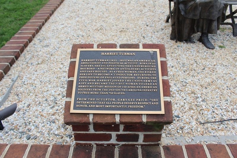
Harriet Tubman
Photographed by Evan Dwyer, April 26, 2025
1. Harriet Tubman Marker
Harriet Tubman (1822-1913) was an American abolitionist and political activist. Born into slavery, she escaped using the Underground Railroad - a network of antislavery activists and safe houses. As a free woman, she risked her life to become a 'conductor' returning to free dozens of enslaved persons. During the Civil War, Harriet joined the Union Army as a spy and became the first woman to lead an armed military mission of 150 African American soldiers from the 2nd South Carolina Infantry to free more than 750 slaves.
From the sculptor, Gary Lee Price: "She determined that all people deserve respect and honor, and most importantly, freedom."
Erected 2021 by Criss Cross Properties.
Topics. This historical marker is listed in these topic lists: Abolition & Underground RR • African Americans • Civil Rights • War, US Civil. A significant historical year for this entry is 2020.
Location. 37° 32.416′ N, 76° 58.616′ W. Marker is in New Kent, Virginia, in New Kent County. It can be reached from Cumberland Road ¾ mile north of Cumberland Estates Road, on the right when traveling north. This marker is one
this page online

Regionally, this marker is on Virginia’s Peninsula and in Coastal Virginia. It is also in the American South, specifically in the Upper South, in the Tidewater, and on the Eastern Seaboard. Globally, it is in the North Atlantic Region, North America, the Western Hemisphere, the Western World, and the Anglosphere. Historically, it finds itself in what was once the territory of the Mississippian Culture, one of the original Thirteen Colonies, one of the Confederate States of America, and the Antebellum South.
Other nearby markers. At least 8 other markers are within walking distance of this marker: A River in View (here, next to this marker); Cumberland House During the Civil War (about 700 feet away, measured in a direct line); Earliest History of Cumberland Plantation
Photographed by Evan Dwyer, April 26, 2025
2. Harriet Tubman Marker & Sculpture
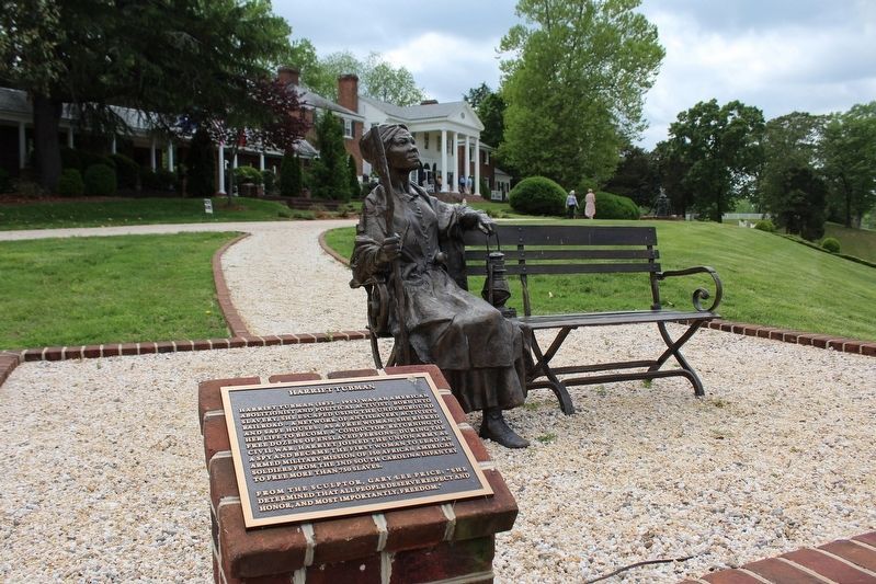
Cumberland Plantation, built ca. 1670 and successively modified into the 18th century (the white portion only - the brick wings are from the 1930s), is visible in the background.
More about this marker. Photographs taken during Garden Week 2025 when the estate was open to the public.
Related marker. Click here for another marker that is related to this marker. An additional accompanying marker contextualizes the sculpture's placement.
Photographed by Evan Dwyer, April 26, 2025
3. Harriet Tubman Marker & Sculpture
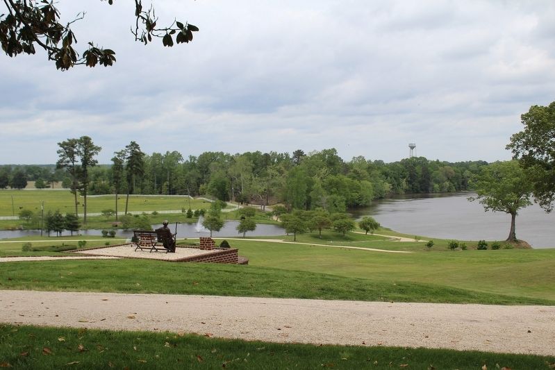
View of the sculpture, with marker encased in brick to the right of it, with the Pamunkey River in the background. The pond is man-made. The plains beyond once held Cumberland Town, which only missed becoming the capital of Virginia by three votes. The area also served as a camp for 120,000 US soldiers during George McClellan's Peninsula Campaign.
Credits. This page was last revised on May 11, 2025. It was originally submitted on May 9, 2025, by Evan Dwyer of Richmond, Virginia. This page has been viewed 243 times since then and 63 times this year. Photos: 1, 2, 3. submitted on May 9, 2025, by Evan Dwyer of Richmond, Virginia. • Devry Becker Jones was the editor who published this page.
