Grafton in Washington County, Utah — The American Mountains (Southwest)
Grafton Cemetery
1862-1924
Photographed by James Hulse, April 7, 2025
1. Grafton Cemetery Marker
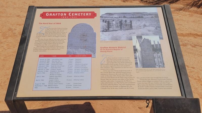
The Hard Year of 1866
In the four years after Grafton's founding in 1862, death came in its usual manner, taking the young, the sick, the old: Mary Lavina Andrus died at one year of age; Mary Jane York, 28, died of tuberculosis, Byron Lee Bybee, 65, died of "poor health." And there were accidents: Joseph C. Field, 9, was dragged to death by a horse.
But when the year 1866 hit, the settlers must have wondered if their Heavenly Father had abandoned them. Thirteen people died in rapid succession, taken by epidemics, a tragic accident and by the friction caused when new folks rub up against old.
Many headstones are missing. It's believed 74 to 84 graves exist. The Grafton Cemetery also includes Southern Paiute people who worked and lived alongside early settlers.
Date - Name - Age - Cause of Death
January 18, 1866, John William York, 10 years, Diphtheria • January 25, 1866, Asa Uriah York, 3 years, Diphtheria • January 25, 1866, James Jasper York, 5 years, Diphtheria • February 9, 1866, Frances Ann Field, 7 years, Diphtheria (Daughter) • February 9, 1866, Sarah Ann Brook Field, 37 years, Diphtheria (Mother)
this page online
Grafton Historic District
On the National Register of Historic Places
The Berry headstone reminds us of a time when there wasn't enough to go around. When the Utah Territory was settled, the upper Virgin River was already inhabited by native Southern Paiute peoples. Pioneers often settled the same places required by these native people for their subsistence. This competition for land and scarce resources led to conflict.
At the same time, Navajo people living south of the Colorado River were squeezed
Photographed by James Hulse, April 7, 2025
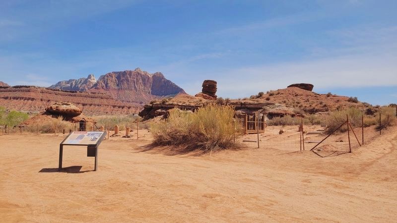
2. The view of the Grafton Cemetery and Marker from the parking area
During this time, Mormon Church leader Brigham Young ordered villages in southern Utah to coalesce in towns of at least 150 men. Grafton and other Virgin River towns were deserted as townsfolk consolidated Rockville. Grafton farmers returned daily to tend the hometown fields, and by 1868, Grafton was resettled.
Captions
(Photo #1) Historic photograph of Grafton Cemetery.
(Photo #2) Robert Madison Berry, 24, his wife Mary Isabella Hales Berry, 20, and brother Joseph Smith Berry, 22, were killed by Navajo raiders.
Topics. This historical marker is listed in these topic lists: Cemeteries & Burial Sites
Photographed by James Hulse, April 7, 2025
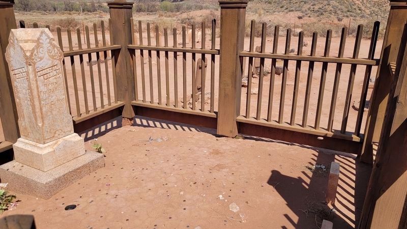
3. Berry Family gravestone
On April 2, 1866, Robert M. Berry (Brother of Joseph), Isabella Hales Berry (Robert's Wife) and Joseph S. Berry (Brother of Robert) were killed by Indians.
Location. 37° 9.765′ N, 113° 4.867′ W. Marker is in Grafton, Utah, in Washington County. It is on West Grafton Road (County Road W 230 S) 1.6 miles west of Smithsonian Butte Rd, in the median. The marker is located in front of the cemetery. Touch for map. Marker is in this post office area: Springdale UT 84767, United States of America. Touch for directions.

Regionally, this marker is in Utah’s Color Country. It is also in the American Southwest, in the Mountain West, and on the Colorado Plateau. Globally, it is in North America, the Rocky Mountains, the Western Hemisphere, the Western World, and the Anglosphere. Historically, it finds itself in what was once New Spain and also Mexico’s Alta California.
Other nearby markers. At least 8 other markers are within 6 miles of this marker, measured as the crow flies: Grafton, Utah (approx. 0.3 miles away); Rockville Bridge (approx. 2.4 miles away); a different marker also named Rockville Bridge (approx. 2.4 miles away); Discovery of Zion Canyon
Photographed by James Hulse, April 7, 2025
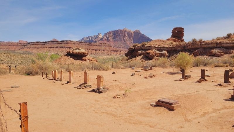
4. Grafton Cemetery
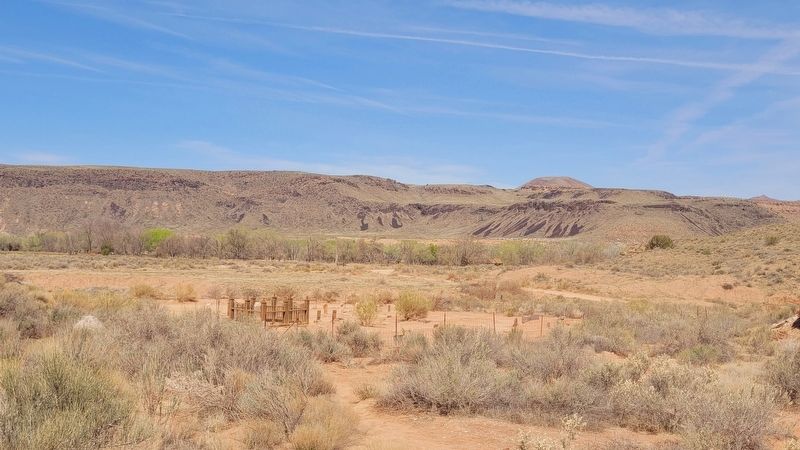
Photographed by James Hulse, April 7, 2025
5. The view of the Grafton Cemetery from the nearby hill
Credits. This page was last revised on August 14, 2025. It was originally submitted on May 16, 2025, by James Hulse of Medina, Texas. This page has been viewed 212 times since then and 35 times this year. Photos: 1, 2, 3, 4, 5. submitted on May 17, 2025, by James Hulse of Medina, Texas.
