Lanark in Lanark County, Ontario — Central Canada (North America)
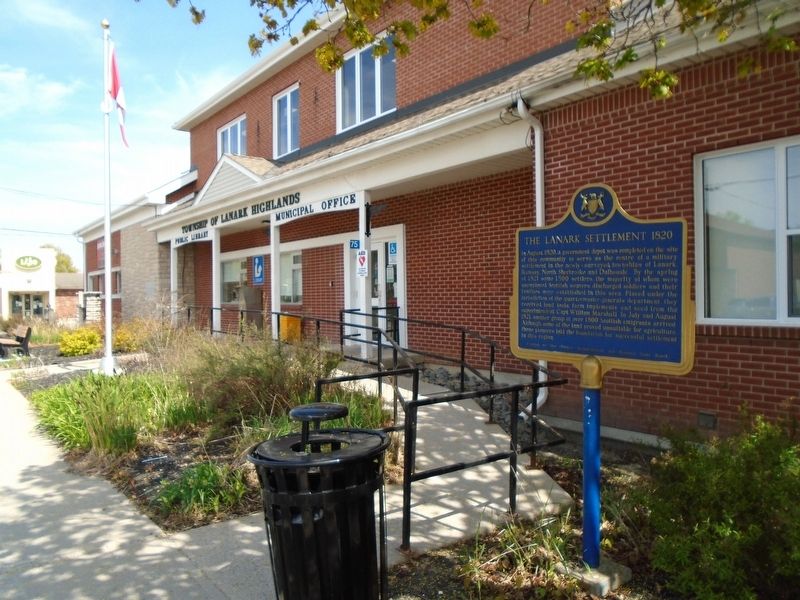
The Lanark Settlement 1820

Photographed by William Fischer, Jr., May 13, 2025
1. The Lanark Settlement 1820 Marker
In August, 1820, a government depot was completed on the site of this community to serve as the centre of a military settlement in the newly-surveyed townships of Lanark, Ramsay, North Sherbrooke and Dalhousie. By the spring of 1821 some 1,500 settlers, the majority of whom were unemployed Scottish weavers, discharged soldiers and their families, were established in this area. Placed under the jurisdiction of the quartermaster-general's department, they received land, tools, farm implements and seed from the superintendent, Capt. William Marshall. In July and August, 1821, another group of over 1800 Scottish emigrants arrived. Although some of the land proved unsuitable for agriculture, these pioneers laid the foundation for successful settlement in this region.
Erected by Ontario Archaelogical and Historic Sites Board.
Topics and series. This historical marker is listed in these topic lists: Agriculture • Colonial Era • Immigration • Settlements & Settlers. In addition, it is included in the Canada, Ontario Heritage Trust series list. A significant historical month for this entry is August 1820.
Location. 45° 1.071′ N, 76° 21.883′ W.
this page online

Regionally, this marker is in the Haliburton Highlands to Ottawa Valley and in Eastern Ontario. It is also in Central Canada. Globally, it is in North America, the Western Hemisphere, the Western World, and the Anglosphere. Historically, it finds itself in what was once a British colony, the Viceroyalty of New France, the Haudenosaunee (Iroquois) Confederacy, and Rupert’s Land.
Other nearby markers. At least 8 other markers are within 14 kilometers of this marker, measured as the crow flies: Charles Mair, 1838-1927 (a few steps from this marker); War Memorial (a few steps from this marker); World Wars Memorial (within shouting distance of this marker); The Dalhousie Library (approx. 7.8 kilometers away); Andrew Ronald Gamble (approx. 14 kilometers away); Capt. Harry D. Campbell and Major Alex. R. Campbell
Photographed by William Fischer, Jr., May 13, 2025
2. The Lanark Settlement 1820 Marker
Credits. This page was last revised on May 19, 2025. It was originally submitted on May 19, 2025, by William Fischer, Jr. of Reynoldsburg, Ohio. This page has been viewed 165 times since then and 57 times this year. Photos: 1, 2. submitted on May 19, 2025, by William Fischer, Jr. of Reynoldsburg, Ohio.
