Middlebury in Addison County, Vermont — The American Northeast (New England)
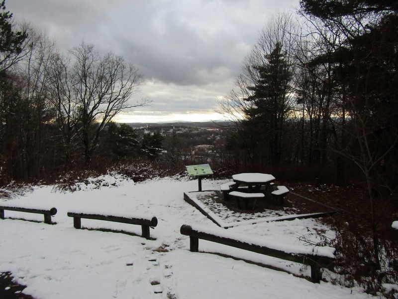
Chipman Hill
People of the Landscape

Photographed by Conrad Ward, November 29, 2024
1. Chipman Hill Marker
Today
Mountain bikers, hikers, runners, and nature lovers enjoy the approximately 132 acres and five miles of trails that weave through Chipman Hill. The Middlebury Area Land Trust's Trail Around Middlebury (TAM) passes over the hill and is part of the 4,600-mile-long North Country National Scenic Trail-running from Vermont to North Dakota.
1900s • Public Park
Chipman Hill was the scene of college ski races, ski jumping, and snowshoeing. (The old ski jump and run out can still be seen near this sign.) By mid-century the hill became the site of the town reservoir, as well as TV, radio, and later microwave towers. An asphalt automobile road took picnickers and lovers to the summit. By the 1970s, access up the hill by auto was largely abandoned. A hardy strain of bees that can tolerate the cold was developed and made Chipman their home.
The Rev. Thomas Merrill, first pastor of the Middlebury Congregational Church, named the hill "Mt. Nebo" (after the biblical site where Moses last glimpsed the promised land) but it never stuck with locals. Middlebury College students had their own moniker for Chipman Hill: "The Hill
this page online
1780s • European Settlement
Congressman, attorney and Middlebury College charter-trustee, Daniel Chipman joined many early settlers as they moved west from the eastern colonies. Settling in Middlebury in 1794, he built a home on the south slope during the early 1800s. The hill was cleared of its timber and became steep grazing land for livestock.
1880s • Conservation
Joseph Battell devoted his life to philanthropy and conservation. During his lifetime the state was 80% deforested and few efforts were made to replant. He made great efforts to buy lands surrounding his home in Ripton. At the time of his death in 1860, Joseph Battell was the largest landowner in the state of Vermont. He willed the hill to the town to be "used, improved and maintained as a public park forever."
"Some folks pay $10,000 for a painting and hang it on the wall where their friends can see it, while I buy a whole mountain for that much money and it is hung up by nature where everybody can see it and it is infinitely more handsome than any picture ever painted." -JosephBattellPhotographed by Conrad Ward, November 29, 20242. Chipman Hill Marker
European Settlement • Pre-1780s
Indigenous Peoples in search of freshwater, edible plants, and game likely climbed the hill long before the arrival of European settlers. Little is known about their time on the hill, as no evidence of their presence here has been uncovered.
The Western Abenaki are the traditional caretakers of these Vermont lands and waters, which they call Ndakinna, or "Homeland. We remember their connection to this region and the hardships they continue to endure. We give thanks for the opportunity to share in the bounty of this place and to protect it.
The Land
Chipman Hill rises 450 feet above Middlebury's dowtown area. It was formed more than 10,000 years ago by Ice Age glacial till deposits which probably accumulate around a core of now-buried limestone bedrock. Thanks to abundant sand-and-gravel deposits here, naturally filtered ground and rainwater appear in multiple springs along the slope.
Topics. This historical marker is listed in these topic lists: Charity & Public Work • Environment • Indigenous Peoples and Communities • Parks & Recreational Areas. A significant historical year for this entry is 1794.
Location. 44° 1.518′ N, 73° 9.923′ W. Marker is in Middlebury, Vermont, in Addison County. It can be reached from North Pleasant Street (U.S. 7) north of High Street, on the right when traveling north. Touch for map. Marker is at or near this postal address: 104 N Pleasant St, Middlebury VT 05753, United States of America. Touch for directions.

Regionally, this marker is in the Champlain Valley and in Greater Burlington. It is also in the American Northeast and in New England. Globally, it is in North America, the Western Hemisphere, the Western World, and the Anglosphere. Historically, it finds itself in what was once the Viceroyalty of New France and also the Vermont Republic.
Other nearby markers. At least 8 other markers are within walking distance of this marker: Samuel Miller, Esq. (approx. 0.7 miles away); Charter House (approx. 0.7 miles away); Emma Willard Memorial (approx. 0.7 miles away); Middlebury Community House (approx. ¾ mile away); Congregational Church (approx. ¾ mile away); Proud Craftsmen from Many Lands (approx. ¾ mile away); Into the Earth (approx. ¾ mile away); Spanning the Falls (approx. ¾ mile away). Touch for a list and map of all markers in Middlebury.
Also see . . .
1. Daniel Chipman (Wikipedia). (Submitted on May 26, 2025.)
2. Joseph Battell (Wikipedia). (Submitted on May 26, 2025.)
Credits. This page was last revised on May 28, 2025. It was originally submitted on May 23, 2025, by Conrad Ward of Guilford, Connecticut. This page has been viewed 277 times since then and 99 times this year. Photos: 1, 2. submitted on May 23, 2025, by Conrad Ward of Guilford, Connecticut. • Devry Becker Jones was the editor who published this page.
