Elk Run in Fauquier County, Virginia — The American South (Mid-Atlantic)
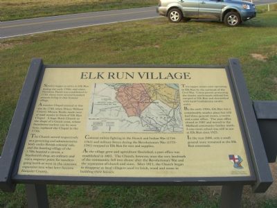
Elk Run Village
A wooden Chapel existed at this site by 1740, when Prince William County Minute Books made note of road repairs in front of Elk Run Chapel. A large Brick Church in the shape of a Greek cross, whose foundation outline can be seen here, replaced the Chapel in the 1750s.
The Church served respectively as a governing and administrative body under British colonial rule, and the bustling village of the 1750s boasted a tavern, a blacksmith shop, an ordinary and was a stopover point for travelers going north or west in the constant expansion into what later became Fauquier County.
Colonial militia fighting in the French and Indian War (1754 – 1763) and military forces during the Revolutionary War (1775-1781) stopped at Elk Run for rest and supplies.
As the village grew and agriculture flourished, a post office was established in 1803. The Church, however, once the very landmark of the community, fell into disuse after the Revolutionary War and the separation of church and state. After 1811, the Church began to disappear as local villagers used its brick, wood and stone in building their houses.
Two copper mines were operating in Elk Run by the outbreak of the Civil War. Union patrols protecting the nearby north-south railroad line camped at Elk Run and skirmished with local Confederate cavalry units.
By the early 1900s, Elk Run was a considerably smaller place but still had three general stores, a tavern and a post office. The post office closed in 1907 and moved to the Midland community further north. A one-room school was still in use at Elk Run circa 1925.
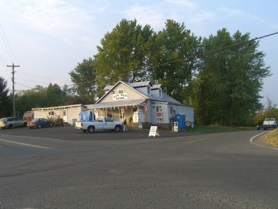
In the year 2000, only a small general store remained at the Elk Run crossroads.
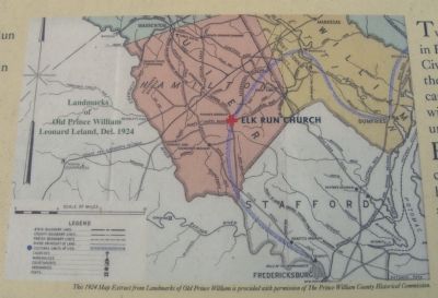
(caption under center picture) This 1924 Map Extract from Landmarks of Old Prince William is provided with permission of The Prince William County Historical Commission.
Erected by Elk Run Church Site Preservation Committee.
Topics and series. This historical marker is listed in these topic lists: Churches & Religion • Colonial Era • War, French and Indian • War, US Civil • War, US Revolutionary. In addition, it is included in the Postal Mail and Philately series list. A significant historical year for this entry is 1730.
Location. 38° 33.25′ N, 77° 40.314′ W. Marker is in Elk Run, Virginia, in Fauquier County. Marker is on Elk Run Road (County Route 806) 0 miles Midland Road (County Route
610), on the right when traveling north. Touch for map. Marker is in this post office area: Midland VA 22728, United States of America. Touch for directions.
Other nearby markers. At least 8 other markers are within 7 miles of this marker, measured as the crow flies. Elk Run Anglican Church Site (a few steps from this marker); John Marshall’s Birthplace Park (approx. 4 miles away); Brent Town (approx. 4 miles away); John Marshall’s Birthplace (approx. 4.1 miles away); a different marker also named John Marshall’s Birthplace (approx. 4.4 miles away); German Town (approx. 5.6 miles away); Dalton Reservoir (approx. 6.2 miles away); Stuart and Mosby (approx. 6.6 miles away).
Credits. This page was last revised on June 16, 2016. It was originally submitted on September 26, 2007, by Kevin W. of Stafford, Virginia. This page has been viewed 2,225 times since then and 63 times this year. Photos: 1, 2, 3, 4. submitted on September 26, 2007, by Kevin W. of Stafford, Virginia.


