Mackinaw City in Emmet County, Michigan — The American Midwest (Great Lakes)
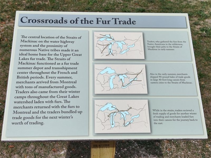
Crossroads of the Fur Trade
Photographed by John Ridley, September 2, 2023
1. Crossroads of the Fur Trade Marker
The central location of the Straits of Mackinac on the water highway system and the proximity of numerous Native tribes made it an ideal home base for the Upper Great Lakes fur trade. The Straits of Mackinac functioned as a fur trade summer depot and transshipment center throughout the French and British periods. Every summer, merchants arrived from Montreal with tons of manufactured goods. Traders also came from their winter camps throughout the Great Lakes watershed laden with furs. The merchants returned with the furs to Montreal and the traders bundled up trade goods for the next winter's worth of trading.
[Captions:]
Traders, who gathered the furs from the Native Americans in the wilderness, brought their pelts to the Straits of Mackinac in early summer.
Also in the early summer, merchants shipped 90-pound bales of trade goods in large 40-foot long canoes from eastern cities to the Straits of Mackinac.
While in the straits, traders received a fresh supply of goods for another winter of trading and merchants loaded furs into their canoes for the journey back to the east.
Topics. This historical marker
this page online
Location. 45° 47.277′ N, 84° 43.967′ W. Marker is in Mackinaw City, Michigan, in Emmet County. It is on North Huron Avenue. The marker is on the foot path within the fort area, past the admission gate. Touch for map. Marker is at or near this postal address: 800 N Huron Ave, Mackinaw City MI 49701, United States of America. Touch for directions.

Regionally, this marker is in Northern Michigan Lower Peninsula, on the Straits of Mackinac, and in one of the Lake Michigan Shore counties. It is also in the American Midwest. Globally, it is in North America, in the Great North Woods, on the Great Lakes, in the Western Hemisphere, in the Western World, and in the Anglosphere. Historically, it finds itself in what was once the Viceroyalty of New France and also the Northwest Territory.
Other nearby markers. At least 8 other markers are within walking distance of this marker: Flags of Michilimackinac (a few steps from this marker); Mackinac State Historic Parks

Photographed by Bill Coughlin, July 13, 2025
2. Crossroads of the Fur Trade Marker
The Mackinac Bridge can be seen in the background.

Photographed by Bill Coughlin, July 13, 2025
3. Crossroads of the Fur Trade Marker
Credits. This page was last revised on July 22, 2025. It was originally submitted on September 6, 2023, by John Ridley of Chelsea, Michigan. This page has been viewed 257 times since then and 32 times this year. Last updated on May 28, 2025, by Craig Doda of Napoleon, Ohio. Photos: 1. submitted on September 6, 2023, by John Ridley of Chelsea, Michigan. 2, 3. submitted on July 18, 2025, by Bill Coughlin of Woodland Park, New Jersey. • Devry Becker Jones was the editor who published this page.
