Hunts Point in the Bronx in Bronx County, New York — The American Northeast (Mid-Atlantic)
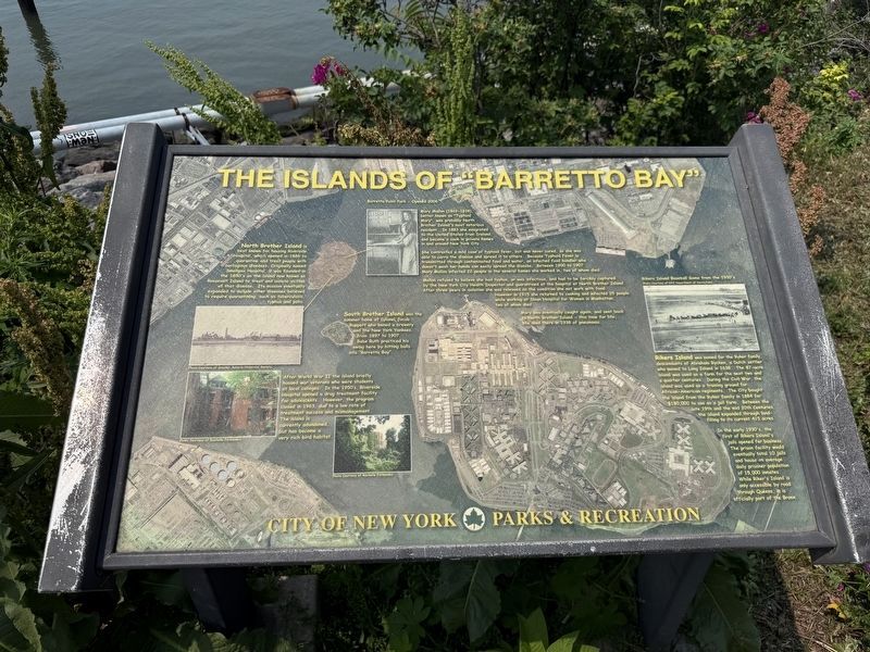
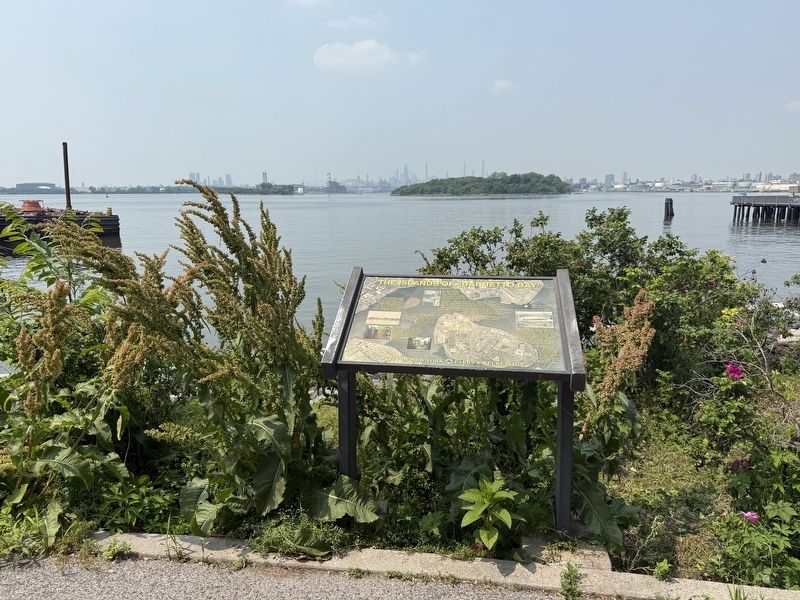
The Islands of "Barretto Bay"
| — | City of New York Parks & Recreation | — |
Barretto Point Park — Opened 2006
North Brother Island is best known for housing Riverside Hospital, which opened in 1886 to quarantine and treat people with contagious diseases. Originally named Smallpox Hospital, it was founded in the 1850's on the island now known as Roosevelt Island to treat and isolate victims of that disease. Its mission eventually expanded to include other diseases believed to require quarantining, such as tuberculosis, typhus and polio.
Mary Mallon (1869-1938), better known as "Typhoid Mary", was probably North Brother Island's most notorious resident. In 1883 she emigrated to the United States from Ireland, and became a cook in private homes in and around New York City.
She contracted a mild case of typhoid fever, but was never cured, so she was able to carry the disease and spread it to others. Because Typhoid Fever is transmitted through contaminated food and water, an infected food handler who doesn't wash her hands can easily spread the disease. Between 1900 to 1907 Mary Mallon infected 22 people in the several homes she worked in, two of whom died.
Mallon refused to believe she
this page online
Mary was eventually caught again, and sent back to North Brother Island — this time for life. She died there in 1938 of pneumonia.
South Brother Island was the summer home of Colonel Jacob Ruppert who owned a brewery and the New York Yankees, from 1897 to 1907. Babe Ruth practiced his swing here by hitting balls into
Barretto Bay".
After World War II the island briefly housed war veterans who were students at local colleges. In the 1950's. Riverside Hospital opened a drug treatment facility for adolescents. However, the program closed in 1963, due to a low rate of treatment success and mismanagement. The island is currently abandoned but has become a very rich bird habitat.
Rikers Island was named for the Ryker family, descendants of Abraham Rycken,
In the early 1930's, the first of Riker's Island jails opened for business. The prison facility would eventually total 10 jails and house an average daily prisoner population of 15,000 inmates. While Riker's Island is only accessible by road through Queens, it is officially part of the Bronx.
Erected by City of New York Parks & Recreation (NYC Parks).
Topics and series. This historical marker is listed in these topic lists: Law Enforcement • Science & Medicine • Sports • Waterways & Vessels. In addition, it is included in the NYC Parks series list. A significant historical year for this entry is 2006.
Location. 40° 48.3′ N, 73° 53.328′ W. Marker is in Bronx, New York, in Bronx County. It is in Hunts Point. It can be reached from the intersection of Viele Avenue and Tiffany Street, on the left when traveling west. Touch for map. Marker is at or near this postal address: 1121 Viele Ave, Bronx NY 10474, United States of America. Touch for directions.

Regionally, this marker is in New York City. It is also in the American Northeast, in the Mid-Atlantic, and on the Eastern Seaboard. Globally, it is in the North Atlantic Region, North America, the Western Hemisphere, the Western World, and the Anglosphere. Historically, it finds itself in what was once New Netherland and also one of the original Thirteen Colonies.
Other nearby markers. At least 8 other markers are within walking distance of this marker: General Slocum Disaster (within shouting distance of this marker); Barretto Point Park (about 500 feet away, measured in a direct line); Joseph Rodman Drake Park (approx. half a mile away); Fufidio Triangle War Memorial (approx. 0.6 miles away); Fufidio Triangle (approx. 0.6 miles away); Willis Avenue Bridge Stones (approx. 0.9 miles away); The Bronx River (approx. 0.9 miles away); what's that box doing over there? (approx. one mile away). Touch for a list and map of all markers in Bronx.
Credits. This page was last revised on June 9, 2025. It was originally submitted on June 9, 2025, by Devry Becker Jones of Washington, District of Columbia. This page has been viewed 214 times since then and 70 times this year. Photos: 1, 2. submitted on June 9, 2025, by Devry Becker Jones of Washington, District of Columbia.
