Near Arbela in Scotland County, Missouri — The American Midwest (Upper Plains)
Scotland County
Photographed by Jason Voigt, June 16, 2025
1. Scotland County Marker
front side
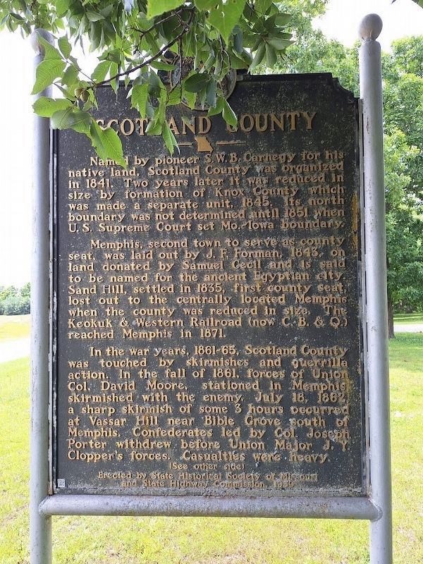
Named by pioneer S.W.B. Carnegy for his native land, Scotland County was organized in 1841. Two years later it was reduced in size by formation by formation of Knox County which was made a separate unit, 1845. Its north boundary was not determined until 1851 when U.S. Supreme Court set Mo.-Iowa boundary.
Memphis, second town to serve as county seat, was laid out by J.F. Forman, 1843, on land donated by Samuel Cecil and is said to be named for the ancient Egyptian city. Sand Hill, settled in 1835, first county seat, lost out to the centrally located Memphis when the county was reduced in size. The Keokuk & Western Railroad (now C.B. & Q.) reached Memphis in 1871.
In the war years, 1861-65, Scotland County was touched by skirmishes and guerrilla action. In the fall of 1861, forces of Union Col. David Moore, stationed in Memphis, skirmished with the enemy. July 18, 1862, a sharp skirmish of some 3 hours occurred at Vassar Hill near Bible Grove south of Memphis. Confederates led by Col. Joseph Porter withdrew before Union Major J.Y. Clopper's forces. Casualties were heavy.
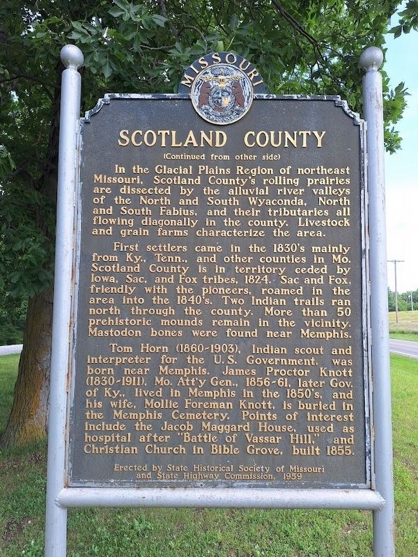
In the Glacial Plains Region of northeast
this page online
First settlers came in the 1830's mainly from Ky., Tenn., and other counties in Mo. Scotland County is in territory ceded by Iowa, Sac, and Fox tribes, 1842. Sac and Fox, friendly with the pioneers, roamed in the area into the 1840's. Two Indian trails ran north through the county. More than 50 prehistoric mounds remain in the vicinity. Mastodon bones were found near Memphis.
Tom Horn (1860-1903), Indian scout and interpreter for the U.S. Government, was born near Memphis. James Proctor Knott (1830-1911), Mo. Att'y Gen., 1856-61, later Gov. of Ky., lived in Memphis in the 1850's, and his wife, Mollie Foreman Knott, is buried in the Memphis Cemetery. Points of interest include the Jacob Maggard House, used as hospital after "Battle of Vassar Hill," and Christian Church in Bible Grove, built 1855.
Erected 1959 by State Historical Society of Missouri and State Highway Commission.
Photographed by Jason Voigt, June 16, 2025
2. Scotland County Marker
reverse side
Topics and series. This historical marker is listed in these topic lists: Immigration • Indigenous Peoples and Communities • Settlements & Settlers • War, US Civil. In addition, it is included in the Missouri, The State Historical Society of series list. A significant historical date for this entry is July 18, 1862.
Location. 40° 27.259′ N, 92° 0.343′ W. Marker is near Arbela, Missouri, in Scotland County. It is on U.S. 136 west of County Route 467, on the right when traveling west. Marker is located at Smith Memorial Roadside Park. Touch for map. Marker is at or near this postal address: 27845 US Hwy 136, Arbela MO 63432, United States of America. Touch for directions.

Regionally, this marker is in North Missouri. It is also in the American Midwest, in the Lewis & Clark Corridor, and in the Corn Belt. Globally, it is in North America, the Western Hemisphere, the Western World, and the Anglosphere. Historically, it finds itself in what was once the territory of the Mississippian Culture, the Louisiana Purchase, and the Antebellum South.
Other nearby markers. At least 2 other markers are within 9 miles of this marker,
Photographed by Jason Voigt, June 16, 2025
3. Scotland County Marker
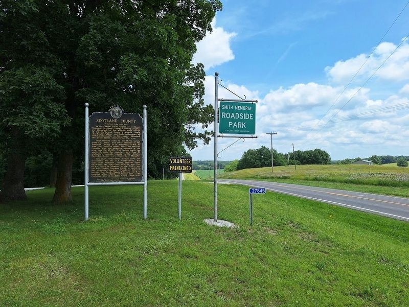
Marker is located at Smith Memorial Roadside Park, looking east
Also see . . . Scotland County, Missouri on Wikipedia. More detailed history of Missouri's seventh-least populated county (as of 2025). (Submitted on June 20, 2025, by Jason Voigt of Glen Carbon, Illinois.)
Credits. This page was last revised on July 20, 2026. It was originally submitted on June 19, 2025, by Jason Voigt of Glen Carbon, Illinois. This page has been viewed 358 times since then and 143 times this year. Photos: 1. submitted on June 19, 2025, by Jason Voigt of Glen Carbon, Illinois. 2, 3. submitted on June 20, 2025, by Jason Voigt of Glen Carbon, Illinois.
