Carolina Beach in New Hanover County, North Carolina — The American South (South Atlantic)
Shipwreck Site
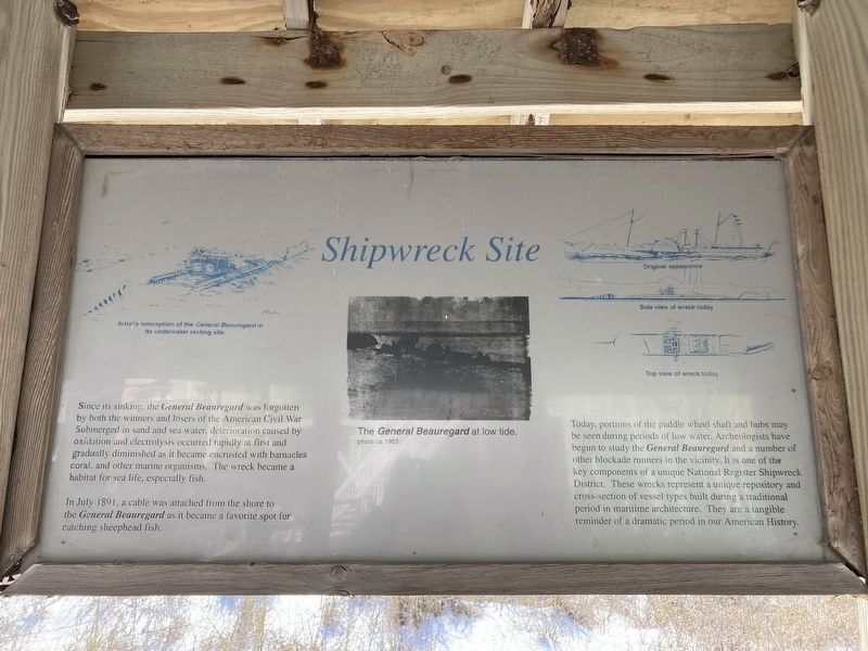
Photographed by Evan Dwyer, January 24, 2025
1. Shipwreck Site Marker
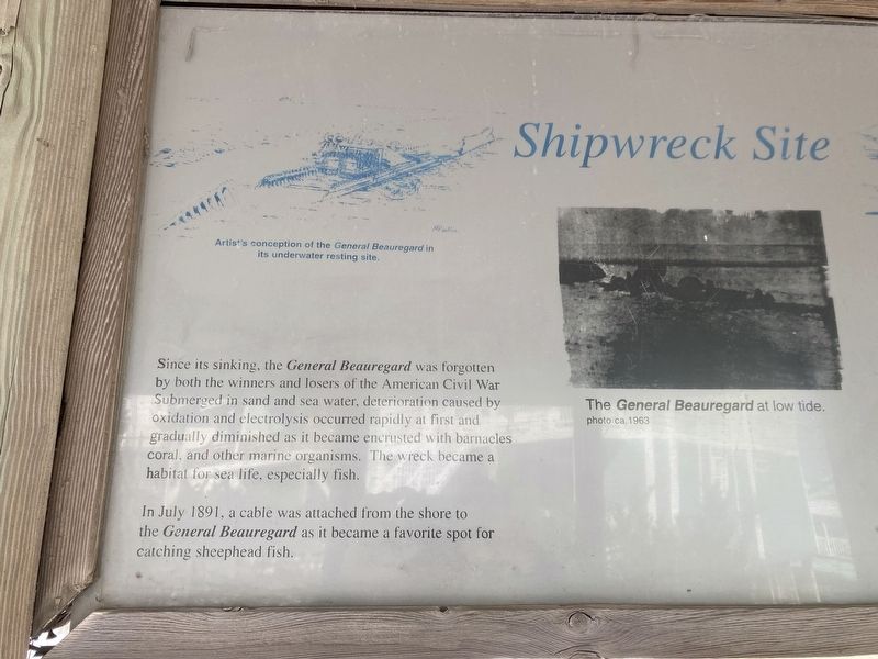
In July 1891, a cable was attached from the shore to the General Beauregard as it became a favorite spot for catching sheephead fish.
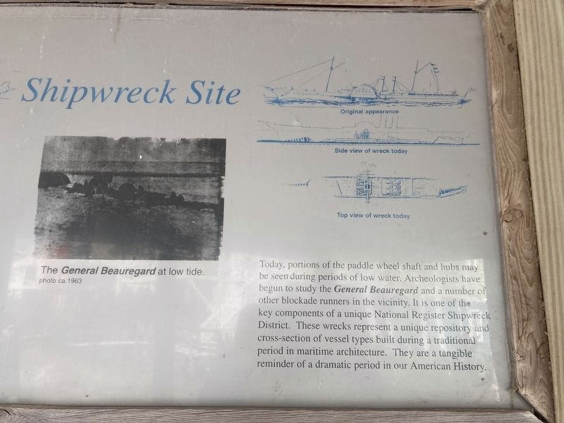
Today, portions of the paddle wheel shaft and hubs may be seen during periods of low water. Archeologists have begun to study the General Beauregard and a number of other blockade runners in the vicinity. It is one of the key components of a unique National Register Shipwreck District. These wrecks represent a unique repository and cross-section of vessel types built during a traditional period in maritime architecture. They are a tangible reminder of a dramatic period in our American History.
(captions)
Artist's conception of the General Beauregard in its underwater resting site.
the General Beauregard at low tide. photo ca. 1963
Original appearance/Side view of wreck today/Top view of wreck today
Topics.
this page online
Location. 34° 1.626′ N, 77° 53.67′ W. Marker is in Carolina Beach, North Carolina, in New Hanover County. It can be reached from the intersection of Lake Drive and Carolina Beach Avenue South when traveling east. Touch for map. Marker is at or near this postal address: 701 Carolina Beach Ave S, Carolina Beach NC 28428, United States of America. Touch for directions.

Regionally, this marker is in the Coastal Plain and on the Cape Fear Coast. It is also in the American South, specifically in the Upper South, in the Tidewater, and on the Eastern Seaboard. Globally, it is in the North Atlantic Region, North America, the Western Hemisphere, the Western World, and the Anglosphere. Historically, it finds itself in what was once the territory of the Mississippian Culture, one of the original Thirteen Colonies, one of the Confederate States of America, and the Antebellum South.
Other nearby markers. At least 8 other markers are within 2 miles of this
Photographed by Evan Dwyer, January 24, 2025
2. Artist's Conception of Wreck
Left side of marker, close-up for better view of the shipwreck drawing.
More about this marker. Marker is one of three mounted in a gazebo located along the Lake Public Beach Access boardwalk.
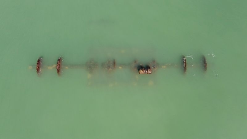
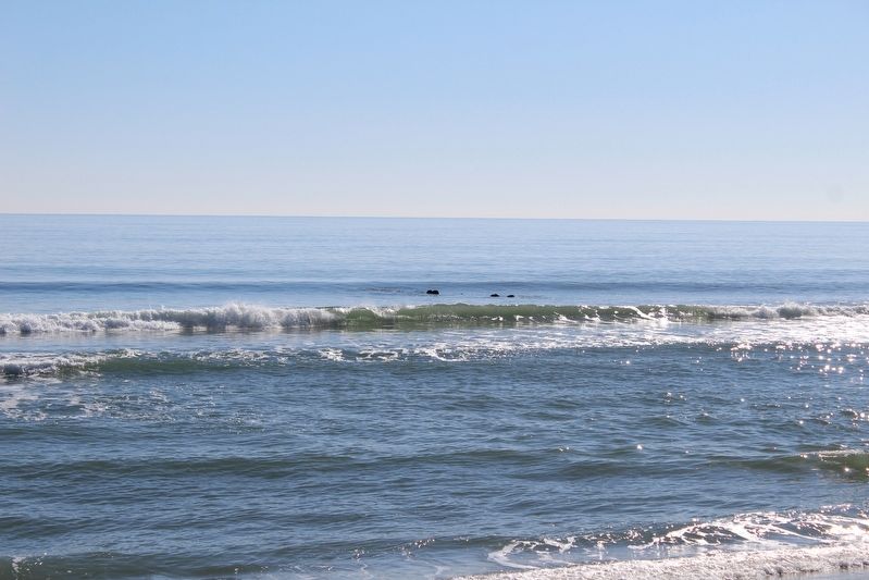
Regarding Shipwreck Site. The wreck of the ship can be seen at low tide when the sidewheels just break the surface beyond the breakers.
Related markers. Click here for a list of markers that are related to this marker. These two other markers combine with this one within the gazebo to add context to the shipwreck off shore.
Photographed by Evan Dwyer, January 24, 2025
3. Plan & Elevation Drawings
Right Side of Marker, detail view of orientation drawings. Useful when looking at the visible wreckage (see next photograph).
Photographed by Evan Dwyer, January 25, 2025
4. Shipwreck
Drone view of the wreckage.
Photographed by Evan Dwyer, January 25, 2025
5. Shipwreck From Shore
Even at low tide, the wreck can be only just exposed. This is at one of the lower winter tides in January 2025.
Photographed by Evan Dwyer, January 25, 2025
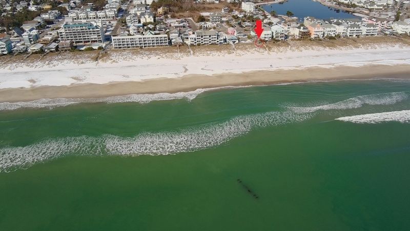
6. Marker Gazebo Proximity to the Wreck
The gazebo with the three markers is circled in red under the red arrow. The wreck itself is right center. Drone photo.
Credits. This page was last revised on June 23, 2025. It was originally submitted on June 20, 2025, by Evan Dwyer of Richmond, Virginia. This page has been viewed 451 times since then and 157 times this year. Photos: 1, 2, 3, 4, 5, 6. submitted on June 20, 2025, by Evan Dwyer of Richmond, Virginia. • Bernard Fisher was the editor who published this page.
