
Northwest in Virginia Beach, Virginia — The American South (Mid-Atlantic)
The Oyster Barge
| — | Oyster Path | — |
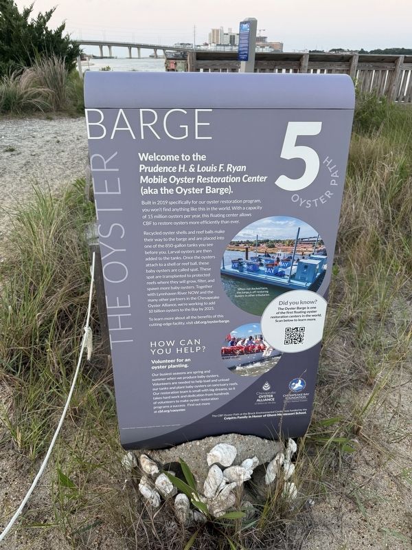
Welcome to the Prudence H. & Louis F. Ryan Mobile Oyster Restoration Center (aka the Oyster Barge).
Built in 2019 specifically for our oyster restoration program, you won't find anything like this in the world. With a capacity of 15 million oysters per year, this floating center allows CBF to restore oysters more efficiently than ever.
Recycled oyster shells and reef balls make their way to the barge and are placed into one of the 850-gallon tanks you see before you. Larval oysters are then added to the tanks. Once the oysters attach to a shell or reef ball, these baby oysters are called spat. These spat are transplanted to protected reefs where they will grow, filter, and spawn more baby oysters. Together with Lynn River NOW and the many other partners in the Chesapeake Oyster Alliance, we're working to add 10 billion oysters to the Bay by 2025.
To learn more about the benefits of this cutting-edge facility, visit cbf.org/oysterbarge.
How Can You Help?
Volunteer for an oyster planting.
Our busiest seasons are spring and summer when we produce baby oysters. Volunteers are needed to help load and unload our tanks
this page online
Did you know?
The Oyster Barge is one of the first floating oyster restoration centers in the world. Scan below to learn more.
[Caption:]
When not docked here, the barge is off restoring oysters in other tributaries.
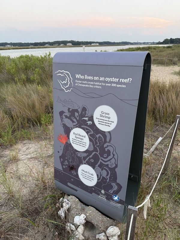
Who lives on an oyster reef?
Oyster reefs create habitat for over 300 species of Chesapeake Bay critters.
Grass Shrimp
Grass shrimp are the most abundant species of shrimp in the Bay.
Red Beard Sponge
Red Beard Sponge are not plants but animals that are filter feeders like oysters.
Mud Crab
There are 5 species of mud crabs found in the Chesapeake Bay.
Erected by Chesapeake Oyster Alliance; Chesapeake Bay Foundation. (Marker Number 5.)
Topics. This historical marker is listed in these topic lists: Animals • Environment • Science & Medicine • Waterways & Vessels. A significant historical year for this entry is 2019.
Location. 36° 54.213′ N, 76° 5.757′ W.

Regionally, this marker is in Virginia’s Hampton Roads, specifically in Coastal Virginia, and in the Hampton Roads Metropolitan Area. It is also in the American South, specifically in the Upper South, in the Tidewater, and on the Eastern Seaboard. Globally, it is in the North Atlantic Region, North America, the Western Hemisphere, the Western World, and the Anglosphere. Historically, it finds itself in what was once the territory of the Mississippian Culture, one of the original Thirteen Colonies, one of the Confederate States of America, and the Antebellum South.
Other nearby markers. At least 8 other markers are within 2 miles of this marker, measured as the crow flies: Fisheries / Blue Crab (here, next to this marker); a different marker also named The Oyster Barge (a few steps from this marker); Battle of the Capes, September 5, 1781
Credits. This page was last revised on June 21, 2025. It was originally submitted on June 21, 2025, by Devry Becker Jones of Washington, District of Columbia. This page has been viewed 111 times since then and 21 times this year. Photos: 1, 2, 3. submitted on June 21, 2025, by Devry Becker Jones of Washington, District of Columbia.
