
San Marcos in Hays County, Texas — The American South (West South Central)
El Camino De Nacogdoches
Photographed by Richard Denney, July 2003
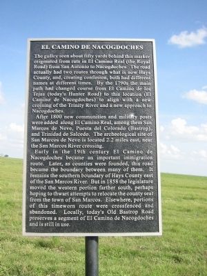
1. El Camino De Nacogdoches Marker
The gulley seen about fifty yards behind this marker originated from ruts in the El Camino Real (the Royal Road) from San Antonio to Nacogdoches. The road actually had two routes through what is now Hays County, and, creating confusion, both had different names at different times. By the 1790s the main path had changed course from El Camino de los Tejas (today's Hunter Road) to this location (El Camino de Nacogdoches) to align with a new crossing of the Trinity River and a new approach to Nacogdoches.
After 1800 new communities and military posts were added along El Camino Real, among them San Marcos de Neve, Puesta del Colorado (Bastrop), and Trinidad de Salcedo. The archeological site of San Marcos de Neve is located 2.2 miles east, near the San Marcos Rivers crossing.
Early in the 19th century El Camino de Nacogdoches became an important immigration route. Later, as counties were founded, this road became the boundary between many of them. It remains the southern boundary of Hays County east of the San Marcos River. But in 1858 the legislature moved the western portion farther south, perhaps hoping to thwart
this page online
Erected 1998 by Preservation Associates, Inc., an umbrella organization that includes the Heritage Association of San Marcos, San Marcos Convention and Visitors Bureau, Hays County Historical Commission, Tanger Outlet Mall, Terry Gilmore, Al Lowman, Don Leggitt and Hill Rylander.
Topics and series. This historical marker is listed in these topic lists: Hispanic Americans • Indigenous Peoples and Communities • Roads & Vehicles • Settlements & Settlers. In addition, it is included in the El Camino Real de los Tejas National Historic Trail series list. A significant historical year for this entry is 1800.
Location. Marker has been permanently removed. It was located near 29° 50.187′ N, 97° 55.484′ W. Marker was in San Marcos, Texas, in Hays County. It was on South Old Bastrop Highway, on the right when traveling east. Touch for map. Marker was at or near this postal address:
Photographed by Richard Denney, July 10, 2003
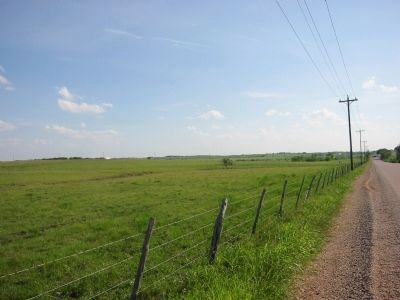
2. Looking southwest. Ruts visible in pasture, left of picture.
We have been informed that this marker is no longer there and will not be replaced. This page is an archival view of what was.
Regionally, this marker was in the Hill Country and in the Austin Metropolitan Area. It was also in the American South. Globally, it was in North America, a Gulf of Mexico state, the Western Hemisphere, the Western World, and the Anglosphere. Historically, it found itself in what was once New Spain, the Republic of Texas, one of the Confederate States of America, and the Antebellum South.

Other nearby markers. At least 8 other markers are within 3 miles of this location, measured as the crow flies: Kings Highway (approx. 0.8 miles away); The Cattle Drives (approx. 1.8 miles away); Lt. Zebulon M. Pike (approx. 2.1 miles away); Don Felipe Roque de la Portilla (approx. 2.1 miles away); Site of the First Town of San Marcos (approx. 2.1 miles away); Charles Lewis McGehee Cabin (approx. 2.1 miles away); Col. Ignacio Elizondo’s 1813 Campaign (approx. 2.2 miles away); Thompson's Islands (approx. 2.3 miles away). Touch for a list and map
Photographed by Richard Denney, October 5, 2013
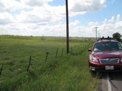
3. Marker still missing
On 10/5/2013 I visited the site of this marker and confirmed the entire marker -- pole and sign -- are still missing. Can only speculate that the marker was removed on purpose for some "valid reason", e.g. by request of the land owner, to prevent say fence-hopping to inspect the ruts.
Another marker is no longer nearby. Gen. Antonio Gaona’s 1836 Campaign (was approx. 1.1 miles away but has been confirmed missing).
Also see . . .
1. ENV’s Old San Antonio Road report leads to Hays County historical markers. An article about the dedication of this and six other historical markers along El Camino De Nacogdoches. (Submitted on July 1, 2009.)
2. El Camino Real de los Tejas National Historic Trail. This trail is part of El Camino Real de los Tejas National Historic Trail. Link provides more detail including map. (Submitted on March 14, 2012, by Richard Denney of Austin, Texas.)
3. What's the story behind the Camino Real in Hays County?. 2022 article by Riane Roldan in KUT News. Excerpt:
“Over right here where that drainage pipe is. That was the swale,” he says.(Submitted on June 26, 2025, by Gary Pinkerton of Kingwood, Texas.)
Swales are shallow indentations in the landscape that were made by years of wagon wheels wearing down the same path over and over again. They're another subtle clue that signals where the Camino once was.
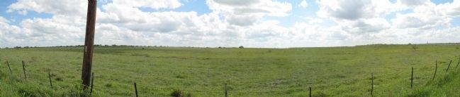
“I'm not sure why they did it, but [the developers] did put the drainage pipe directlyinto the swale and have now obliterated that physical remnant of the road that was right here,” Gonzales says.Photographed by Richard Denney4. Panorama of where marker was, with ruts somewhat visible from road.
Additional commentary.
1. Ruts still visible.
Ruts are best viewed by clicking on the map, switching to satellite view, then zooming in. Ruts run parallel to road, Old Bastrop Highway.
— Submitted June 26, 2009, by Richard Denney of Austin, Texas.
2.
The marker was removed by a developer.
— Submitted June 23, 2025, by Gary Pinkerton of Kingwood, Texas.
Credits. This page was last revised on June 27, 2025. It was originally submitted on June 26, 2009, by Richard Denney of Austin, Texas. This page has been viewed 3,811 times since then and 82 times this year. Last updated on June 23, 2025, by Gary Pinkerton of Kingwood, Texas. Photos: 1, 2. submitted on June 26, 2009, by Richard Denney of Austin, Texas. 3, 4. submitted on October 7, 2013, by Richard Denney of Austin, Texas. • Devry Becker Jones was the editor who published this page.
