Near Crow Wing in Crow Wing County, Minnesota — The American Midwest (Upper Plains)
Lakes on the Plains
Photographed by McGhiever, June 28, 2025
1. Lakes on the Plains Marker
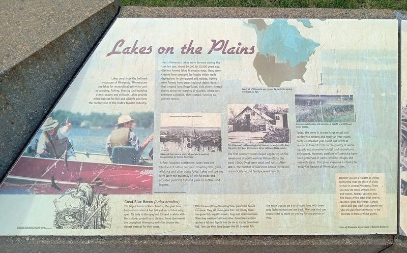
Lakes constitute the hallmark resources of Minnesota. Minnesotans use lakes for recreational activities such as camping, fishing, boating and enjoying scenic beauty and solitude. Lakes provide prime habitat for fish and wildlife and form the cornerstone of the state's tourism industry.
Most Minnesota lakes were formed during the last ice age, about 10,000 to 20,000 years ago. Glaciers formed lakes in several ways. Many were created from stranded blocks which made depressions in the ground and melted. Others were formed from deposited rock debris dams that created long finger-lakes. Still others formed chains along the margins of glaciers, where wet sediment collected, then settled, forming an uneven terrain.
Lakes and rivers were a source of food and a means of transportation for Native Americans.
Before European settlement, lakes were the lifeblood of native culture, providing fish, game, wild rice and other plant foods. Lakes and streams were later the mainstay of the fur trade and provided plentiful fish and game to settlers and loggers.
Nearly all of Minnesota was covered by glacial ice during the "Great Ice Age."
This fisherman's cabin was typical of those of the early 1900s. Over the years, they have given way to larger cabins and lake homes.
The
this page online
Some natural shoreline still remains—a benefit to wildlife and water quality.
Today, the move is toward large resort and conference centers and spacious year-round homes. Increased year-round use of these resources takes its toll on the quality of water, aquatic and shoreline habitat and recreational enjoyment. However, portions of lakeshore have been preserved in parks, wildlife refuges and research areas. This gives everyone a chance to enjoy the beauty of Minnesota's lakes.
Great Blue Heron (Ardea herodias)
The largest heron in North America, the great blue heron stands about 4 feet tall and has a 7-foot wing span. Its body is blue-gray and its head is white with black plumes projecting to the rear. Great blue herons live throughout Minnesota and often choose the highest treetops for their nests.
With the exception of breeding time, great blue herons live alone. They eat some game fish, but mostly
Photographed by McGhiever, June 28, 2025
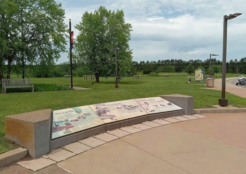
2. Lakes on the Plains Marker (left) at the Brainerd Lakes Welcome Center
The heron's tracks are 6 to 8 inches long with three toes facing forward and one back. The large hind toes enable them to stand on one leg for long periods of time.
Whether you are a resident or visitor, spend time near the shore of a lake or river in central Minnesota. There you may see many animals, birds and insects. Nearby, you may also find tracks of the black bear, beaver, raccoon, great blue heron, Canada goose and gray wolf. Look closely and you will also find their tracks in the concrete in front of these panels.
Topics. This historical marker is listed in these topic lists: Architecture • Environment • Indigenous Peoples and Communities • Waterways & Vessels.
Location. 46° 15.628′ N, 94° 19.169′ W. Marker is near Crow Wing, Minnesota, in Crow Wing County. It can be reached from the intersection of N. Koering Road and Minnesota Highway 371. The marker is at the Explore Brainerd Lakes Welcome Center and Rest Area. Touch for map. Marker is at or near this postal address: 7053 N Koering Road, Brainerd MN 56401, United States of America. Touch for directions.

Regionally, this marker is in the Northland. It is also in the American Midwest, in the Corn Belt, and in the Great River Road Region. Globally, it is in North America, the Great North Woods, the Western Hemisphere, the Western World, and the Anglosphere. Historically, it finds itself in what was once Rupert’s Land, the territory of the Mississippian Culture, and the Northwest Territory.
Other nearby markers. At least 8 other markers are within walking distance of this marker: Hunting Hospitality (here, next to this marker); Entrepreneurs and Upstarts (here, next to this marker); Roughnecks and River Pigs (a few steps from this marker); Ojibwe Origins (a few steps from this marker); Land in the Middle (a few steps from this marker); Paul Bunyan Statue (a few steps from this marker); Lumberjack Legend (a few steps from this marker); Mississippi Crossings (a few steps from this marker). Touch for a list and map of all markers in Crow Wing.
Credits. This page was last revised on July 4, 2025. It was originally submitted on July 4, 2025, by McGhiever of Minneapolis, Minnesota. This page has been viewed 110 times since then and 22 times this year. Photos: 1. submitted on July 4, 2025, by McGhiever of Minneapolis, Minnesota. 2. submitted on July 2, 2025, by McGhiever of Minneapolis, Minnesota.
