Van Cortlandt Park in the Bronx in Bronx County, New York — The American Northeast (Mid-Atlantic)
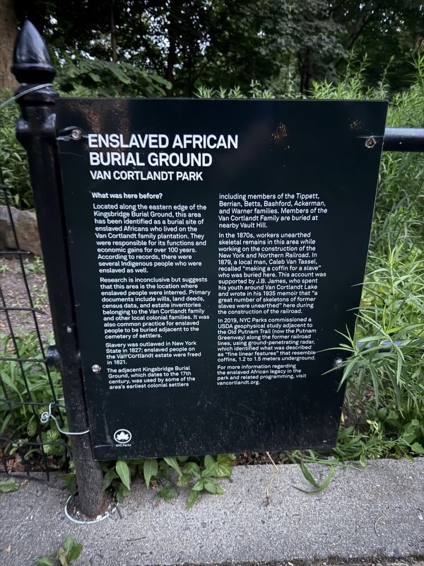
Enslaved African Burial Ground
Van Cortlandt Park
What was here before?
Located along the eastern edge of the Kingsbridge Burial Ground, this area has been identified as a burial site of enslaved Africans who lived on the Van Cortlandt family plantation. They were responsible for its functions and economic gains for over 100 years. According to records, there were several Indigenous people who were enslaved as well.
Research is inconclusive but suggests that this area is the location where enslaved people were interred. Primary documents include wills, land deeds, census data, and estate inventories belonging to the Van Cortlandt family and other local colonial families. It was also common practice for enslaved people to be buried adjacent to the cemetery of settlers.
Slavery was outlawed in New York State in 1827; enslaved people on the Van Cortlandt estate were freed in 1821.
The adjacent Kingsbridge Burial Ground, which dates to the 17th century, was used by some of the area's earliest colonial settlers including members of the Tippett, Berrian, Betts, Bashford, Ackerman, and Warner families. Members of the Van Cortlandt Family are buried at nearby Vault
this page online
In the 1870s, workers unearthed skeletal remains in this area while working on the construction of the New York and Northern Railroad. In 1879, a local man, Caleb Van Tassel, recalled "making a coffin for a slave" who was buried here. This account was supported by J.B. James, who spent his youth around Van Cortlandt Lake and wrote in his 1935 memoir that "a great number of skeletons of former slaves were unearthed" here during the construction of the railroad.
In 2019, NYC Parks commissioned a USDA geophysical study adjacent to the Old Putnam Trail (now the Putnam Greenway) along the former railroad lines, using ground-penetrating radar, which identified what was described as "fine linear features" that resemble coffins, 1.2 to 1.5 meters underground.
For more information regarding the enslaved African legacy in the park and related programming, visit vancortlandt.org
Erected by NYC Parks. (Marker Number 301.)
Topics and series. This historical marker is listed in these topic lists: African Americans • Anthropology & Archaeology • Cemeteries & Burial Sites • Indigenous Peoples and Communities.

Location. 40° 53.418′ N, 73° 53.578′ W. Marker is in Bronx, New York, in Bronx County. It is in Van Cortlandt Park. It is on John Kieran Nature Trail north of Empire State Trail, on the right when traveling north. Touch for map. Marker is in this post office area: Bronx NY 10471, United States of America. Touch for directions.

Regionally, this marker is in New York City. It is also in the American Northeast, in the Mid-Atlantic, and on the Eastern Seaboard. Globally, it is in the North Atlantic Region, North America, the Western Hemisphere, the Western World, and the Anglosphere. Historically, it finds itself in what was once New Netherland and also one of the original Thirteen Colonies.
Other nearby markers. At least 8 other markers are within walking distance of this marker: Kingsbridge Burial Ground (here, next to this marker); Algernon Sydney Sullivan (about 500 feet away, measured in a direct line); The Empire State Trail (about 500 feet away); Grand Central Stones (about 500 feet away); Prison Window (about 600 feet away); Adoption of the Constitution (about 600 feet away); Cortlandt House (about 600 feet away); Van Cortlandt Mansion (about 600 feet away). Touch for a list and map of all markers in Bronx.
Credits. This page was last revised on September 1, 2025. It was originally submitted on July 12, 2025, by Devry Becker Jones of Washington, District of Columbia. This page has been viewed 162 times since then and 38 times this year. Photos: 1, 2. submitted on July 12, 2025, by Devry Becker Jones of Washington, District of Columbia.
