Crow Wing State Park in Crow Wing County, Minnesota — The American Midwest (Upper Plains)
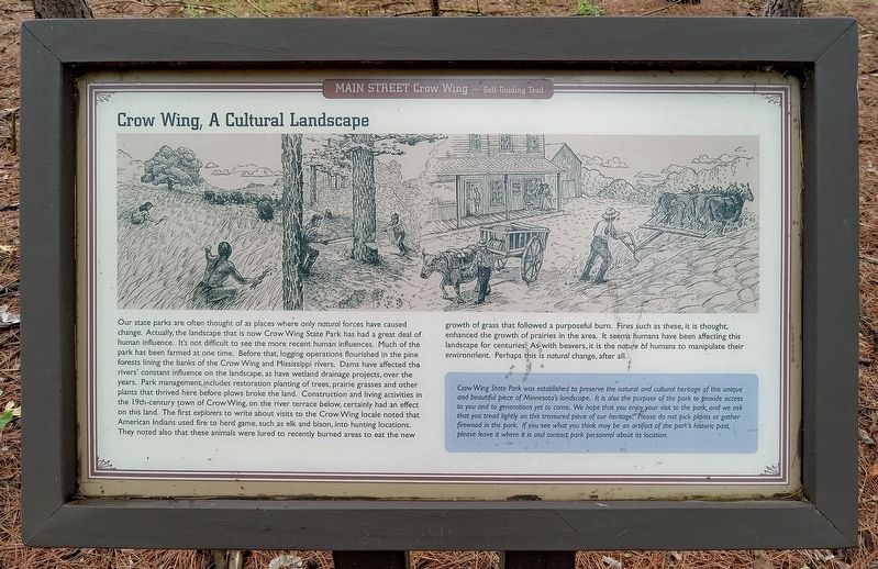
Crow Wing, A Cultural Landscape
Main Street, Crow Wing — Self-Guiding Trail
Photographed by McGhiever, June 28, 2025
1. Crow Wing, A Cultural Landscape Marker
Our state parks are often thought of as places where only natural forces have caused change. Actually, the landscape that is now Crow Wing State Park has had a great deal of human influence. It's not difficult to see the more recent human influences. Much of the park has been farmed at one time. Before that, logging operations flourished in the pine forests lining the banks of the Crow Wing and Mississippi rivers. Dams have affected the rivers' constant influence on the landscape, as have wetland drainage projects, over the years. Park management includes restoration planting of trees, prairie grasses and other plants that thrived here before plows broke the land. Construction and living activities in the 19th-century town of Crow Wing, on the river terrace below, certainly had an effect on this land. The first explorers to write about visits to the Crow Wing locale noted that American Indians used fire to herd game, such as elk and bison, into hunting locations. They noted also that these animals were lured to recently burned areas to eat the new growth of grass that followed a purposeful burn. Fires such as these, it
this page online
Crow Wing State Park was established to preserve the natural and cultural heritage of this unique and beautiful piece of Minnesota's landscape. it is also the purpose of the park to provide access to you and to generations yet to come. We hope that you enjoy your visit to the park, and we ask that you tread lightly on this treasured piece of our heritage. Please do not pick plants or gather firewood in the park. If you see what you think may be an artifact of the park's historic past, please leave it where it is and contact park personnel about its location.
Erected by Minnesota Department of Natural Resources.
Topics. This historical marker is listed in these topic lists: Environment • Indigenous Peoples and Communities • Parks & Recreational Areas.
Location. 46° 16.667′ N, 94° 20.28′ W. Marker is near Crow Wing, Minnesota,
Photographed by McGhiever, June 28, 2025
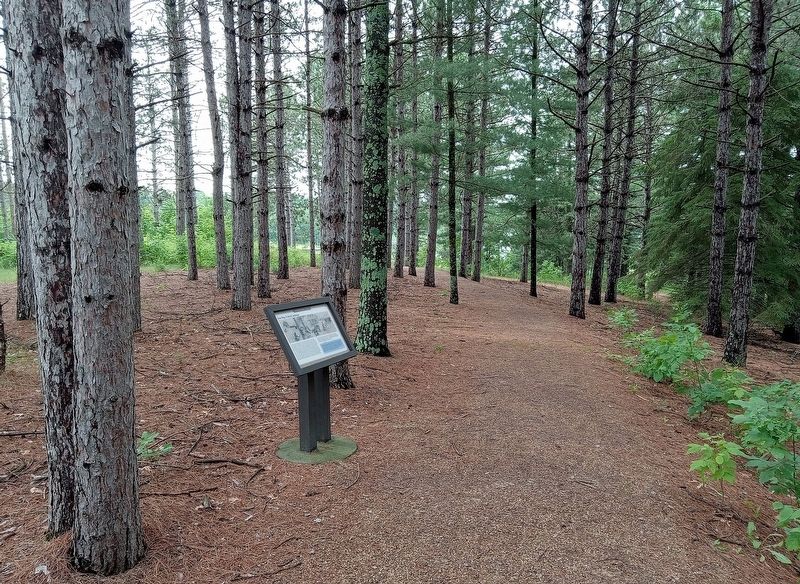
2. Crow Wing, A Cultural Landscape Marker in the woods north of the townsite

Regionally, this marker is in Minnesota’s Northland. It is also in the American Midwest, in the Corn Belt, and in the Great River Road Region. Globally, it is in North America, the Great North Woods, the Western Hemisphere, the Western World, and the Anglosphere. Historically, it finds itself in what was once Rupert’s Land, the territory of the Mississippian Culture, and the Northwest Territory.
Other nearby markers. At least 8 other markers are within walking distance of this marker: Bailey House (a few steps from this marker); The Clement H. Beaulieu Mansion (within shouting distance of this marker); The Beaulieu House: Removal, Return, Research, Restoration (within shouting distance of this marker); The Clement Beaulieu House (within shouting distance of this marker); Welcome to Main Street, Crow Wing (within shouting distance of this marker); Red River Oxcart Trail (within shouting distance of this marker); Commercial District (about 300 feet away, measured in a direct line); Warehouse (about 300 feet away). Touch for a list and map of all markers in Crow Wing.
Credits. This page was last revised on April 16, 2026. It was originally submitted on July 19, 2025, by McGhiever of Minneapolis, Minnesota. This page has been viewed 97 times since then and 13 times this year. Photos: 1, 2. submitted on July 19, 2025, by McGhiever of Minneapolis, Minnesota.
