Marker Logo
THE HISTORICAL
MARKER DATABASE
“Bite-Size Bits of Local, National, and Global History”
Municipio Roma X in Ostia Antica in Città metropolitana di Roma Capitale, Latium, Rome, Italy — Central Italy (Tyrrhenian Coast)
 

Area Archeologica di Ostia
⎯⎯⎯
Archeological Area of Ostia
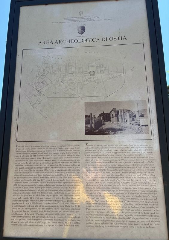
 
 
Area Archeologica di Ostia / The Archeological Area of Ostia Marker image. Click for full size.
Photographed by Sean P. Flynn, August 5, 2025
1. Area Archeologica di Ostia / The Archeological Area of Ostia Marker
Inscription.  
I resti dell'antica Ostia si inseriscono in un contesto geografico e territoriale molto diverso da quello antico: infatti in età romana il Tevere costeggiava il lato settentrionale dell'abitato, mentre ora ne tocca solo in minima parte un tratto del settore occidentale, essendo stato il suo letto trascinato a valle da una rovinosa e famosa alluvione, nel 1557; inoltre la linea di costa, in origine vicina alla città, risulta attualmente distante circa 4 Km, per l'avanzata della terraferma dovuta ai detriti lasciati dal fiume negli ultimi 2.000 anni. Ostia era quindi una città sorta -con un suo porto fluviale- sul mare e sul fiume, e questa sua particolare posizione ne determinò l'importanza attraverso i secoli sotto il profilo strategico-militare ed sotto quello economico. Un'antica tradizione ne attribuiva la fondazione al quarto re di Roma, Anco Marzio, intorno al 620 a.C., per lo sfruttamento delle saline alla foce del Tevere (da cui il nome Ostia, da ostium = imboccatura). Comunque i resti più antichi sono rappresentati da un fortilizio (castrum) in blocchi di tufo, costruito dai coloni romani nella seconda metà del IV secolo a.C. con scopi esclusivamente militari, per il controllo della foce del Tevere e della costa laziale. Successivamente, soprattutto dopo il II secolo a.C. (quando Roma aveva ormai il predominio su tutto il Mediterraneo), cominciò a venir meno la funzione militare della città, destinata a diventare in poco tempo il principale emporio commerciale della Capitale. Ma l'inadeguatezza del suo porticciolo fluviale rese necessaria la costruzione dei grandi impianti portuali più a nord della foce del fiume (nell'attuale sito di Fiumicino), nell'arco dei primi due secoli dell'era volgare: prima con l'imperatore Claudio (metà del I secolo d.C.) e poi con Traiano (113 d.C.). Da allora Ostia vide aumentare la propria importanza, specialmente nel II secolo d.C., quando ospitava popolazione di circa 50.000 abitanti ed era dotata di edifici e strutture direttamente o indirettamente collegate alle attività commerciali dei porti. Dalla fine del III secolo d.C., sia per la generale crisi dell'Impero e sia per l'accresciuta importanza del porto di Traiano, iniziò il lento declino che, nel giro di due secoli, portò all'abbandono della città. L'abitato, delimitato dalla cinta muraria la cui costruzione fu promossa da Cicerone verso la metà del I secolo a.C., era scandito da due principali assi stradali ortogonali: il decumano massimo, su cui si affacciavano gli edifici principali (horrea, cioè magazzini, terme, teatro, etc.), e il cardine massimo, che s'incrociavano nel punto nevralgico e principale della città: il Foro.

The ruins of ancient Ostia are part of a geographical and territorial context very different from the original one: in the Roman age, in fact, the Tiber ran along all the northern part of the populated area, whereas today, after the well known, destructive flood, in 1557, which dragged the river bed downstrean, it only touches a little part of the occidental section. Moreover, the coastline, once close to the town, is now about 4 Km for from it, because of the advance of the mainland due to the debris left by the river throughout the past 2,000 years. Thus, with its river port, Ostia was a town standing on the sea and the river, a peculiar position which established its importance from a strategic, military and economic point of view for centuries. An old tradition attributed the foundation of the town to the fourth king of Rome, Anco Marzio, around 620 B.C., because of the exploitation of rock salt mines at the outlet of the Tiber (thence, the name Ostia, from Ostium opening). In any case, the most ancient remains are represented by a small fortress (castrum), made of blocks of tufa built for exclusive military purposes by Roman settlers, in the second half of the IVth century B.C. to control the mouth of the Fiber and the coast of Lazio. Later on, especially after the IInd century B.C.(by then, Rome already ruled over the whole Mediterranean Sea), the town gradually lost its military function and quickly became the main commercial emporium of the Capital. Though, in the course of the first two centuries of the vulgar age, the inadequacy of its limited river port, made the construction of the great harbour system more north of the river outlet necessary (on the actual site of Fiumicino): first, under the emperor Claudius (mid-Ist century A.D.) and, then, under Traianus (113 A.D.). From that time onwards, especially during the IInd century A.D., the importance of Ostia increased, with a population of about 50,000 inhabitants and, the erection of buildings and structures directly or indirectly linked to the commercial activities of the harbours. From the end of the IIIrd century onwards, a slow decline began which led, within two centuries, to the desertion of the town, either because of the general decay of the Empire and the increased importance of the port of Trajan. Defined by the boundary walls favoured by Cicero towards the middle of the Ist century B.C., the populated area articulated with two main orthogonal road axes: the decumanus maximus, with the main buildings facing it (horrea, that is, warehouses, baths, theatre, etc.) and, the cardine massimo, interfacing in the main part, the nerve-centre of the town: the Forum.
 
Erected by Ministry
Paid Advertisement
Click or scan to see
this page online
of Cultural Heritage and Activities, Municipality of Rome.
 
Topics. This historical marker is listed in these topic lists: Anthropology & ArchaeologyIndustry & CommerceRoads & VehiclesWaterways & Vessels. A significant historical year for this entry is 1557.
 
Location. 41° 45.506′ N, 12° 17.931′ E. Marker is in Ostia Antica, Lazio (Latium, Rome), in Città metropolitana di Roma Capitale. It is in Municipio Roma X. It is on Viale degli Scavi, on the right when traveling east. The marker is east of the entrance to the Archeological Park of Ostia Antica. Touch for map. Marker is in this post office area: Ostia Antica, Lazio 00119, Italy. Touch for directions.

Regionally, it is in Europe, the European Union, the Schengen Area, a coastal Mediterranean country, and the Western World. Historically, it finds itself in what was once the Roman Empire.

Other nearby markers. At least 8 other markers are within walking distance of this marker: The Archeological Area of Ostia Antica / L'Area Archeologica di Ostia Antica (about 90 meters away, measured in a direct line); Ostia Antica: Storia e Sviluppo Urbano / Ancient Ostia: History and Urban Development (about 180 meters away); La Necropoli della Via Ostiense / The Via Ostiensis Necropolis (about 180 meters away); Tomba degli Archetti / Tomb of the Arches (about 240 meters away); Mura Repubblicane — Porta Romana / Republican Walls — Roman Gate (approx. 0.3 kilometers away); Magazzini Repubblicani e Caseggiato del Cane Monnus / Republican Warehouses and Cane Monnus Building (approx. 0.3 kilometers away); L'Area a Servizio del Fiume e Il Quartiere Dei Magazzini / Area Serving River and Warehouse District (approx. 0.3
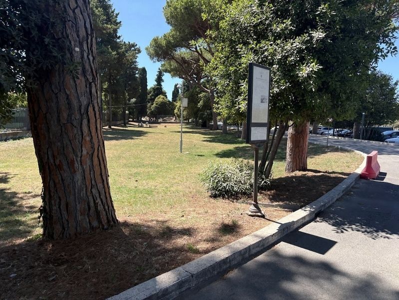
Area Archeologica di Ostia / Archeological Area of Ostia Marker image. Click for full size.
Photographed by Sean P. Flynn, August 5, 2025
2. Area Archeologica di Ostia / Archeological Area of Ostia Marker
The road toward the archaeological park is in the background.
kilometers away); Cippi di Caninio / The Boundary Stones of Gaius Caninius (approx. 0.4 kilometers away). Touch for a list and map of all markers in Ostia Antica.
 
Also see . . .  Ostia Antica official site. (Submitted on August 8, 2025, by Sean P. Flynn of Oak Park, Illinois.)
 
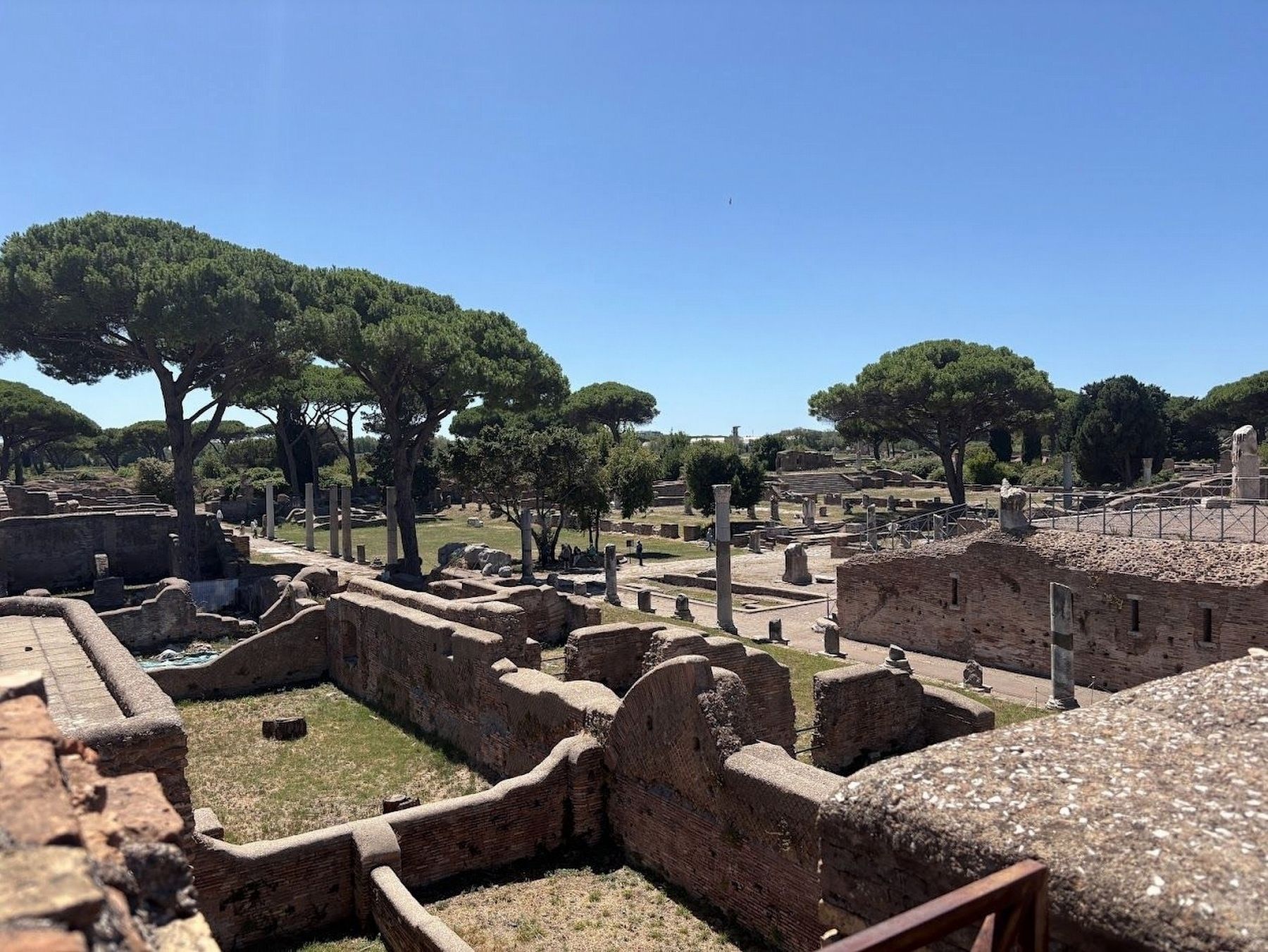
A view inside Ostia Antica image. Click for full size.
Photographed by Sean P. Flynn, August 5, 2025
3. A view inside Ostia Antica
 
 
Credits. This page was last revised on November 4, 2025. It was originally submitted on August 8, 2025, by Sean P. Flynn of Oak Park, Illinois. This page has been viewed 85 times since then and 19 times this year. Photos:   1, 2, 3. submitted on August 8, 2025, by Sean P. Flynn of Oak Park, Illinois.

m=281024

CeraNet Cloud Computing sponsors the Historical Marker Database.
This website earns income from purchases you make after using our links to Amazon.com. We appreciate your support.
Paid Advertisement
Aug. 8, 2026