
the Town of Ticonderoga in Essex County, New York — The American Northeast (Mid-Atlantic)
Lake Champlain
Ticonderoga Boat Launch Site
Photographed by William Fischer, Jr., July 31, 2025
1. Lake Champlain Marker (Side 1)
[Marker excerpts with historical information; balance not transcribed]
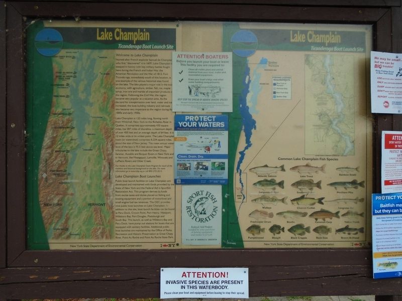
Welcome to Lake Champlain
Named after French explorer Samuel de Champlain who first "discovered" it in 1609, Lake Champlain is steeped in history with key military battles fought here during the French and Indian War, the American Revolution and the War of 1812. Fort Ticonderoga, immediately south of this location, is one example of the various historical sites found on the lake. The lake played a major role in the local economy, with agriculture, timber, fish, ice, maple syrup, iron ore and marble all important products of the region. Following the Civil War, the region became very popular as a vacation area. As the demand for transportation over land, water and ice increased, the boat building industry and railroads also became very important to the region during the 1800s and early 1900s.
—————————————————————————
Lake Champlain Fisheries Management
Shared with Vermont to the east and Quebec to the north, Lake Champlain is one of New York's largest lakes with a surface water area of just under 100,000 acres. The lake provides
this page online

Photographed by William Fischer, Jr., July 31, 2025
2. Lake Champlain Marker (Side 2)
Erected by NY State Dept of Environmental Conservation and Lake Champlain Basin Program.
Topics. This historical marker is listed in these topic lists: Charity & Public Work • Environment • Science & Medicine • Waterways & Vessels. A significant historical year for this entry is 1609.
Location. 43° 51.22′ N, 73° 23.139′ W. Marker is near Ticonderoga, New York, in Essex County. It is in the Town of Ticonderoga. It can be reached from Fort Ti Road. Marker is at the Ticonderoga Boat Launch, adjacent to the Fort Ticonderoga Ferry on Fort Ticonderoga Road (New York Route 74) at Lake Champlain. Touch for map. Marker is in this post office area: Ticonderoga NY 12883, United States of America. Touch for directions.

Regionally, this marker is in Upstate New York, in the Adirondacks & North Country, and in the Champlain Valley. It is also in the American Northeast and in the Mid-Atlantic. Globally, it is in North America, the Great North Woods, the Western Hemisphere, the Western World, and the Anglosphere. Historically, it finds itself in what was once the Viceroyalty of New France, New Netherland, and one of the original Thirteen Colonies.
Other nearby markers. At least 8 other markers are within walking distance of this marker: Edmund "Undy" Morette (a few steps from this marker); Larrabee’s Point (approx. half a mile away in Vermont); The Fort Ticonderoga Ferry (approx. half a mile away in Vermont); Near this spot stood Montcalm (approx. half a mile away); The French Lines (approx. half a mile away); The Carillon Battlefield (approx. half a mile away); Hut Sites (approx. half a mile away); “The Black Watch” (approx. half a mile away). Touch for a list and map of all markers in Ticonderoga.
Also see . . . Lake Champlain Basin History. (Submitted on August 11, 2025, by William Fischer, Jr. of Reynoldsburg, Ohio.)
Credits. This page was last revised on August 11, 2025. It was originally submitted on August 11, 2025, by William Fischer, Jr. of Reynoldsburg, Ohio. This page has been viewed 109 times since then and 23 times this year. Photos: 1, 2. submitted on August 11, 2025, by William Fischer, Jr. of Reynoldsburg, Ohio.
