Fonthill in Niagara-on-the-Lake in Niagara Region, Ontario — Central Canada (North America)
The Decisive Battle
Battle of Queenston Heights Walking Tour
⎯⎯⎯
La bataille décisive
Sentier auto-guidé de la bataille de Queenston
Photographed by Dale K. Benington, July 27, 2011
1. The Decisive Battle Marker
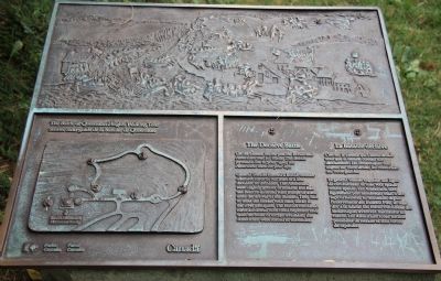
View of the plaque on the top of the historical monument.

On the plateau before you, the British and Americans met for battle. The British formed a line to your right, the Americans were on your left.
General Sheaffe formed a British counter offensive force of 900 men in a line shoulder to shoulder. The Americans were slightly greater in number but had not been re-inforced with troops or arms since the arrival of the Indians. They had to meet the British with their backs to the river precipice. The British combined force advanced with fixed bayonets and, with no route of escape available, the Americans were forced to surrender.
C'est sur le plateau qui s'étend devant vous que la bataille connaît son dénouement. Les Britanniques sont alignés sur votre droite, les Américains sur votre gauche.
Le général Sheaffe organise une ligne de combattants: ils sont 900, épaule contre épaule. Les Américains sont légèrement plus nombreux, mais n'ont reçu ni renforts, ni munitions depuis l'intervention des Indiens. Pire, ils sont dos à la falaise. Les forces combinées des Britanniques avancent baïonnette au canon. Les Américains n'ont aucune possibilité
this page online
Erected by Parks Canada. (Marker Number 5.)
Topics. This historical marker is listed in these topic lists: Colonial Era • Indigenous Peoples and Communities • War of 1812. A significant historical date for this entry is October 13, 1812.
Location. 43° 9.618′ N, 79° 3.149′ W. Marker is in Niagara-on-the-Lake, Ontario, in Niagara Region. It is in Fonthill. It can be reached from Niagara River Parkway. The marker is within Queenston Heights Park, 40 metres east of Brock's Monument, along a walking trail near the crest of the Niagara Escarpment. Touch for map. Marker is at or near this postal address: 14184 Niagara River Pkwy, Niagara-on-the-Lake ON L0S 1J0, Canada. Touch for directions.

Regionally, this marker is on the Golden Horseshoe and in Niagara Canada. It is also in Central Canada. Globally, it is in North America, on the Great Lakes, in the Western Hemisphere, in the Western World, and in the Anglosphere. Historically, it finds itself in what was once a British colony, the Viceroyalty of New France, the Haudenosaunee (Iroquois) Confederacy, and Rupert’s Land.
Other nearby markers. At
Photographed by Dale K. Benington, July 27, 2011
2. The Decisive Battle Marker
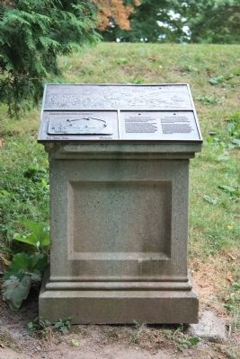
Regarding The Decisive Battle / La bataille décisive. A retired historical marker claimed: This battle ended in a complete Victory on the part of the British, having captured 927 men, killed or wounded about 500, [and] taken 1400 Stand of Arms, a six pounder and a stand of Colours.
Related markers. Click here for a list of markers that are related to this marker. To better understand the relationship, study each marker in the order shown.
Photographed by Dale K. Benington, July 27, 2011
3. The Decisive Battle Marker
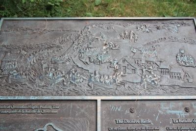
A close-up view of the battlefield scene sculpting on the top of the historical monument.
Photographed by Dale K. Benington, July 27, 2011
4. The Decisive Battle Marker
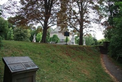
View of the historical marker looking southwest along the Battle of Queenston Heights walking tour pathway, with the crest of the Niagara Escarpment in the background, and in the distant background just beyond the two trees is the Brock Memorial Monument.
Photographed by Dale K. Benington, July 27, 2011
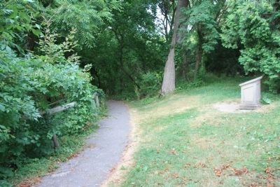
5. The Decisive Battle Marker
View of the historical marker looking northeast along the Battle of Queenston Heights walking tour pathway, which is heading down the face of the Niagara Escarpment.
Credits. This page was last revised on November 10, 2025. It was originally submitted on January 16, 2012, by Dale K. Benington of Toledo, Ohio. This page has been viewed 1,015 times since then and 30 times this year. Last updated on August 18, 2025, by Kevin Westell of St. Catharines, Ontario. Photos: 1, 2, 3, 4, 5. submitted on January 16, 2012, by Dale K. Benington of Toledo, Ohio. • Devry Becker Jones was the editor who published this page.
