Fonthill in Niagara-on-the-Lake in Niagara Region, Ontario — Central Canada (North America)
The Battle of Queenston Heights
The Battle of Queenston Heights Walking Tour
⎯⎯⎯
la Bataille de Queenston
Sentier auto-guidé de la Bataille de Queenston
Photographed by Dale K. Benington, July 27, 2011
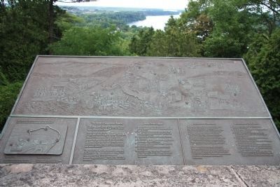
1. The Battle of Queenston Heights Marker
View of the historical marker at its location at the National Historic Site - Brock's Monument at the lookout, and of the Niagara River Valley which is situated below the lookout, at the base of the Niagara escarpment.

The Battle of Queenston Heights
The village below you and the heights on which you are standing were the stage for the famous Battle of Queenston Heights.
It took place during the Anglo-American conflict 1812-1815 known as the War of 1812. During the early morning hours of October 13, 1812 an American invasion force, camped at Lewiston, crossed the Niagara river and gained control of the heights of Queenston. After many hours of fierce combat, they were crushed by a combined force of British Army regulars, Canadian militia and Indian warriors.
This victory had a great significance. It prevented, for some time, the Americans from establishing a foot hold in Canada. It inspired confidence in Canadians that they could defend an immense territory despite their meager human and material resources.
Battle Scene Legend
A. American attackers cross the river.
B. British defenders contain the Americans at the landing area.
C. Detachment of Americans secretly scale the steep river cliff behind the British position on Queenston Heights.
D. Americans take the British defensive battery by surprise.
E. British
this page online
F. Indians harass Americans trying to establish defensive positions.
G. British reinforcements arrive and ascend the heights.
H. British combined force faces Americans in final battle. The latter, trapped between the river and a powerful opposing force, surrender.
Le village qui s'étend à vos pieds, et les hauteurs où vous vous trouvez actuellement, ont été le théâtre de la célèbre bataille de Queenston. Elle s'est déroulée le 13 octobre 1812, dans le cadre de la guerre anglo-américaine de 1812-1815. Cette nuit-là, une force d'invasion américaine cantonné en face, à Lewiston, traversa le Niagara et réussit à atteindre ces hauteurs. Après plusieurs heures d'un combat acharné, elle fut écrasée par une armée de réguliers britanniques, de miliciens canadiens, et de guerriers indiens.
Cette victoire fut un tournant de la guerre. Elle engloutit pour six mois tout espoir des Américains d'établir une tête de pont au Canada. Elle renforça la conviction des Canadiens qu'ils pouvaient défendre leur immense territoire
Photographed by Dale K. Benington, July 27, 2011
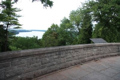
2. The Battle of Queenston Heights Marker
A`more distant view of the historical marker at its location at the National Historic Site - Brock's Monument at the lookout, and of the Niagara River Valley which is situated below the lookout, at the base of the Niagara escarpment.
Le déroulement de la bataille
A. Les Américains lancent leur offensive en traversant la rivière.
B. Les Britanniques conduisent les Américains a leur point de débarquement.
C. Un détachement d'Américains escalade la falaise derrière les positions des Britanniques sans se faire voir.
D. Les Américains prennent le canon du redan britannique par la surprise.
E. Les Britanniques tentent de reprendre le canon, Brock, leur chef, et tuer.
F. Les Américaines cherchent a consolider leurs positions malgré le harcèlement des Indiens.
G. D'autres Britanniques arrivent en renfort et grimpent sur les hauteurs.
H. L'armée britannique se regroupe face aux Américains. Ces derniers, coincés entre la rivière et l'armée britannique se rendent.
Erected by Parks Canada.
Topics and series. This historical marker is listed in these topic lists: Colonial Era • Indigenous Peoples and Communities • War of 1812. In addition, it is included in the Battlefield Trails - War of 1812 series list. A significant historical date for this entry is October 13, 1812.
Location. 43° 9.628′ N, 79° 3.194′ W.
Photographed by Dale K. Benington, July 27, 2011
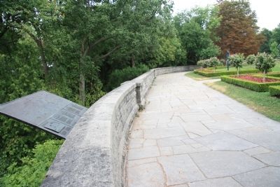
3. The Battle of Queenston Heights Marker
View of the historical marker at the scenic lookout point over the Niagara escarpment, looking east along the park pathway that runs along the crest of the escarpment, that is located just to the north of the Brock Memorial Monument.

Regionally, this marker is on the Golden Horseshoe and in Niagara Canada. It is also in Central Canada. Globally, it is in North America, on the Great Lakes, in the Western Hemisphere, in the Western World, and in the Anglosphere. Historically, it finds itself in what was once a British colony, the Viceroyalty of New France, the Haudenosaunee (Iroquois) Confederacy, and Rupert’s Land.
Other nearby markers. At least 8 other markers are within walking distance of this marker: Sir Roger Hale Sheaffe (a few steps from this marker); Brock's Monument (within shouting distance of this marker); Sir Isaac Brock (within shouting distance of this marker); Brock's Monument - Queenston Heights Battlefield (within shouting distance of this marker); The "Colored Corps" 1812 - 1815 (within shouting distance of this marker); The Battle of Queenston Heights (within shouting distance of this marker); Black Militia Units In Upper Canada, 1812-1850 (within shouting distance of this marker); The Decisive Battle / La bataille décisive (within shouting distance of this marker). Touch for a list and map of all markers in Niagara-on-the-Lake.
Related markers. Click here for a list of markers that are related to this marker. To better understand the relationship, study each marker in the order shown.
Credits. This page was last revised on November 10, 2025. It was originally submitted on January 17, 2012, by Dale K. Benington of Toledo, Ohio. This page has been viewed 1,507 times since then and 54 times this year. Last updated on August 19, 2025, by Kevin Westell of St. Catharines, Ontario. Photos: 1, 2, 3. submitted on January 21, 2012, by Dale K. Benington of Toledo, Ohio. • Devry Becker Jones was the editor who published this page.
