
Niagara-on-the-Lake in Niagara Region, Ontario — Central Canada (North America)
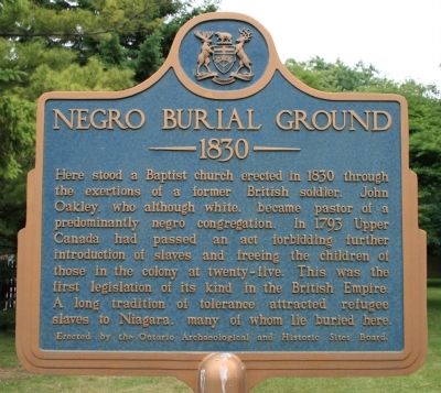
Negro Burial Ground
1830
Photographed by Dale K. Benington, June 11, 2012
1. Negro Burial Ground 1830 Marker
Erected 1957 by Ontario Archaeological and Historic Sites Board.
Topics and series. This historical marker is listed in these topic lists: Abolition & Underground RR • African Americans • Cemeteries & Burial Sites. In addition, it is included in the Canada, Ontario Heritage Trust series list. A significant historical year for this entry is 1830.
Location. Marker has been reported missing. It was located near 43° 15.135′ N, 79° 5.057′ W. Marker was in Niagara-on-the-Lake, Ontario, in Niagara Region. It was on Mississagua Street just north of John Street West, on the right when traveling north. This historical marker is located
this page online

Regionally, this marker was on Ontario’s Golden Horseshoe and in Niagara Canada. It was also in Central Canada. Globally, it was in North America, on the Great Lakes, in the Western Hemisphere, in the Western World, and in the Anglosphere. Historically, it found itself in what was once a British colony, the Viceroyalty of New France, the Haudenosaunee (Iroquois) Confederacy, and Rupert’s Land.
Other nearby markers. At least 8 other markers are within walking distance of this location: Niagara Baptist Church Burial Ground (here, next to this marker); The Upper Canadian Act Against Slavery (1793) (a few steps from this marker); William and Susannah Steward House (about 180 meters away, measured in a direct line); Memorial Cairn For John Butler (approx. 0.4 kilometers away); Lieutenant-Colonel John Butler 1725-1796 (approx. half a kilometer away); St. Andrew's Church (approx. half a kilometer away); Butler's Burial Ground
Photographed by Dale K. Benington, June 11, 2012
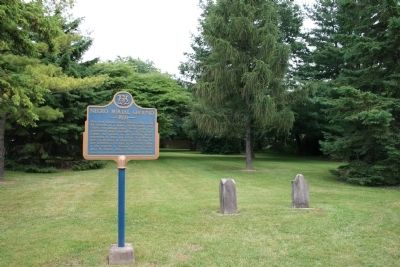
2. Negro Burial Ground 1830 Marker
View of the historical marker and two gravestones at the Negro Burial Ground.
Regarding Negro Burial Ground. The church formerly at this site was called the Niagara Baptist Church.
Also see . . . Negro Burial Ground (Baptist)+, OGS#3353 Niagara-on-the-Lake - Niagara (Lincoln & Welland) , Ontario. This is a link to information provided by the CanadianHeadstones.com website. (Submitted on June 18, 2013, by Dale K. Benington of Toledo, Ohio.)
Photographed by Dale K. Benington, June 11, 2012
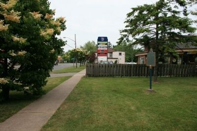
3. Negro Burial Ground 1830 Marker
View of the historical marker looking northeast along Mississauga Street.
Photographed by Dale K. Benington, June 11, 2012
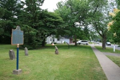
4. Negro Burial Ground 1830 Marker
View of the historical marker and grave yard looking southwest along Mississauga Street.
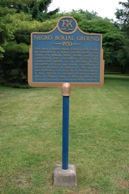
Photographed by Dale K. Benington, June 11, 2012
5. Negro Burial Ground 1830 Marker
Credits. This page was last revised on January 3, 2026. It was originally submitted on June 18, 2013, by Dale K. Benington of Toledo, Ohio. This page has been viewed 1,456 times since then and 29 times this year. Last updated on August 30, 2025, by Kevin Westell of St. Catharines, Ontario. Photos: 1, 2, 3, 4, 5. submitted on June 18, 2013, by Dale K. Benington of Toledo, Ohio. • Devry Becker Jones was the editor who published this page.
