
Near Niagara-on-the-Lake in Niagara Region, Ontario — Central Canada (North America)
Capture of Fort Niagara 1813
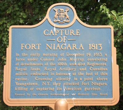
Photographed by Dale K. Benington, July 27, 2011
1. Capture of Fort Niagara Marker
Erected by Ontario Archaeological and Historic Sites Board.
Topics and series. This historical marker is listed in these topic lists: Colonial Era • Forts and Castles • War of 1812 • Waterways & Vessels. In addition, it is included in the Canada, Ontario Heritage Trust series list. A significant historical date for this entry is December 19, 1813.
Location. 43° 14.087′ N, 79° 3.637′ W. Marker is near Niagara-on-the-Lake, Ontario, in Niagara Region. It is at the intersection of Niagara River Parkway and East & West Line, on the right when traveling north on Niagara River Parkway. This marker is 10 metres east of a large parking lot (for picnickers) adjacent to Niagara River Parkway. Touch for map. Marker is at or near this postal address: 16052 Niagara River Parkway,
this page online

Regionally, this marker is on Ontario’s Golden Horseshoe and in Niagara Canada. It is also in Central Canada. Globally, it is in North America, on the Great Lakes, in the Western Hemisphere, in the Western World, and in the Anglosphere. Historically, it finds itself in what was once a British colony, the Viceroyalty of New France, the Haudenosaunee (Iroquois) Confederacy, and Rupert’s Land.
Other nearby markers. At least 8 other markers are within walking distance of this marker: McFarland House 1800 / Maison McFarland, 1800 (approx. 0.3 kilometers away); Thomas Moore (approx. 0.7 kilometers away); Upper Canada Heritage Trail (approx. 0.9 kilometers away); La Belle Famille (approx. 1.1 kilometers away in the U.S.); a different marker also named La Belle Famille (approx. 1.1 kilometers away in the U.S.); Field of La Belle Famille (approx. 1.1 kilometers away in the U.S.); Nationally-Rare Trees in Niagara-on-the-Lake (approx. 1.2 kilometers away); The Ancient Oak: A Witness To History (approx. 1.2 kilometers away). Touch for a list and map of all
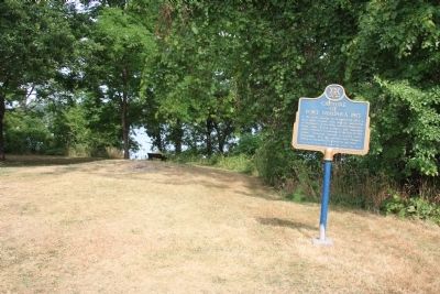
Photographed by Dale K. Benington, July 27, 2011
2. Capture of Fort Niagara Marker
View of the historical marker situated on the high ground above the Niagara River, which can be seen in the background.
Also see . . .
1. The Storming of Fort Niagara, December 18, 1813. This is a link to information provided by The War of 1812 Website. (Submitted on November 11, 2011, by Dale K. Benington of Toledo, Ohio.)
2. Capture of Fort Niagara. This is a link to information provided by Wikipedia, the free encyclopedia. (Submitted on November 11, 2011, by Dale K. Benington of Toledo, Ohio.)
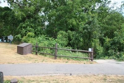
Photographed by Dale K. Benington, July 27, 2011
3. Capture of Fort Niagara Marker
View of the historical marker (to the left of the picture) situated just north of the ravine pathway that leads down to the Niagara River.
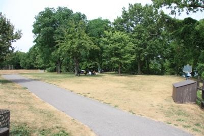
Photographed by Dale K. Benington, July 27, 2011
4. Capture of Fort Niagara Marker
View looking north along the Niagara Parkway Recreational Trail of the historical marker in the extreme right side of the picture.
Photographed by Dale K. Benington, July 27, 2011
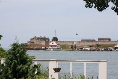
5. Capture of Fort Niagara
View of Fort Niagara as seen from the Canadian side of the Niagara River.
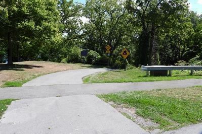
Photographed by Kevin Westell, August 31, 2025
6. Capture of Fort Niagara 1813 - Marker in context 2025
Photo faces east and south-east from the parking lot. This private driveway crosses the walking/biking trail, then plunges right down a private ravine. The marker (barely left of centre) is just left of the driveway, and beside a wooden pole fence, at the brink of the ravine. The Niagara River shows through the trees. The brown box (behind the metal railing) is for a mix of sand and salt, for that steep driveway in winter.
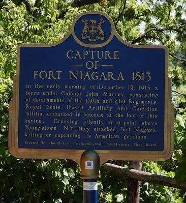
Photographed by Kevin Westell, August 31, 2025
7. Capture of Fort Niagara 1813 - Marker in 2025
Traditional Royal blue and dazzling gold tell us they refurbished this plaque.
Credits. This page was last revised on November 10, 2025. It was originally submitted on November 5, 2011, by Dale K. Benington of Toledo, Ohio. This page has been viewed 1,030 times since then and 59 times this year. Last updated on September 2, 2025, by Kevin Westell of St. Catharines, Ontario. Photos: 1, 2, 3, 4, 5. submitted on November 12, 2011, by Dale K. Benington of Toledo, Ohio. 6, 7. submitted on September 2, 2025, by Kevin Westell of St. Catharines, Ontario. • Devry Becker Jones was the editor who published this page.
