Dolores in Montezuma County, Colorado — The American Mountains (Southwest)
Respite Along the Dolores
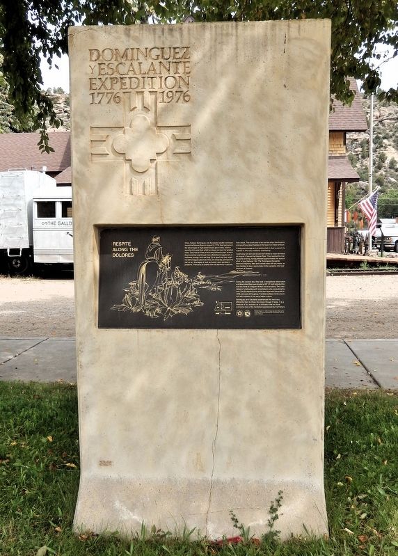
Dominguez y Escalante Expedition • 1776-1976
Photographed by Cosmos Mariner, July 17, 2025
1. Respite Along the Dolores Marker
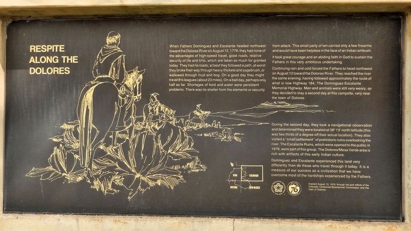
When Fathers Dominguez and Escalante headed northwest toward the Dolores River on August 12, 1776, they had none of the advantages of high-speed travel, good roads, relative security of life and limb, which are taken so much for granted today. They had no roads; at best they followed a path, at worst they broke their way through heavy thickets and sagebrush, or wallowed through mud and bog. On a good day they might travel 8½ leagues (about 23 miles). On a bad day, perhaps only half as far. Shortages of food and water were persistent problems. There was no shelter from the elements or security from attack. This small party of ten carried only a few firearms and would have been helpless in the face of an Indian ambush.
It took great courage and an abiding faith in God to sustain the Fathers in this very ambitious undertaking.
Continuing rain and cold forced the Fathers to head northwest on August 12 toward the Dolores River. They reached the river the same evening, having followed approximately the route of what is now Highway 184, The Dominguez-Escalante Memorial Highway. Men and animals were still very weary, so they decided
this page online
During the second day, they took a navigational observation and determined they were located at 38° 13' north latitude (this was two thirds of a degree off their actual location). They also visited a “small settlement” of prehistoric ruins overlooking the river. The Escalante Ruins, which were opened to the public in 1976, were part of this group. The Dolores/Mesa Verde area is rich with artifacts of this early Indian culture.
Dominguez and Escalante experienced this land very differently than do those who travel through it today. It is a measure of our success as a civilization that we have overcome most of the hardships experienced by the Fathers.
Erected 1976 by The Colorado Centennial-Bicentennial Commission and the town of Dolores.
Topics and series. This historical marker is listed in these topic lists: Anthropology & Archaeology • Exploration • Hispanic Americans • Indigenous Peoples and Communities. In addition, it is included in the Dominguez y Escalante Expedition, and the The Spirit of ’76, America’s Bicentennial Celebration series
Photographed by Cosmos Mariner, July 17, 2025
2. Respite Along the Dolores Marker
Location. 37° 28.407′ N, 108° 30.198′ W. Marker is in Dolores, Colorado, in Montezuma County. It is at the intersection of Railroad Avenue (State Highway 145) and 5th Street, on the left when traveling east on Railroad Avenue. The marker is located near the southeast corner of Flanders Park. Touch for map. Marker is at or near this postal address: 421 Railroad Avenue, Dolores CO 81323, United States of America. Touch for directions.

Regionally, this marker is in the American Mountain West, on the Colorado Plateau, and at the Four Corners. Globally, it is in North America, the Rocky Mountains, the Western Hemisphere, the Western World, and the Anglosphere. Historically, it finds itself in what was once the territory of the Ancestral Puebloans and also Mexico’s Alta California.
Other nearby markers. At least 8 other markers are within 3 miles of this marker, measured as the crow flies: The Anasazi (here, next to this marker); Galloping Goose #5 (a few steps from this marker); Galloping Geese of the Rio Grande Southern Railroad (within shouting distance of this marker); The Southern Hotel
Photographed by Cosmos Mariner, July 17, 2025
3. Respite Along the Dolores Marker
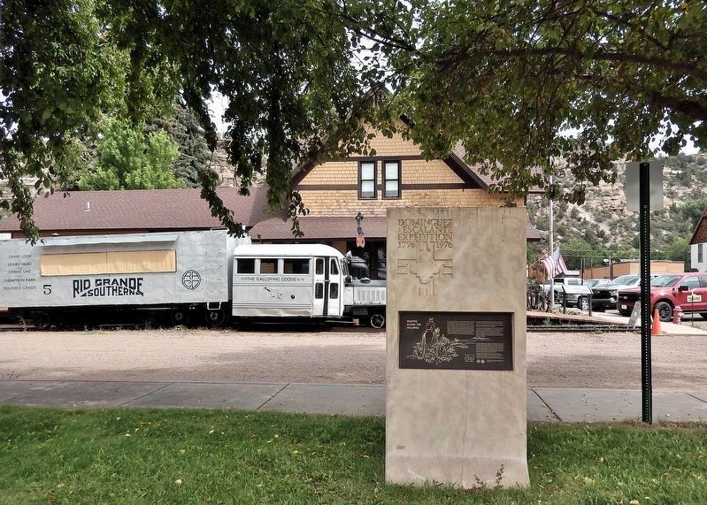
Looking north from Railroad Avenue; the Dolores Railroad Museum & Galloping Goose Historical Society building is in the background.
Related markers. Click here for a list of markers that are related to this marker.
Also see . . .
1. Domínguez–Escalante Expedition (Wikipedia).
Excerpt: The Domínguez–Escalante Expedition was a Spanish journey of exploration conducted in 1776 by two Franciscan priests, Atanasio Domínguez and Silvestre Vélez de Escalante, to find an overland route from Santa Fe, New Mexico, to their Roman Catholic mission in Monterey, on the coast of modern day central California. Domínguez, Vélez de Escalante, and Bernardo de Miera y Pacheco, acting as the expedition's cartographer, traveled with ten men from Santa Fe through many unexplored portions of the American West, including present-day western Colorado, Utah, and northern Arizona. Along part of the journey, they were aided by three indigenous guides of the Timpanogos tribe (Ute people).(Submitted on September 7, 2025, by Cosmos Mariner of Cape Canaveral, Florida.)
The land was harsh and unforgiving, and hardships encountered during travel forced the group to return to Santa Fe before reaching Las Californias. Maps and documentation produced by the expedition aided future travelers. The Domínguez–Escalante route eventually became an early template for the Old Spanish Trail, a trade route from Santa Fe to Pacific Coast settlements.
2. Dominguez–Escalante Expedition (Legends of America).
Excerpt: On July 29, 1776, the two friars began the journey, accompanied by eight volunteers outfitted with saddle horses, pack animals, and cattle. They aimed to find a route north of the Grand Canyon and the Colorado River over Comanche territory, where Spaniards had experienced violent encounters in previous decades. Ultimately, the expedition made a wide loop, traveling north instead of west, and covered a vast territory in Colorado, Utah, Arizona, and New Mexico.(Submitted on September 7, 2025, by Cosmos Mariner of Cape Canaveral, Florida.)
They entered Colorado through Arboles, Ignacio, Durango, and Hesperus. On August 10, they camped at the base of the La Plata Mountains near the current Mesa Verde National Park. Escalante and Dominguez were the first white men to find and record the ancestral Puebloan ruins in southwestern Colorado. The men traveled north and west of the San Juan Mountains, crossing the Dolores River several times, and camped along its banks northeast of present-day Cahone.
Credits. This page was last revised on September 7, 2025. It was originally submitted on September 6, 2025, by Cosmos Mariner of Cape Canaveral, Florida. This page has been viewed 115 times since then and 36 times this year. Photos: 1, 2, 3. submitted on September 7, 2025, by Cosmos Mariner of Cape Canaveral, Florida.
