Near Riverdale in McLean County, North Dakota — The American Midwest (Upper Plains)
Displaced Communities
Photographed by Barry Swackhamer, July 23, 2025
1. Displaced Communities Marker
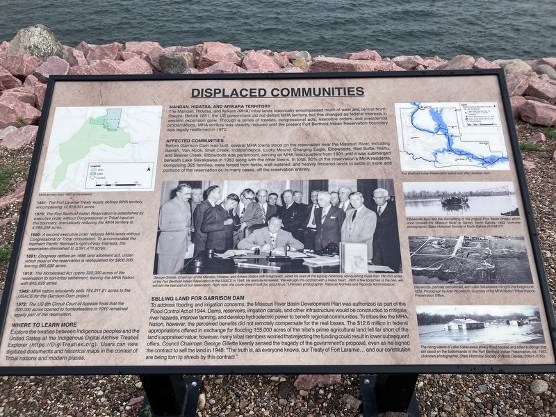
Captions: (right side, top to bottom) Fort Berthold Indian Reservation before and after Garrison Dam; Elbowoods Ferry and the dismantling of the original Bears Bridge, which once crossed the Missouri River at Sanish, North Dakota, 1953.; Elbowoods, partially demolished, with Lake Sakakawea rising in the foreground, 1953.; The rising waters of Lake Sakakawea slowly flood house and other buildings that still stood on the bottomlands of the Fort Berthold Indian Reservation, ca. 1953.
Mandan, Hidatsa, and Arikara Territory
The Mandan, Hidatsa, and Arikara (MHA) tribal lands historically encompassed much of the west and central North Dakota, Before 1851, the US government did not delimit MHA territory, but this changed as federal interests in western expansion grew. Through a series of treaties, congressional acts, executive orders, and presidential proclamations, MHA territory was steadily reduced until the present Fort Berthold Indian Reservation boundary was legally reaffirmed in 1972.
Affected Communities
Before Garrison Dam was built, several MHA towns stood on the reservation near the Missouri River, including Sanish, Van Hook, Shell Creek, Independence, Lucky Mound, Charging Eagle, Elbowoods, Red Butte, Nishu, and Beaver Creek. Elbowoods, was paramount, serving as MHA headquarters from 1891 until it was submerged beneath Lake Sakakawea in 1953 along with the other towns. In total, 80% of the reservation's MHA residents, comprising 325 families, were forced from fertile, well- watered, and heavily timbered lands to settle in more arid portions of the reservation or, in many cases,
this page online
Selling Land for Garrison Dam
To address flooding and irrigation concerns, the Missouri River, Basin Development Plan was authorized as part of the Flood Control Act of 1944. Dams reservoirs, irrigation canals, and other infrastructures would be constructed to mitigate river hazards, improve farming, and develop hydroelectric power to benefit regional communities. To tribes like the MHA Nation, however, the perceived befits did not remotely compensate for the real losses The $12.6 million in federal appropriations offered in exchange for flooding 155,000 acres of the tribe's prime agricultural land fell far short of the land's appraised value; however, many tribal members worried that rejecting the funding could result in lower subsequent offers, Council Chairman, Geoarge Gillette keenly sensed the tragedy of the government's proposal, even as he signed the contract to sell the land in 1948: "The truth is. as everyone knows, our Treaty of Fort Laramie ... and our constitution are being torn to shreds by this contract."
(timeline on left:) View map: HMA territory from 1851 to the present.
Photographed by Barry Swackhamer, July 23, 2025
2. Displaced Communities Marker
1851: The Fort Laramie Treaty legally defines MHA territory, encompassing 12,618,301 acres.
1870: The Fort Berthold Indian Reservation is established by executive order without Congressional or Tribal input on the boundary, dramatically reducing the HMA territory to 4,785, 258 acres.
1880: A second executive order reduces MHA lands without Congressional or Tribal consultation. To accommodate the Northern Pacific Railroad's right-of-way interests, the reservation diminished to 3,591,470 acres.
1891: Congress ratifies an 1886 land allotment act, under which most of the reservation is relinquished for $800,000, leaving 965,620 acres.
1910: The Homestead Act opens 320,000 acres of reservation to non-tribal settlement, leaving the HMA Nation with 645,620 acres.
1949: HMA nation reluctantly sells 154,911.61 acres to USACE for the Garrison Dam Project.
1851: The US 8th Circuit Court of Appeals finds that the 320,000 acres opened to homesteaders in 1910 remained legally part of the reservation.
Where to Learn More
Explore the treaties between Indigenous peoples and the United States at the Indigenous Digital Archive Treaties Explorer (https://DigiTreaties.org). Users can view digitized documents and historical maps in the context of Tribal nations and modern places.
Erected by US Army Corps of Engineers.
Topics. This historical marker is listed in these topic lists: Indigenous Peoples and Communities • Man-Made Features • Waterways & Vessels.
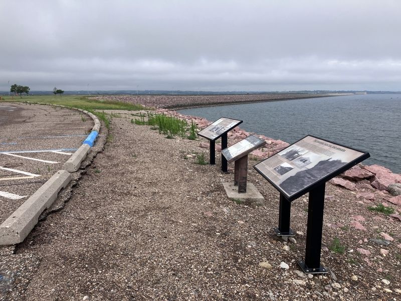
Location. 47° 29.554′ N, 101° 23.541′ W. Marker is near Riverdale, North Dakota, in McLean County. It is on State Highway 200 near West Missouri Drive, on the right when traveling north. The marker is located at the Garrison Dam Overlook,. Touch for map. Marker is in this post office area: Riverdale ND 58565, United States of America. Touch for directions.

Regionally, this marker is in the Mandan, Hidatsa, and Arikara Nation, in the Standing Rock Sioux Tribe, in the Drift Prairie, and on the Missouri Plateau. It is also in the American Lewis & Clark Corridor, on the prairies, and on the Northern Plains. Globally, it is in North America, the Western Hemisphere, the Western World, and the Anglosphere. Historically, it finds itself in what was once Rupert’s Land and also the Louisiana Purchase.
Other nearby markers. At least 8 other markers are within 3 miles of this marker, measured as the crow flies: Garrison Dam Overlook (here, next to this marker); The Mandan, Hidatsa, and Arikara (here, next to this marker); Growing out of the wheat fields and many have since returned. (within shouting distance of this marker); Taming the mighty Missouri by building the world's largest rolled earth dam of its time. (within shouting distance of this marker); The Spillway Bridge is often believed to be "the dam", (about 400 feet away, measured in a direct line); Riverdale (about 500 feet away); Powerhouse (approx. 2.1 miles away); Garrison Dam (approx. 2.1 miles away). Touch for a list and map of all markers in Riverdale.
Credits. This page was last revised on September 10, 2025. It was originally submitted on September 9, 2025, by Barry Swackhamer of Brentwood, California. This page has been viewed 199 times since then and 116 times this year. Photos: 1, 2. submitted on September 9, 2025, by Barry Swackhamer of Brentwood, California.
