
Leesylvania in Prince William County, Virginia — The American South (Mid-Atlantic)
Potomac Path
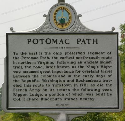
Photographed by Kevin White, August 24, 2007
1. Potomac Path Marker
Erected 1979 by Prince William County Historical Commission. (Marker Number 6.)
Topics and series. This historical marker is listed in these topic lists: Colonial Era • Indigenous Peoples and Communities • Roads & Vehicles • Settlements & Settlers. In addition, it is included in the Former U.S. Presidents: #01 George Washington, the The Washington-Rochambeau Route, and the Virginia, Prince William County Historical Commission series lists. A significant historical year for this entry is 1781.
Location. 38° 37.221′ N, 77° 17.038′ W. Marker is in Leesylvania, Virginia, in Prince William County. It is on Richmond
this page online

Regionally, this marker is in the Washington Metropolitan Area, in Northern Virginia, and in the Piedmont. It is also in the American South, specifically in the Upper South, in the Mid-Atlantic, and on the Eastern Seaboard. Globally, it is in the North Atlantic Region, North America, the Western Hemisphere, the Western World, and the Anglosphere. Historically, it finds itself in what was once the territory of the Mississippian Culture, one of the original Thirteen Colonies, one of the Confederate States of America, and the Antebellum South.
Other nearby markers. At least 8 other markers are within walking distance of this marker: The King's Highway (approx. ¼ mile away); Native Americans from Eastern Prince William County (approx. ¼ mile away); Freedom High School Sundial Memorial (approx. ¼ mile away); Passing Blackburn House (approx. ¼ mile away); Ellis and Preservation (approx. 0.3 miles away); The Old Potomac Path
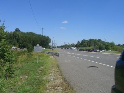
Photographed by Kevin W., September 12, 2007
2. Potomac Path Marker
Other markers no longer nearby. Preserving History (was approx. 0.3 miles away but has been replaced with another marker now near it); a different marker also named The Potomac Path (was approx. 0.4 miles away but has been replaced with another marker now near it); Centuries of History (was approx. half a mile away but has been replaced with another marker now near it).
Regarding Potomac Path. The King’s Highway was part of the north-south, inter-colonial postal route through the colonies. It was also part of what is known as the “Washington and Rochambeau Road.” From Alexandria to Fredericksburg, the highway incorporated the Potomac Path.
Related markers. Click here for a list of markers that are related to this marker. This Marker is the trail head for the King's Highway virtual tour.
Also see . . .
1. King's Highway (Charleston to Boston). Wikipedia entry (Submitted on December 24, 2025, by Larry Gertner of New York, New York.)
2. Rippon Lodge (An article originally published in 1932).
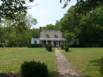
Photographed by Kevin White, August 24, 2007
3. Rippon Lodge
Rippon Lodge and its access road are undergoing upgrades and renovations.
3. Prince William County Historic Preservation of Rippon Lodge. (Submitted on August 24, 2007, by Kevin W. of Stafford, Virginia.)
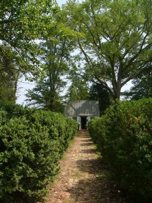
Photographed by Kevin White, August 24, 2007
4. Rippon Lodge Gift Shop
One of the outlying structures of Rippon Lodge serves as a gift shop (currently closed during renovations).
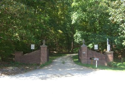
Photographed by Kevin W., September 12, 2007
5. Entrance to Rippon Lodge
Credits. This page was last revised on December 24, 2025. It was originally submitted on August 24, 2007, by Kevin W. of Stafford, Virginia. This page has been viewed 3,887 times since then and 44 times this year. Last updated on October 1, 2025, by N. Jozsa of Woodbridge, Virginia. Photos: 1. submitted on August 24, 2007, by Kevin W. of Stafford, Virginia. 2. submitted on September 13, 2007, by Kevin W. of Stafford, Virginia. 3, 4. submitted on August 24, 2007, by Kevin W. of Stafford, Virginia. 5. submitted on September 13, 2007, by Kevin W. of Stafford, Virginia. • Devry Becker Jones was the editor who published this page.
