Greater Upper Marlboro in Prince George's County, Maryland — The American Northeast (Mid-Atlantic)
Billingsley
Photographed by Allen C. Browne, October 3, 2025
1. Billingsley Marker
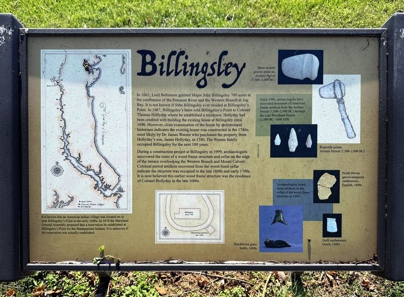
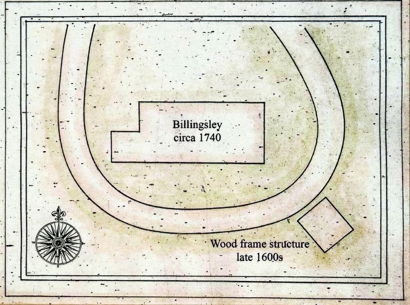
During a construction project at Billingsley in 1999, archaeologists uncovered the ruins of a wood-frame structure and cellar on the edge of-the terrace overlooking the Western Branch and Mount Calvert. Colonial period artifacts recovered from the wood-lined cellar indicate the structure was occupied in the late 1600s and early 1700s. It is now believed this earlier wood frame structure was the residence of Colonel Hollyday
this page online
Topics. This historical marker is listed in these topic lists: Anthropology & Archaeology • Colonial Era • Indigenous Peoples and Communities. A significant historical year for this entry is 1662.
Location. 38° 47.67′ N, 76° 43.069′ W. Marker is in Upper Marlboro, Maryland, in Prince George's County. It is in Greater Upper Marlboro. It can be reached from Green Landing Road. Green Landing Road is a private road not open to the public. To reach Billingsley turn off MD 301 at Maude Savoy Brown road and drive around or through the county composting facility and the water treatment plant to find Billingsley. Touch for map. Marker is at or near this postal address: 6900 Green Landing Rd, Upper Marlboro MD 20772, United States of America. Touch for directions.

Regionally, this marker is in the Washington Metropolitan Area. It is also in the American South, specifically in the Upper South, in the Mid-Atlantic, and on the Eastern Seaboard. Globally, it is in the North Atlantic Region, North America, the Western Hemisphere, the Western World, and the Anglosphere. Historically, it finds itself in what was
Photographed by Allen C. Browne, October 3, 2025
2. Billingsley Marker
Other nearby markers. At least 8 other markers are within walking distance of this marker: Mount Calvert: A Confluence of Three Cultures (here, next to this marker); a different marker also named Billingsley's Point (approx. 0.7 miles away); Mount Calvert Manor (approx. 0.7 miles away); Mount Calvert Federal Period Plantation House (approx. 0.7 miles away); Mount Calvert Historical and Archaeological Park (approx. 0.7 miles away); African-Americans at Mount Calvert (approx. 0.7 miles away); Mount Calvert, Early Town (approx. 0.7 miles away); Woodland Indians (approx. 0.7 miles away). Touch for a list and map of all markers in Upper Marlboro.
Another marker is no longer nearby. Billingsley's Point (was approx. 0.7 miles away but has been reported to have been replaced with another marker now near it).

Photographed by Allen C. Browne, October 3, 2025
3. American Indian Village
It is known that an American-Indian village was located on or near Billingsley's Point in the early 1600s. In 1674 the Maryland General Assembly proposed that a reservation be established at Billingsley's Point for the Mattapanient Indians. It is unknown if the reservation was actually-established.
Close-up of image on marker.
Photographed by Allen C. Browne, October 3, 2025
4. Billingsley circa 1740

Photographed by Allen C. Browne, October 3, 2025
5. American Indian Artifacts
Since 1990, archaeologists have recovered thousands of American Indian artifacts from the Archaic period (75,00 – 200 BC) through the Late Woodland period (2,000 BC – 1600 AD).
Close of images on marker.

Photographed by Allen C. Browne, October 3, 2025
6. Colonial Artifacts
Archaeologists found these artifacts in the cellar of wood frame structure in 1999.
Close-up of images on marker.
Photographed by Allen C. Browne, October 3, 2025
7. Billingsley House
Credits. This page was last revised on October 7, 2025. It was originally submitted on October 4, 2025, by Allen C. Browne of Silver Spring, Maryland. This page has been viewed 156 times since then and 52 times this year. Photos: 1, 2, 3, 4, 5, 6, 7. submitted on October 4, 2025, by Allen C. Browne of Silver Spring, Maryland.
