
Oldtown in Greene County, Ohio — The American Midwest (Great Lakes)
Discover
Great Council State Park
| — | Learn More at OhioStateParks.gov | — |
Photographed by Pete Skillman, June 26, 2025
1. Discover Marker
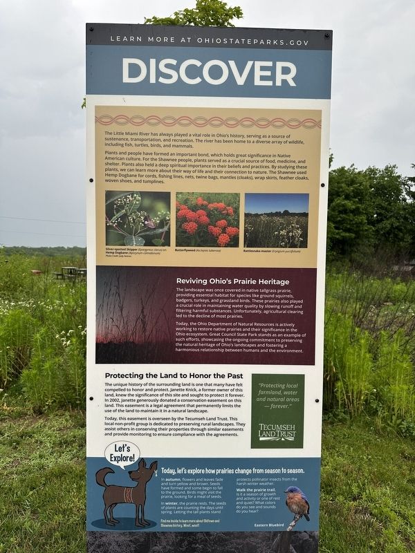
The Little Miami River has always played a vital role in Ohio's history, serving as a source of sustenance, transportation, and recreation. The river has been home to a diverse array of wildlife, including fish, turtles, birds, and mammals.
Plants and people have formed an important bond, which holds great significance in Native American culture. For the Shawnee people, plants served as a crucial source of food, medicine, and shelter. Plants also held a deep spiritual importance in their beliefs and practices. By studying these plants, we can learn more about their way of life and their connection to nature. The Shawnee used Hemp Dogbane for cords, fishing lines, nets, twine bags, mancles (cloaks), wrap skirts, feather cloaks, woven shoes, and tumplines.
Reviving Ohio's Prairie Heritage
The landscape was once covered in native tallgrass prairie providing essential habitat for species like ground squirrels, badgers, turkeys, and grassland birds. These prairies also played a crucial role in maintaining water quality by slowing runoff and filtering harmful substances. Unfortunately, agricultural clearing led to
this page online
Today, the Ohio Department of Natural Resources is actively working to restore native prairies and their significance in the Ohio ecosystem. Great Council State Park stands as an example of such efforts, showcasing the ongoing commitment to preserving the natural heritage of Ohio's landscapes and fostering a harmonious relationship between humans and the environment.
Protecting the Land to Honor the Past
The unique history of the surrounding land is one that many have felt compelled to honor and protect. Janette Knick, a former owner of this land, knew the significance of this site and sought to protect it forever. In 2002, Janette generously donated a conservation easement on this land. This easement is a legal agreement that permanently limits the use of the land to maintain it in a natural landscape.
Today, this easement is overseen by the Tecumseh Land Trust. This local non-profit group is dedicated to preserving rural landscapes. They assist others in conserving their properties through similar easements and provide monitoring to ensure compliance with the agreements.
Today, let's
Photographed by Pete Skillman, June 26, 2025
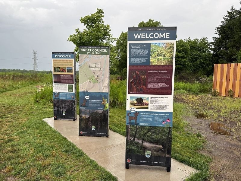
2. Discover Marker - wide view
In autumn flowers and leaves fade and turn yellow and brown. Seeds have formed and some begin to fall to the ground. Birds might visit the prairie looking for a meal of seeds.
In winter, the prairie rests. The seeds of plants are counting the days until spring. Letting the tall plants stand protects pollinator insects from the harsh winter weather.
Walk the prairie trail.
Is it a season of growth and activity or one of rest and quiet? What colors do you see and sounds do you hear?
[Captions:]
Hi, I'm Siikona!
Find my inside to learn more about Oldtown and Shawnee history. Woof, woof!
Silver-spotted Skipper (Epargyreus clarus) on Hemp Dogbane (Apocynum cannabinum)
Photo Credit: Judy Semroc
Butterflyweed (Asclepias tuberosa)
Rattlesnake-master (Eryngium yuccifolium)
Eastern Bluebird
Erected 2024 by Great Council State Park.
Topics. This historical marker is listed in these topic lists: Environment • Indigenous Peoples and Communities • Parks & Recreational Areas.
Location. 39° 43.744′ N, 83° 56.259′ W. Marker is in Oldtown, Ohio, in Greene County. It can be reached from U.S. 68. Touch for map. Marker is at or near this postal address: 1587 US-68, Xenia OH 45385, United States of America. Touch for directions.

Regionally, this marker is in Ohio’s Dayton Metro and in the Miami Valley. It is also in the American Midwest and in the Corn Belt. Globally, it is in North America, the Western Hemisphere, the Western World, and the Anglosphere. Historically, it finds itself in what was once the Haudenosaunee (Iroquois) Confederacy, the territory of the Mississippian Culture, and the Northwest Territory.
Other nearby markers. At least 8 other markers are within walking distance of this marker: Welcome (here, next to this marker); Blackfish Trail (a few steps from this marker); Site of Old Chillicothe (within shouting distance of this marker); Daniel Boone Memorial (within shouting distance of this marker); a different marker also named Daniel Boone Memorial (within shouting distance of this marker); Council House (within shouting distance of this marker); Old Chillicothe (within shouting distance of this marker); a different marker also named Site of Old Chillicothe (within shouting distance of this marker). Touch for a list and map of all markers in Oldtown.
Also see . . .
1. Great Council State Park. Wikipedia entry (Submitted on July 1, 2025, by Larry Gertner of New York, New York.)
2. Tecumseh Land Trust. (Submitted on June 30, 2025, by Pete Skillman of Wilmington, Delaware.)
Credits. This page was last revised on October 7, 2025. It was originally submitted on June 30, 2025, by Pete Skillman of Wilmington, Delaware. This page has been viewed 143 times since then and 32 times this year. Last updated on October 7, 2025, by Craig Doda of Napoleon, Ohio. Photos: 1, 2. submitted on June 30, 2025, by Pete Skillman of Wilmington, Delaware. • Devry Becker Jones was the editor who published this page.
