Chesterfield in Chesterfield County, Virginia — The American South (Mid-Atlantic)
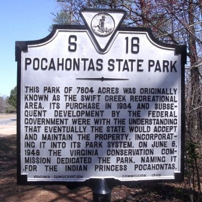
Pocahontas State Park
Erected 1948 by Virginia Conservation Commission. (Marker Number S-16.)
Topics and series. This historical marker is listed in these topic lists: Horticulture & Forestry • Native Americans • Parks & Recreational Areas • Women. In addition, it is included in the Virginia Department of Historic Resources (DHR) series list. A significant historical date for this entry is June 6, 1946.
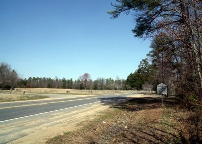
Location. 37° 21.933′ N, 77° 34.349′ W. Marker is in Chesterfield, Virginia, in Chesterfield County. Marker is at the intersection of Beach Road (Virginia Route 655) and State Park Road on Beach Road. Touch for map. Marker is in this post office area: Chesterfield VA 23832, United States of America. Touch for directions.
Other nearby markers. At least 8 other markers are within 4 miles of this marker, measured as the crow flies. Civilian Conservation Corps - Company 2386 (approx. half a mile away); CCC Camp Site (approx. half a mile away); Dividends for the Future (approx. 1˝ miles away); Apostles of Religious Liberty (approx. 3.7 miles away); 1917 Courthouse (approx. 3.7 miles away); Veterans Memorial Wall (approx. 3.7 miles away); Chesterfield Court House (approx. 3.7 miles away); Chesterfield County Courthouse (approx. 3.7 miles away). Touch for a list and map of all markers in Chesterfield.
Also see . . .
1. Pocahontas State Park. Virginia Department of Conservation and Recreation (Submitted on March 21, 2010, by Bernard Fisher of Richmond, Virginia.)
2. Friends of Pocahontas State Park. (Submitted on March 21, 2010, by Bernard Fisher of Richmond, Virginia.)
Additional commentary.
1. "Indian Princess" Pocahontas
It's a misnomer to describe Pocahontas as a "princess" since Native Americans did not have royalty in the same understanding as European cultures.
— Submitted January 25, 2020, by Devry Becker Jones of Washington, District of Columbia.
Credits. This page was last revised on January 13, 2022. It was originally submitted on March 21, 2010, by Bernard Fisher of Richmond, Virginia. This page has been viewed 1,405 times since then and 39 times this year. Photos: 1, 2. submitted on March 21, 2010, by Bernard Fisher of Richmond, Virginia.

