Near Greycliff in Sweet Grass County, Montana — The American West (Mountains)
The Thomas Party
Photographed by Rich Pfingsten, March 22, 2009
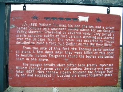
1. The Thomas Party Marker
From the site of this fort the Thomas party pushed on alone. A few days later they were killed at this spot by hostile Indians. Emigrants found the bodies and buried them in one grave.
The meager details which sifted back greatly impressed William Thomas' seven year old nephew. Seventy-one years later (1937) this nephew closely followed the Bridger Trail by car and succeeded in locating the almost forgotten grave.
Topics. This historical marker is listed in these topic lists: Cemeteries & Burial Sites • Exploration • Forts and Castles • Indigenous Peoples and Communities • Notable Events • Settlements & Settlers. A significant historical year for this entry is 1866.
Location. This marker has been replaced by another marker nearby. It was located near 45° 44.109′ N,
this page online

Regionally, this marker was in Yellowstone Country. It was also in the American Mountain West and in the Lewis & Clark Corridor. Globally, it was in North America, the Rocky Mountains, the Western Hemisphere, the Western World, and the Anglosphere. Historically, it found itself in what was once Rupert’s Land and also the Louisiana Purchase.
Other nearby markers. At least 8 other markers are within 3 miles of this location, measured as the crow flies: A different marker also named The Thomas Party (here, next to this marker); Montana's Jurassic Park (approx. 2 miles away); The Cattle Drive of 1866 (approx. 2 miles away); The Crazy Mountains (original title obscured)
Photographed by Rich Pfingsten, March 22, 2009
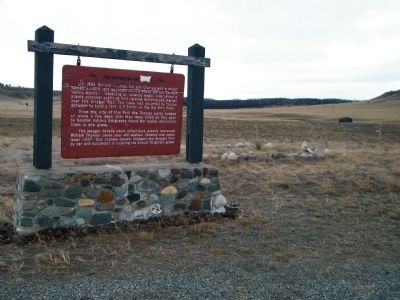
2. The Thomas Party Marker with gravesite in background
More about this marker. This marker is pretty well-worn and could use some repair work.
Related marker. Click here for another marker that is related to this marker. This marker has been replaced with the linked marker.
Photographed by Rich Pfingsten, March 22, 2009
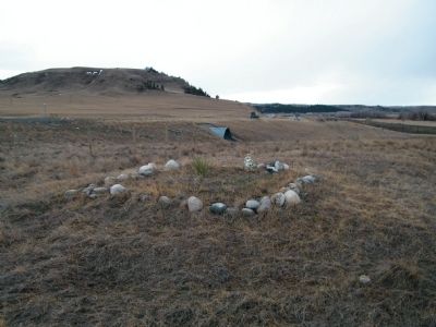
3. Thomas Party gravesite
Credits. This page was last revised on December 27, 2024. It was originally submitted on March 22, 2010, by Rich Pfingsten of Forest Hill, Maryland. This page has been viewed 3,890 times since then and 178 times this year. Last updated on March 22, 2010, by Rich Pfingsten of Forest Hill, Maryland. Photos: 1, 2, 3. submitted on March 22, 2010, by Rich Pfingsten of Forest Hill, Maryland. • Bill Pfingsten was the editor who published this page.
