
Willey Lumber Camp in Jackson County, Colorado — The American Mountains (Southwest)
Auto Tourism
Photographed by Cosmos Mariner, July 29, 2025
1. Auto Tourism Marker
Highway 14
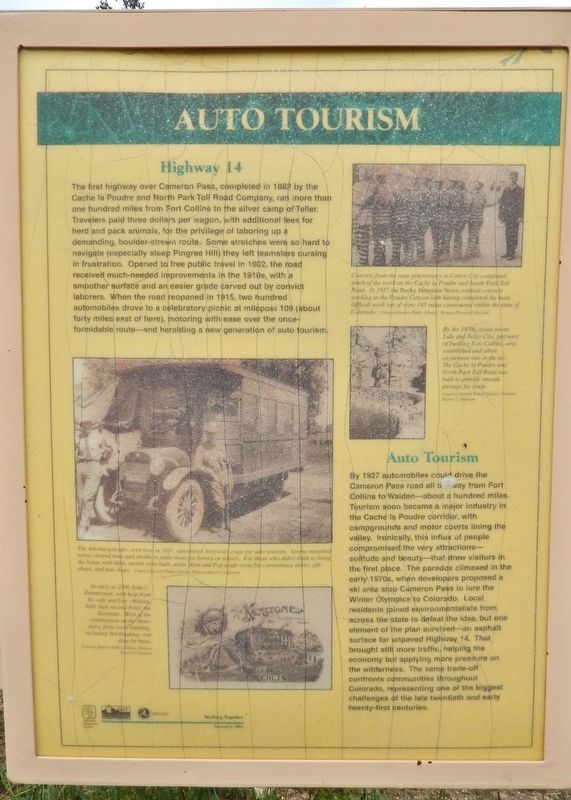
The first highway over Cameron Pass, completed in 1882 by the Cache la Poudre and North Park Toll Road Company, ran more than one hundred miles from Fort Collins to the silver camp of Teller. Travelers paid three dollars per wagon, with additional fees for herd and pack animals, for the privilege of laboring up a demanding, boulder-strewn route. Some stretches were so hard to navigate (especially steep Pingree Hill) they left teamsters cursing in frustration. Opened to free public travel in 1902, the road received much-needed improvements in the 1910s, with a smoother surface and an easier grade carved out by convict laborers. When the road reopened in 1915, two hundred automobiles drove to a celebratory picnic at milepost 109 (about forty miles east of here), motoring with ease over the once-formidable route — and heralding a new generation of auto tourism.
Auto Tourism
By 1927 automobiles could drive the Cameron Pass road all the way from Fort Collins to Walden — about a hundred miles. Tourism soon became a major industry in the Cache la Poudre corridor, with campgrounds and motor courts lining the valley. Ironically,
this page online
[photo captions]
• The Autobungaloufer, seen here in 1921, epitomized America’s craze for auto tourism. Serene mountain towns cleared trees and shrubs to make room for homes on wheels. For those who didn’t think to bring the house with them, motels were built, while Mom and Pop made room for convenience stores, gift shops, and bait shops.
• As early as 1896 John C. Zimmerman, with help from his wife and four children, built their second hotel, the Keystone. Most of the
Photographed by Cosmos Mariner, July 29, 2025
2. Auto Tourism Marker
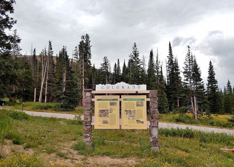
This marker is the leftmost of two panels on the south side of the Colorado Department of Transportation interpretive kiosk in the Cameron Pass wayside.
• Convicts from the state penitentiary in Cañon City completed much of the work on the Cache la Poudre and North Park Toll Road. In 1917 the Rocky Mountain News credited convicts working in the Poudre Canyon with having completed the most difficult work out of some 145 miles constructed within the state of Colorado.
• By the 1870s, boom towns Lulu and Teller City, just west of bustling Fort Collins, were established and silver excitement was in the air. The Cache la Poudre and North Park Toll Road was built to provide smooth passage for trade.
Erected 2002 by Colorado Historical Society, Colorado Department of Transportation and Federal Highway Administration.
Topics and series. This historical marker is listed in these topic lists: Environment • Parks & Recreational Areas • Roads & Vehicles. In addition, it is included in the History Colorado series list. A significant historical year for this entry is 1882.
Location. 40° 31.236′ N, 105° 53.615′ W. Marker is in Willey Lumber Camp, Colorado, in Jackson County. It is on State Highway 14 at milepost 64.9, on the left when traveling east. The marker is in the Cameron Pass Summit wayside. Touch for map. Marker is in this post office area: Walden CO 80480, United States of America. Touch for directions.

Regionally, this marker is in the Colorado High Rockies and on the Continental Divide. It is also in the American Mountain West. Globally, it is in North America, the Rocky Mountains, the Western Hemisphere, the Western World, and the Anglosphere.
Other nearby markers. At least 8 other markers are within 9 miles of this marker, measured as the crow flies: The Industrial Frontier (here, next to this marker); Forest Conservation (here, next to this marker); Cameron Pass Country (here, next to this marker); Joe Wright Reservoir (approx. 1.4 miles away); Poudre Pioneer Tourism (approx. 1.4 miles away); Get to Know your Native Greenback Cutthroat Trout (approx. 1.4 miles away); The Colorado State Forest Management Complex (approx. 4 miles away); Beaver Trade (approx. 8.2 miles away). Touch for a list and map of all markers in Willey Lumber Camp.
Also see . . . Cache La Poudre-North Park Scenic and Historic Byway (Federal Highway Administration).
Excerpt: The Cache La Poudre-North Park Scenic Byway leads visitors from the city of Fort Collins to the quiet, bowl-shaped valley of North Park, located just west of the Continental Divide. The Cache La Poudre River Canyon and the Roosevelt National Forest characterize the eastern section of the byway, while the North Park valley dominates the western section. The Cache La Poudre-North Park Scenic Byway was once a useful transit corridor for Native Americans and early white explorers. Today, the byway is a destination spot for travelers looking for beautiful scenery, solitude, diverse landscape, and recreational opportunities.(Submitted on December 8, 2025, by Cosmos Mariner of Cape Canaveral, Florida.)
Credits. This page was last revised on December 8, 2025. It was originally submitted on December 8, 2025, by Cosmos Mariner of Cape Canaveral, Florida. This page has been viewed 79 times since then and 47 times this year. Photos: 1, 2. submitted on December 8, 2025, by Cosmos Mariner of Cape Canaveral, Florida.
