
Willey Lumber Camp in Jackson County, Colorado — The American Mountains (Southwest)
Forest Conservation
Photographed by Cosmos Mariner, July 31, 2025
1. Forest Conservation Marker
Pingree Park
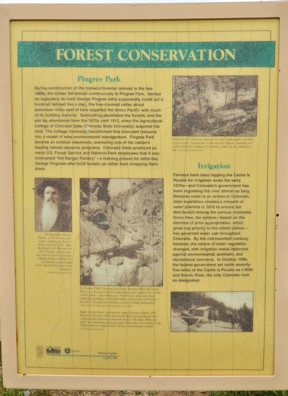
During construction of the transcontinental railroad in the late 1860s, the timber fell almost continuously in Pingree Park. Named for legendary tie hack George Pingree (who supposedly could cut a hundred railroad ties a day), the tree-covered valley about seventeen miles east of here supplied the Union Pacific with much of its building material. Overcutting decimated the forests, and the site lay abandoned from the 1870s until 1912, when the Agricultural College of Colorado (later Colorado State University) acquired the land. The college, ironically, transformed this overused resource into a model of wise environmental management. Pingree Park became an outdoor classroom, anchoring one of the nation's leading natural resource programs. Colorado State produced so many U.S. Forest Service and National Park employees that it was nicknamed “the Ranger Factory” — a training ground for latter-day George Pingrees who build forests up rather than chopping them down.
Irrigation
Farmers have been tapping the Cache la Poudre for irrigation since the early 1870s — and Colorado’s government has been regulating the river
this page online
[photo captions]
• The legendary George Pingree in 1859 — two years before enlisting in the U.S. Army at Central City. After the Sand Creek Massacre in 1864, Pingree served a ten-day sentence at Fort Lyon for scalping thirteen Indians; he resented his sentence and never regretted his part in the massacre.
• In October 1986, Congress passed the National Wild and Scenic Rivers Act to protect the few unpolluted, undeveloped rivers in the United States. Since then, over 10,000 river
Photographed by Cosmos Mariner, July 29, 2025
2. Forest Conservation Marker
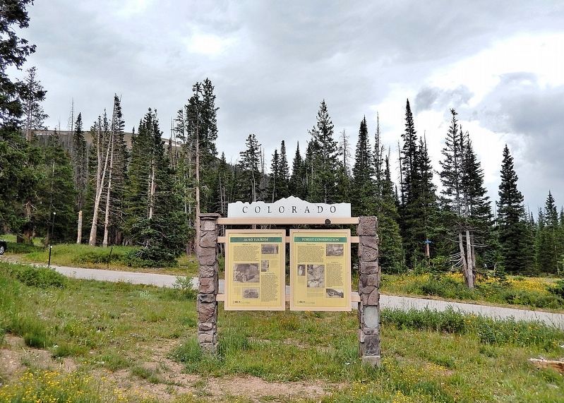
This marker is the rightmost of two panels on the south side of the Colorado Department of Transportation interpretive kiosk in the Cameron Pass wayside.
• Grand Ditch construction camp, Hitchen’s Gulch, 1942. Begun in the early 1900s, the Grand Ditch was among the first transmountain diversion structures built in the state. There are eight such structures carrying water from other river basins to the Poudre River to supplement it during warm summer months.
• Tie hacks were paid ten cents per tie and could usually cut thirty to forty a day. Legend has it that George Pingree, standing over six feet tall and weighing 225 pounds, could cut one hundred a day.
Erected 2002 by Colorado Historical Society, Colorado Department of Transportation and Federal Highway Administration.
Topics and series. This historical marker is listed in these topic lists: Environment • Horticulture & Forestry • Parks & Recreational Areas • Waterways & Vessels. In addition, it is included in the History Colorado series list. A significant historical month for this entry is October 1986.
Location. 40° 31.236′ N, 105° 53.614′ W. Marker is in Willey Lumber Camp, Colorado, in Jackson County. It is on State Highway 14 at milepost 64.9, on the left when traveling east. The marker is in the Cameron Pass Summit wayside. Touch for map. Marker is in this post office area: Walden CO 80480, United States of America. Touch for directions.

Regionally, this marker is in the Colorado High Rockies and on the Continental Divide. It is also in the American Mountain West. Globally, it is in North America, the Rocky Mountains, the Western Hemisphere, the Western World, and the Anglosphere.
Other nearby markers. At least 8 other markers are within 9 miles of this marker, measured as the crow flies: Cameron Pass Country (here, next to this marker); Auto Tourism (here, next to this marker); The Industrial Frontier (here, next to this marker); Joe Wright Reservoir (approx. 1.4 miles away); Poudre Pioneer Tourism (approx. 1.4 miles away); Get to Know your Native Greenback Cutthroat Trout (approx. 1.4 miles away); The Colorado State Forest Management Complex (approx. 4 miles away); Beaver Trade (approx. 8.2 miles away). Touch for a list and map of all markers in Willey Lumber Camp.
Also see . . .
1. George Pingree (losthistory.net).
Excerpt: "Pingree's Camp," a "tie camp" on the Poudre River, was established in the 1860's by George Washington Pingree. Born in Orono, Maine in 1832, Pingree came to the Poudre after serving in the army and participating in the Sand Creek Massacre. Pingree spent many winters in the upper Poudre Canyon trapping and hunting. His camp was established at what is now called "Rustic," a resort along the river. George cut a trail up a gulch on the north side of the river in order to pack out his pelts and pack in supplies. When the tie camp was established, Pingree's trail was widened to accommodate stages, wagons, and freighters, and is now called Pingree Hill Road. Built in the bottom of the gulch, it climbs up out of the Poudre Canyon rising over 1100 feet in elevation in just two and a half miles to the Red Feather Lakes area. Until 1920, this was the only road that wagons, and then automobiles could get into Poudre Canyon.(Submitted on December 8, 2025, by Cosmos Mariner of Cape Canaveral, Florida.)
2. Cache la Poudre River (Wikipedia).
Excerpt : The river is a popular summer destination for fly fishing, whitewater rafting, tubing, and kayaking in the Poudre Canyon, due in large part to the enormous 6,155 feet elevation variance between its headwaters and its mouth, resulting in a typically very swift current.(Submitted on December 8, 2025, by Cosmos Mariner of Cape Canaveral, Florida.)
A project proposed by the Northern Colorado Water Conservation District called the Northern Integrated Supply Project (NISP) includes several water supply projects, but focuses on the Glade Reservoir, which would be located north of Fort Collins, Colorado, and the Galeton Reservoir, which would be located north of Eaton, Colorado, and would supply 40,000 acre-feet of water annually to 15 communities in Northern Colorado. Both reservoirs would be filled by a diversion from the Cache la Poudre River and would store that water for use by these communities.
3. Wild and Scenic Rivers Act (U.S. Fish & Wildlife Service).
Excerpt: The National Wild and Scenic Rivers System was established by the Wild and Scenic Rivers Act of 1968 and authorizes Congress to preserve certain rivers with outstanding natural, cultural, and recreational values in a free-flowing condition for the enjoyment of present and future generations. It safeguards the special character of these rivers, while also recognizing the potential for their appropriate use and development. It encourages river management that crosses political boundaries and promotes public participation in developing goals for river protection.(Submitted on December 8, 2025, by Cosmos Mariner of Cape Canaveral, Florida.)
Credits. This page was last revised on December 9, 2025. It was originally submitted on December 8, 2025, by Cosmos Mariner of Cape Canaveral, Florida. This page has been viewed 122 times since then and 93 times this year. Photos: 1, 2. submitted on December 8, 2025, by Cosmos Mariner of Cape Canaveral, Florida.
