Near Dolores in Montezuma County, Colorado — The American Mountains (Southwest)
Farmland... Now & Then
Photographed by Cosmos Mariner, July 17, 2025
1. Farmland... Now & Then Marker
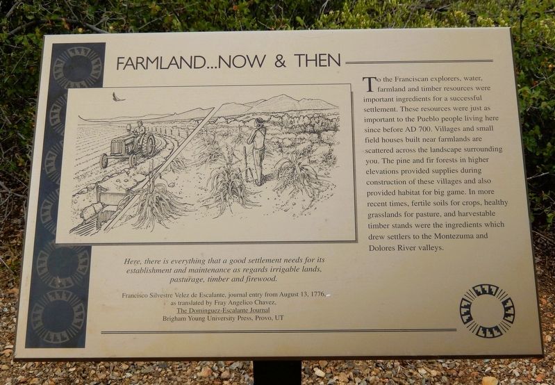
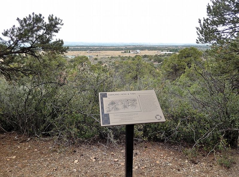
To the Franciscan explorers, water, farmland and timber resources were important ingredients for a successful settlement. These resources were just as important to the Pueblo people living here since before AD 700. Villages and small field houses built near farmlands are scattered across the landscape surrounding you. The pine and fir forests in higher elevations provided supplies during construction of these villages and also provided habitat for big game. In more recent times, fertile soils for crops, healthy grasslands for pasture, and harvestable timber stands were the ingredients which drew settlers to the Montezuma and Dolores River valleys.
Here, there is everything that a good settlement needs for its establishment and maintenance as regards irrigable lands, pasturage, timber and firewood.
—Francisco Silvestre Velez de Escalante, journal entry from August 13, 1776,
as translated by Fray Angelico Chavez,
The Dominguez-Escalante Journal
Brigham Young University Press, Provo, UT
Erected by The Colorado Historical Society, the Bureau of Land Management, the Family of Nellie Mulnix Joy and the Frankston Family.
Topics.
this page online
Location. 37° 28.727′ N, 108° 32.802′ W. Marker is near Dolores, Colorado, in Montezuma County. It can be reached from State Highway 184 at milepost 7, on the right when traveling west. The marker is on the Escalante Pueblo Trail at the Canyons of the Ancients National Monument Visitor Center. Touch for map. Marker is at or near this postal address: 27501 Colorado Highway 184, Dolores CO 81323, United States of America. Touch for directions.

Regionally, this marker is in the American Mountain West, on the Colorado Plateau, and at the Four Corners. Globally, it is in North America, the Rocky Mountains, the Western Hemisphere, the Western World, and the Anglosphere. Historically, it finds itself in what was once the territory of the Ancestral Puebloans and also Mexico’s Alta California.
Other nearby markers. At least 8 other markers are within walking distance of this marker: Great Sage Plain, Colorado and Utah (a
Photographed by Cosmos Mariner, July 17, 2025
2. Farmland... Now & Then Marker
Also see . . .
1. Domínguez–Escalante expedition (Wikipedia).
Excerpt: A Spanish journey of exploration conducted in 1776 by two Franciscan priests, Atanasio Domínguez and Silvestre Vélez de Escalante, to find an overland route from Santa Fe, New Mexico, to their Roman Catholic mission in Monterey, on the coast of modern-day central California. Domínguez, Vélez de Escalante, and Bernardo de Miera y Pacheco, acting as the expedition's cartographer, traveled with ten men from Santa Fe through many unexplored portions of the American West, including present-day western Colorado, Utah, and northern Arizona. Along part of the journey, they were aided by three indigenous guides of the Timpanogos tribe (Ute people).(Submitted on December 23, 2025, by Cosmos Mariner of Cape Canaveral, Florida.)
The land was harsh and unforgiving, and hardships encountered during travel forced the group to return to Santa Fe before reaching Las Californias. Maps and documentation produced by the expedition aided future travelers. The Domínguez–Escalante route eventually became an early template for the Old Spanish Trail, a trade route from Santa Fe to Pacific Coast settlements.
2. Dominguez Escalante Journal (University of Utah Press).
Excerpt: The chronicle of Fray Francisco Atanasio Domínguez and Fray Silvestre Vélez de Escalante’s most remarkable 1776 expedition through the Rocky Mountains, the eastern Great Basin, and the Colorado Plateau to inventory new lands for the Spanish crown and to find a route from Santa Fe to Monterey, California.(Submitted on December 23, 2025, by Cosmos Mariner of Cape Canaveral, Florida.)
Escalante’s journal wonderfully describes every detail of the rugged and scenic country through which they journeyed, along the qualities and customs of its inhabitants. Working as far north as present-day Provo, Utah, the expedition finally returned south. An approaching severe winter and mishaps among the maze of the Grand Canyon forced the party to return to Santa Fe by way of the Hopi pueblos.
Credits. This page was last revised on December 23, 2025. It was originally submitted on December 21, 2025, by Cosmos Mariner of Cape Canaveral, Florida. This page has been viewed 85 times since then and 41 times this year. Photos: 1, 2. submitted on December 23, 2025, by Cosmos Mariner of Cape Canaveral, Florida.
