Near Dolores in Montezuma County, Colorado — The American Mountains (Southwest)
Spanish Explorers
Photographed by Cosmos Mariner, July 17, 2025
1. Spanish Explorers Marker
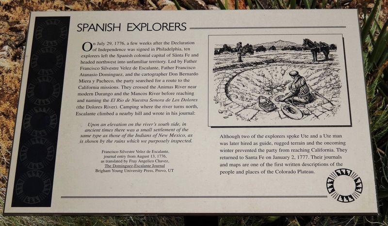
On July 29, 1776, a few weeks after the Declaration of Independence was signed in Philadelphia, ten explorers left the Spanish colonial capital of Santa Fe and headed northwest into unfamiliar territory. Led by Father Francisco Silvestre Velez de Escalante, Father Francisco Atanasio Dominguez, and the cartographer Don Bernardo Miera y Pacheco, the party searched for a route to the California missions. They crossed the Animas River near modern Durango and the Mancos River before reaching and naming the El Rio de Nuestra Senora de Los Dolores (the Dolores River). Camping where the river turns north, Escalante climbed a nearby hill and wrote in his journal:
Upon an elevation on the river's south side, in ancient times there was a small settlement of the same type as those of the Indians of New Mexico, as is shown by the ruins which we purposely inspected.
—Francisco Silvestre Velez de Escalante, journal entry from August 13, 1776, as translated by Fray Angelico Chavez,
The Dominguez-Escalante Journal
Brigham Young University Press, Provo, UT
Although two of the explorers spoke Ute and a Ute man was later hired as guide, rugged
this page online
Erected by The Colorado Historical Society, the Bureau of Land Management, the Family of Nellie Mulnix Joy and the Frankston Family.
Topics. This historical marker is listed in these topic lists: Anthropology & Archaeology • Exploration • Hispanic Americans • Indigenous Peoples and Communities. A significant historical date for this entry is July 29, 1776.
Location. 37° 28.655′ N, 108° 32.735′ W. Marker is near Dolores, Colorado, in Montezuma County. It can be reached from State Highway 184 at milepost 7, on the right when traveling west. The marker is on the Escalante Pueblo Trail at the Canyons of the Ancients National Monument Visitor Center. Touch for map. Marker is at or near this postal address: 27501 Colorado Highway 184, Dolores CO 81323, United States of America. Touch for directions.

Regionally, this marker is in the American Mountain West, on the Colorado Plateau, and at the
Photographed by Cosmos Mariner, July 17, 2025
2. Spanish Explorers Marker
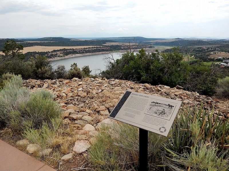
Looking east from the Escalante Pueblo Trail across McPhee Reservoir.
Other nearby markers. At least 8 other markers are within walking distance of this marker: The People (here, next to this marker); Mesa Verde National Park & Ute Mountain Tribal Park (a few steps from this marker); The Landscape (a few steps from this marker); Escalante Pueblo (within shouting distance of this marker); Rabbitbrush (within shouting distance of this marker); Big Sagebrush (about 300 feet away, measured in a direct line); Prickly Pear Cactus (about 300 feet away); Wildlife or Relatives? (about 300 feet away). Touch for a list and map of all markers in Dolores.
Also see . . . Domínguez–Escalante Expedition (Wikipedia).
Excerpt: The Domínguez–Escalante expedition was undertaken in 1776 with the purpose of finding a route across the largely unexplored continental interior from Santa Fe, New Mexico, to Spanish missions in Las Californias, such as the Spanish presidio at Monterey. The land was harsh and unforgiving, and hardships encountered during travel forced the group to return to Santa Fe before reaching Las Californias. Maps and documentation produced by the expedition aided future travelers. The Domínguez–Escalante route eventually became an early template for the Old Spanish Trail, a trade route from Santa Fe to Pacific Coast settlements.(Submitted on December 24, 2025, by Cosmos Mariner of Cape Canaveral, Florida.)
Near present-day Dolores, Escalante and Domínguez found and recorded Ancestral Puebloan ruins in southwestern Colorado, the first white men to do so. Escalante Pueblo and Domínguez Pueblos, named for them, are included within the Anasazi Heritage Center.
Credits. This page was last revised on December 24, 2025. It was originally submitted on December 23, 2025, by Cosmos Mariner of Cape Canaveral, Florida. This page has been viewed 101 times since then and 58 times this year. Photos: 1, 2. submitted on December 24, 2025, by Cosmos Mariner of Cape Canaveral, Florida.
