Sharpsburg in Washington County, Maryland — The American Northeast (Mid-Atlantic)
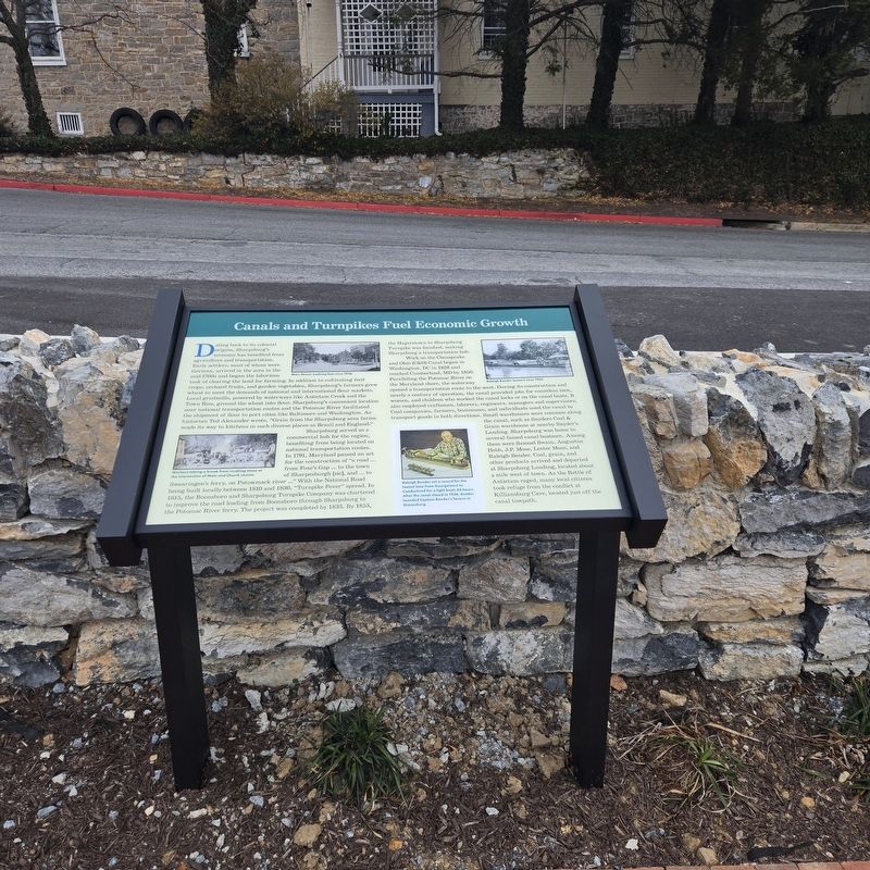
Canals and Turnpikes Fuel Economic Growth

Photographed by Mike McKeown, January 3, 2026
1. Canals and Turnpikes Fuel Economic Growth Marker
Dating back to its colonial origins. Sharpsburg's economy has benefited from agriculture and transportation. Early settlers, most of whom were German, arrived in the area in the mid-1700s and began the laborious task of clearing the land for farming. In addition to cultivating feed crops, orchard fruits, and garden vegetables, Sharpsburg's farmers grew wheat to meet the demands of national and international flour markets. Local gristmills, powered by waterways like Antietam Creek and the Town Run, ground the wheat into flour. Sharpsburg's convenient location near national transportation routes and the Potomac River facilitated the shipment of flour to port cities like Baltimore and Washington. As historian Ted Alexander wrote, "Grain from the Sharpsburg area farms made its way to kitchens in such diverse places as Brazil and England."
Sharpsburg served as a commercial hub for the region, benefiting from being located on national transportation routes. In 1791, Maryland passed an act for the construction of "a road ... from Foxe's Gap ... to the town of Sharpesburgh [sic], and ... to Swearingen's ferry, on Patowmack
this page online
Work on the Chesapeake and Ohio (C&O) Canal began in Washington, DC in 1828 and reached Cumberland, MD by 1850. Paralleling the Potomac River on the Maryland shore, the waterway opened a transportation route to the west. During its construction and nearly a century of operation, the canal provided jobs for countless men, women, and children who worked the canal locks or on the canal boats. It also employed craftsmen, laborers, engineers, managers and supervisors. Coal companies, farmers, businesses, and individuals used the canal to transport goods in both directions. Small warehouses were common along the canal, such as Snyders Coal & Grain warehouse at nearby Snyder's Landing. Sharpsburg was home to several famed canal boatmen. Among them
Photographed by Mike McKeown, January 3, 2026
2. Canals and Turnpikes Fuel Economic Growth Marker
(captions)
Main Street, looking East circa 1910.
Worker's taking a break from crushing stone at the intersection of Main and Church Streets.
Raleigh Bender (center) circa 1905.
Raleigh Bender set a record for the fastest time from Georgetown to Cumberland for a light boat: 62 hours. After the canal closed in 1936, Bender founded Captain Bender's Tavern in Sharpsburg.
Erected 2025.
Topics. This historical marker is listed in these topic lists: Industry & Commerce • Roads & Vehicles • Settlements & Settlers • War, US Civil • Waterways & Vessels. A significant historical year for this entry is 1791.
Location. 39° 27.525′ N, 77° 44.767′ W. Marker is in Sharpsburg, Maryland, in Washington County. It can be reached from the intersection of East Main Street (Maryland Route 34) and South Church Street, on the right when traveling east. Located in the new Sharpsburg Historical Park. Touch for map. Marker is at or near this postal address: 139 E Main St, Sharpsburg MD 21782, United States of America. Touch for directions.

Regionally, this marker is in Western Maryland. It is also in the American Mid-Atlantic, in Appalachia, and specifically in Northern Appalachia. Globally, it is in North America, the Western Hemisphere, the Western World, and the Anglosphere. Historically, it finds itself in what was once one of the original Thirteen Colonies.
Other nearby markers. At least 8 other markers are within walking distance of this marker: Sharpsburg and the Battle (a few steps from this marker); Returning Veterans and Remembrance (a few steps from this marker); Sharpburg's Architecture and Prominent Residents (within shouting distance of this marker); Kretzer Homestead (within shouting distance of this marker); Lutheran Cemetery (about 300 feet away, measured in a direct line); 1862 Lutheran Church Site (about 400 feet away); Collateral Damage (about 400 feet away); General Edward Braddock (about 600 feet away). Touch for a list and map of all markers in Sharpsburg.
Credits. This page was last revised on January 3, 2026. It was originally submitted on January 3, 2026, by Mike McKeown of Baltimore, Maryland. This page has been viewed 44 times since then. Photos: 1, 2. submitted on January 3, 2026, by Mike McKeown of Baltimore, Maryland. • Bernard Fisher was the editor who published this page.
