Durango in La Plata County, Colorado — The American Mountains (Southwest)
Welcome to the San Juan Skyway
an “All-American Road”
Photographed by Cosmos Mariner, July 16, 2025
1. Welcome to the San Juan Skyway Marker (east side)
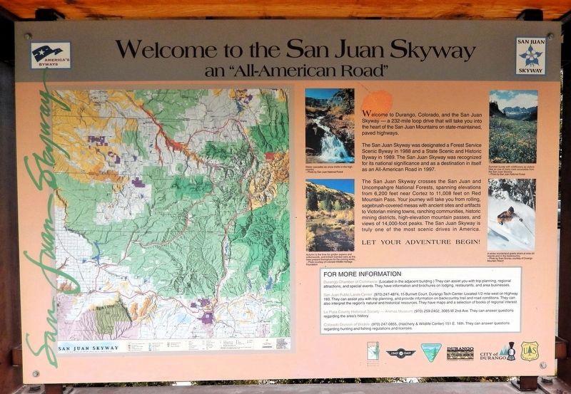
Welcome to Durango, Colorado, and the San Juan Skyway — a 232-mile loop drive that will take you into the heart of the San Juan Mountains on state-maintained, paved highways.
The San Juan Skyway was designated a Forest Service Scenic Byway in 1988 and a State Scenic and Historic Byway in 1989. The San Juan Skyway was recognized for its national significance and as a destination in itself as an All-American Road in 1997.
The San Juan Skyway crosses the San Juan and Uncompahgre National Forests, spanning elevations from 6,200 feet near Cortez to 11,008 feet on Red Mountain Pass. Your journey will take you from rolling, sagebrush-covered mesas with ancient sites and artifacts to Victorian mining towns, ranching communities, historic mining districts, high-elevation mountain passes, and views of 14,000-foot peaks. The San Juan Skyway is truly one of the most scenic drives in America.
[photo captions]
• Water cascades as snow melts in the high country.
• Summer bursts with wildflowers as visitors hike on one of the many trails accessible from the San Juan Skyway.
• Autumn is the time for golden aspens and cottonwoods, and brilliant
this page online
• A winter wonderland greets skiers at area ski resorts and in the backcountry.
The San Juan Skyway
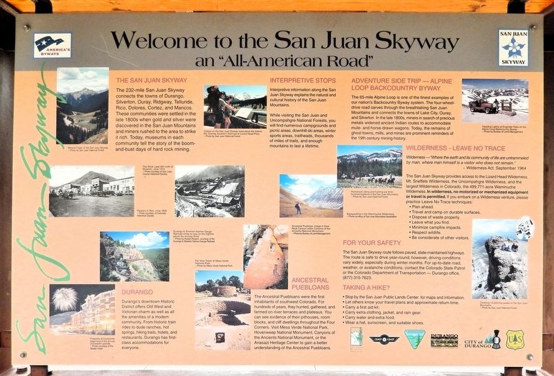
The 232-mile San Juan Skyway connects the towns of Durango, Silverton, Ouray, Ridgway, Telluride, Rico, Dolores, Cortez, and Mancos. These communities were settled in the late 1800s when gold and silver were discovered in the San Juan Mountains and miners rushed to the area to strike it rich. Today, museums in each community tell the story of the boom-and-bust days of hard rock mining.
Durango
Durango's downtown Historic District offers Old West and Victorian charm as well as all the amenities of a modern community. From historic train rides to dude ranches, hot springs, hiking trails, hotels, and restaurants, Durango has first-class accommodations for everyone.
Interpretive Stops
Interpretive information along the San Juan Skyway explains the natural and cultural history of the San Juan Mountains.
While visiting the San Juan and Uncompahgre National Forests, you will find numerous campgrounds and picnic areas, downhill ski areas, winter sports areas, trailheads, thousands
Photographed by Cosmos Mariner, July 16, 2025
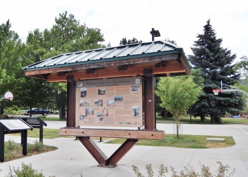
2. Welcome to the San Juan Skyway Marker (west side)
Ancestral Puebloans
The Ancestral Puebloans were the first inhabitants of southwest Colorado. For hundreds of years, they hunted, gathered, and farmed on river terraces and plateaus. You can see evidence of their pithouses, room blocks, and cliff dwellings throughout the Four Corners. Visit Mesa Verde National Park, Hovenweep National Monument, Canyons of the Ancients National Monument, or the Anasazi Heritage Center to gain a better understanding of the Ancestral Puebloans.
Adventure Side Trip — Alpine Loop Backcountry Byway
The 65-mile Alpine Loop is one of the finest examples of our nation's Backcountry Byway system. The four-wheel-drive road carves through the breathtaking San Juan Mountains and connects the towns of Lake City, Ouray, and Silverton. In the late 1800s, miners in search of precious metals widened ancient Indian routes to accommodate mule- and horse-drawn wagons. Today, the remains of ghost towns, mills, and mines are prominent reminders of the 19th century mining history.
Wilderness — Leave no Trace
Wilderness — “Where the earth and its community of life are untrammeled by man, where man himself is a visitor who does not remain.”
—Wilderness
Photographed by Cosmos Mariner, July 16, 2025
3. Welcome to the San Juan Skyway Marker (east side)
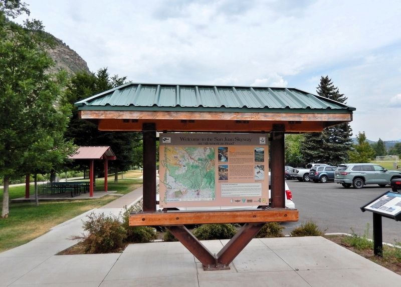
The Santa Rita Park parking lot is in the background.
The San Juan Skyway provides access to the Lizard Head Wilderness, Mt. Sneffels Wilderness, the Uncompahgre Wilderness, and the largest Wilderness in Colorado, the 499,771-acre Weminuche Wilderness. In wilderness, no motorized or mechanized equipment or travel is permitted. If you embark on a Wilderness venture, please practice Leave No Trace techniques:
• Plan ahead.
• Travel and camp on durable surfaces.
• Dispose of waste properly.
• Leave what you find.
• Minimize campfire impacts.
• Respect wildlife.
• Be considerate of other visitors.
For Your Safety
The San Juan Skyway route follows paved, state-maintained highways. The route is safe to drive year-round; however, driving conditions vary widely, especially during winter months. For up-to-date road, weather, or avalanche conditions, contact the Colorado State Patrol or the Colorado Department of Transportation Durango office, (877) 315-7623.
Taking A Hike?
• Stop by the San Juan Public Lands Center for maps and information.
• Let others know your travel plans and approximate return time.
• Carry a first aid kit.
• Carry extra clothing, jacket, and rain gear.
•
Photographed by Cosmos Mariner, July 16, 2025
4. Welcome to the San Juan Skyway Marker (west side)
• Wear a hat, sunscreen, and suitable shoes.
[photo captions]
• Mineral Creek on the San Juan Skyway.
• The Silver Lake Mill north of Silverton, circa 1910.
• Packers in Rico, circa 1890.
• Visitors on the San Juan Skyway read about the historic Rio Grande Southern Railroad at Lizard Head Pass.
• Durango & Silverton Narrow Gauge Railroad winds its way on the highline above the Animas River.
• Fireworks announce the beginning of the annual Snowdown parade.
• Far View Tower at Mesa Verde National Park.
• Ancestral Puebloan village in East Rock Canyon within Canyons of the Ancients National Monument.
• Treading Lightly at Engineer Pass on the Alpine Loop Backcountry Byway.
• Horseback riding and hunting are time-honored traditions in the San Juan Mountains.
• Backpacking in the Weminuche Wilderness.
• Climbing 14,000-foot peaks in the San Juan Mountains.
Erected by US Forest Service, Bureau of Land Management, San Juan Mountains Association and the City of Durango.
Topics. This historical marker is listed in these topic lists: Indigenous Peoples and Communities • Parks & Recreational Areas • Roads & Vehicles • Settlements & Settlers. A significant historical year for this entry is 1988.
Location. 37° 15.639′ N, 107° 52.685′ W. Marker is in Durango, Colorado, in La Plata County. It can be reached from Santa Rita Drive just west of South Camino Del Rio (Highway 160/550). The interpretive kiosk and marker are at the southeast corner of the parking lot in Santa Rita Park. Touch for map. Marker is at or near this postal address: 111 South Camino Del Rio, Durango CO 81301, United States of America. Touch for directions.

Regionally, this marker is in the American Mountain West and at the Four Corners. Globally, it is in North America, the Rocky Mountains, the Western Hemisphere, the Western World, and the Anglosphere. Historically, it finds itself in what was once the territory of the Ancestral Puebloans.
Other nearby markers. At least 8 other markers are within walking distance of this marker: Santa Rita (here, next to this marker); Vanishing Homeland (here, next to this marker); Santa Rosa Community, circa 1948 (within shouting distance of this marker); Durango's Smelter (within shouting distance of this marker); Rose Garden (within shouting distance of this marker); Emma Sweeny — Movie Star (about 400 feet away, measured in a direct line); Hollywood of the Rockies (about 400 feet away); Let The Good Times Roll (approx. ¼ mile away). Touch for a list and map of all markers in Durango.
Also see . . .
1. San Juan Skyway Scenic and Historic Byway (Wikipedia).
Excerpt: The byway forms a loop in southwestern Colorado traversing the heart of the San Juan Mountains. Mesa Verde National Park was one of the original UNESCO World Heritage Sites. The Silverton Historic District and the Telluride Historic District are National Historic Landmarks.(Submitted on January 15, 2026, by Cosmos Mariner of Cape Canaveral, Florida.)
It roughly parallels the routes of the narrow gauge railways: Rio Grande Southern (US 160, SH 145 and SH 62); and the unconnected Ouray and Silverton Branches of the Denver & Rio Grande along US 550 with the Silverton Railroad bridging a part of the gap. Its origin can be traced to the Around the Circle Route promoted by the D&RG.
The San Juan Skyway overlaps with the Trail of the Ancients Scenic and Historic Byway on Colorado State Highway 145 between U.S. Highway 160 and Colorado State Highway 184. The San Juan Skyway connects with the Tracks Across Borders Scenic and Historic Byway at Durango, the Alpine Loop Back Country Byway at Silverton and Ouray, and the Unaweep Tabeguache Scenic Byway at Placerville.
2. San Juan Skyway (Colorado Department of Transportation).
Excerpt: Start with the major towns along the route - Durango, a well-preserved descendant of the Old West; picturesque Telluride, renowned for world-class skiing and film, jazz, and bluegrass festivals; and Silverton and Ouray, Victorian jewels tucked in deep alpine valleys. Add another crown - Mesa Verde National Park, home to one of the densest collections of prehistoric ruins in the U.S. - and five million acres of undisturbed national forest. Then there are the roads themselves, snaking through the woods in the shadow of impressive 14,000-foot peaks. The segment from Ouray to Silverton is called the “Million Dollar Highway.” But you can't put a price tag on this experience.(Submitted on January 15, 2026, by Cosmos Mariner of Cape Canaveral, Florida.)
The San Juan Skyway was designated by the U.S. Secretary of Transportation as an All-American Road, the highest level of designation, in 1996. It is one of 13 America's Byways® designated in Colorado.
Credits. This page was last revised on February 18, 2026. It was originally submitted on January 15, 2026, by Cosmos Mariner of Cape Canaveral, Florida. This page has been viewed 107 times since then. Photos: 1, 2, 3, 4. submitted on January 15, 2026, by Cosmos Mariner of Cape Canaveral, Florida.
