Powderhorn in Gunnison County, Colorado — The American Mountains (Southwest)
The Old Spanish Trail
1829-1848
| — | Silver Thread Colorado Scenic and Historic Byway | — |
Photographed by Cosmos Mariner, July 21, 2025
1. The Old Spanish Trail Marker
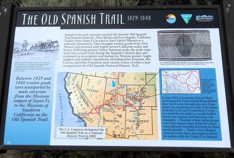
Between 1829 and 1848 woolen goods were transported by mule caravans from the Mexican outpost of Santa Fe to the Missions of Southern California on the Old Spanish Trail.
Annual mule pack caravans traveled the historic Old Spanish Trail between Santa Fe, New Mexico and Los Angeles, California. Traders from Santa Fe headed to San Gabriel Mission as a welcome destination. They brought woolen goods from New Mexico and returned with highly prized California mules and horses. Following ancient Native American trails, the trade route went into central Utah during the Spanish Colonial days and continued as an emigrant trail during the Mexican period. Anglo trappers and military expeditions, including John Fremont, Kit Carson, and John Gunnison used various routes of what is now recognized as the Old Spanish National Historic Trail.
In June 1853, Lieutenant Edward Beale accompanied by Gwinn Harris Heap detailed their travel route through this area. Heap wrote “we crossed the two forks of the Jaroso [Cebolla Creek and Powderhorn Creek] … we rested for the night by a small shallow brook very marshy, and swarming with mosquitos. …
this page online
Erected by Western Colorado Interpretive Association and Bureau of Land Management, U.S. Department of the Interior.
Topics and series. This historical marker is listed in these topic lists: Hispanic Americans • Indigenous Peoples and Communities • Industry & Commerce • Roads & Vehicles. In addition, it is included in the Old Spanish National Trail series list. A significant historical year for this entry is 1829.
Location. 38° 17.649′ N, 107° 13.301′ W. Marker is in Powderhorn, Colorado, in Gunnison County. It is on State Highway 149 at milepost 93, just west of County Road 25, on the right when traveling south. The marker is in a pull-out on the west side of the highway. Touch for map. Marker is in this post office area: Powderhorn CO 81243, United States of America. Touch for directions.

Regionally, this marker is in the Colorado High Rockies. It is also in the American Mountain
Courtesy Museum of New Mexico, #139985
2. Marker detail: Mule Pack Caravan
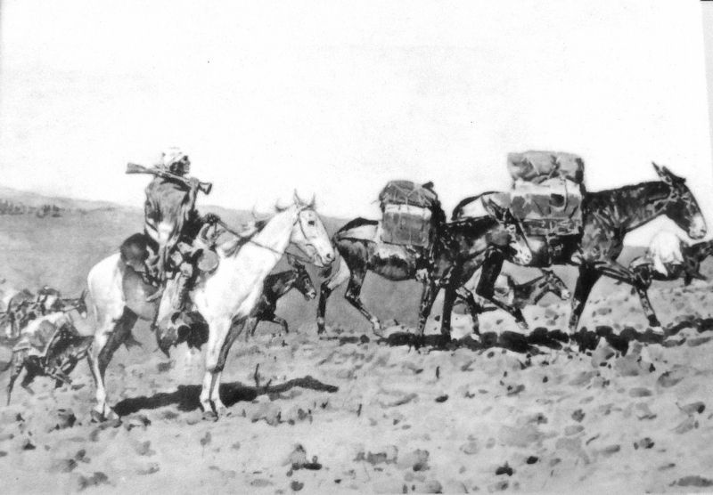
Mules carried woolen goods from northern New Mexico to California on annual pack caravans between 1829 and 1848.
Painting by Frederick Remington. Image from The Old Santa Fe Trail by Henry Inman.
Painting by Frederick Remington. Image from The Old Santa Fe Trail by Henry Inman.
Other nearby markers. At least 8 other markers are within 13 miles of this marker, measured as the crow flies: Saguache and San Juan Toll Road (here, next to this marker); Lost in a Blizzard (here, next to this marker); People of the Shining Mountains (approx. 3.9 miles away); Keeping the Peace (approx. 3.9 miles away); Powderhorn Valley (approx. 5.3 miles away); Forming a Pinnacle (approx. 12.1 miles away); If You Only Knew (approx. 12.1 miles away); Wayne N. Aspinall (approx. 12.1 miles away). Touch for a list and map of all markers in Powderhorn.
Also see . . .
1. Old Spanish Trail (Wikipedia).
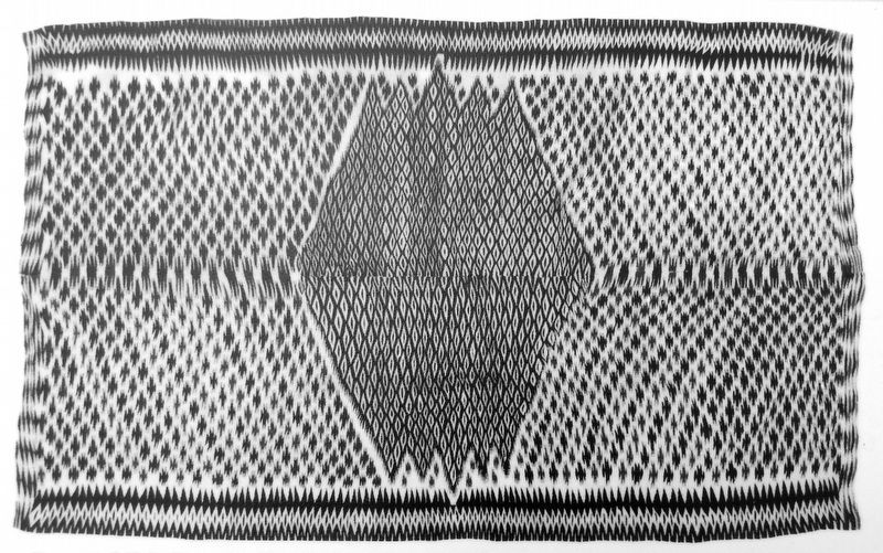
Excerpt: The Old Spanish Trail is a historic trade route that connected the Nuevo México settlements of (or near) Santa Fe with those of Los Angeles and the rest of Alta California. Approximately 700 miles long, the trail ran through areas of high mountains, arid deserts, and deep canyons. It is considered one of the most arduous of all trade routes ever established in the United States. Explored,(Submitted on January 18, 2026, by Cosmos Mariner of Cape Canaveral, Florida.)in part, by Spanish explorers as early as the late 16th century, the trail was extensively used by traders with pack trains from about 1830 until the mid-1850s. The area was part of Mexico from Mexican independence in 1821 to the Mexican Cession to the United States in 1848.Courtesy Fort Lewis College — Center for Southwest Studies3. Marker detail: Pre-1850 Frazada-style blanket was an important trade item
2. Old Spanish National Historic Trail (National Park Serivce).
Excerpt: It took the vision and courage of Mexican trader Antonio Armijo to lead the first commercial caravan from Abiquiú, New Mexico to Los Angeles in late 1829. Following suit over the next twenty years, Mexican and American traders continued to use routes similar to the one he pioneered, frequently trading with Indian tribes along the way. It was from a combination of the indigenous footpaths, early trade and exploration routes, and horse and mule routes that the trail network known collectively as the “Old Spanish Trail” evolved. There was money to be made in transporting serapes and other woolen goods from New Mexico to Los Angeles and in wrangling California-bred horses and mules back to Santa Fe.(Submitted on January 19, 2026, by Cosmos Mariner of Cape Canaveral, Florida.)After the United States took control of the Southwest in 1848, other routes to California emerged, a wagon route was opened to southern California, and use of the Old Spanish Trail sharply declined.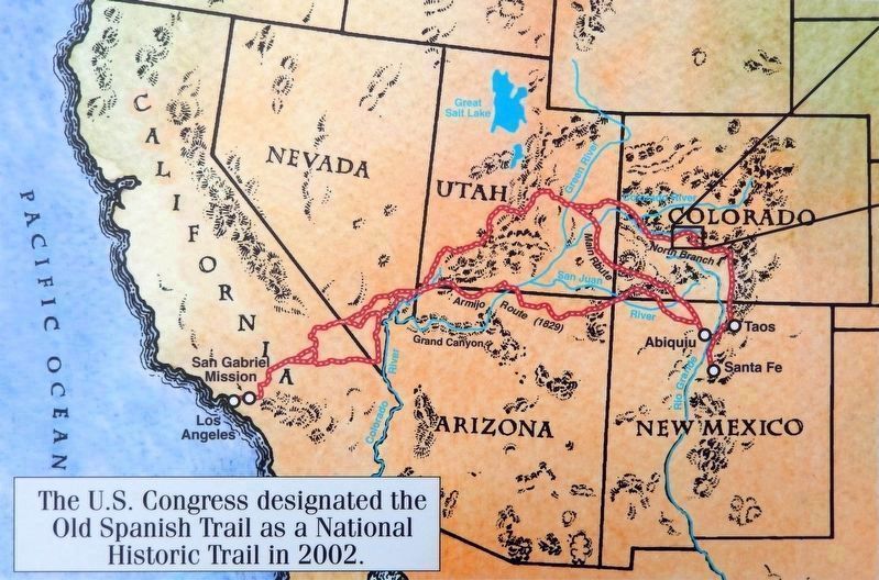 4. Marker detail: Historic Otto Mears Tollroads in the 1880s.The U.S. Congress designated the Old Spanish Trail as a National Historic Trail in 2002.
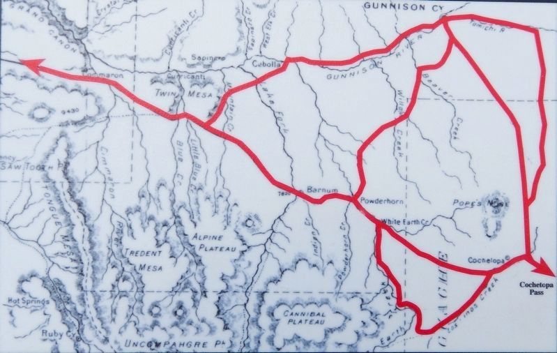
5. Marker detail: Various routes of the Old Spanish Trail between 1830 and 1850
Base Map — Historic Otto Mears Tollroads in the 1880s.
Photographed by Cosmos Mariner, July 21, 2025
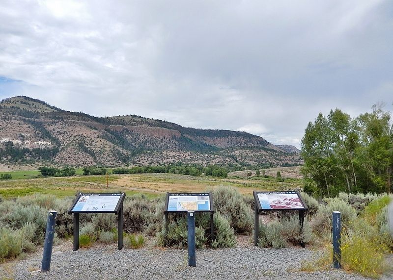
6. The Old Spanish Trail Marker
This is the center one of three interpretive panels at this location.
Credits. This page was last revised on January 19, 2026. It was originally submitted on January 15, 2026, by Cosmos Mariner of Cape Canaveral, Florida. This page has been viewed 97 times since then. Photos: 1, 2, 3, 4, 5, 6. submitted on January 18, 2026, by Cosmos Mariner of Cape Canaveral, Florida.
