Knoxville in Weverton in Washington County, Maryland — The American Northeast (Mid-Atlantic)
Goodloe E. Byron
1929-1978
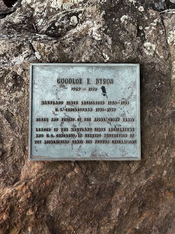
Photographed by Carter Hughes, January 19, 2026
1. Goodloe E. Byron Marker
Maryland State Legislator 1963-1971
Hiker and friend of the Appalachian Trail
Leader in the Maryland State Legislator and U.S. Congressman in seeking the protection of the Appalachian Trail for future generations
Topics. This historical marker is listed in these topic lists: Government & Politics • Natural Features • Parks & Recreational Areas • Roads & Vehicles.
Location. 39° 19.937′ N, 77° 40.59′ W. Marker is in Weverton, Maryland, in Washington County. It is in Knoxville. It can be reached from Appalachian Trail. Touch for map. Marker is at or near this postal address: 340 Albert Roelkey Ln, Knoxville MD 21758, United States of America. Touch for directions.

Regionally, this marker is in Western Maryland. It is also in the American Mid-Atlantic, in Appalachia, and specifically in Northern Appalachia. Globally, it is in North America, the Western Hemisphere, the Western World, and the Anglosphere. Historically, it finds itself in what was once one of the original Thirteen Colonies.
Other nearby markers. At least 8 other markers are within
this page online
More about this marker. The marker lies on the Weverton Cliffs overlook from the Appalachian Trail.
Credits. This page was last revised on January 28, 2026. It was originally submitted on January 24, 2026, by Carter Hughes of Harpers Ferry, West Virginia. This page has been viewed 40 times since then. Last updated on January 25, 2026, by Carter Hughes of Harpers Ferry, West Virginia. Photo 1. submitted on January 24, 2026, by Carter Hughes of Harpers Ferry, West Virginia. • Devry Becker Jones was the editor who published this page.
