
Fermanagh Township near Macedonia in Juniata County, Pennsylvania — The American Northeast (Mid-Atlantic)
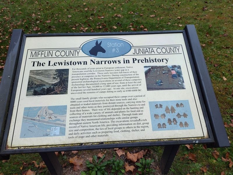
The Lewistown Narrows in Prehistory
Mifflin County
⎯⎯⎯
Juniata County
Photographed by Craig Doda, October 19, 2025
1. The Lewistown Narrows in Prehistory Marker
The small family groups who occupied these camps over a period of 8000 years used local materials for their stone tools and also obtained or traded materials from distant sources, carrying stone for tools and other items as they journeyed through the Narrows to and from their homes. Their way of life depended on the hunting and collecting of a wide variety of animals and plants for food and as sources of materials for clothing and shelter.. Through trade and exchange they maintained relationships
this page online
(Marker Number Station #3.)
Topics. This historical marker is listed in these topic lists: Anthropology & Archaeology • Indigenous Peoples and Communities • Roads & Vehicles.
Location. 40° 36.618′ N, 77° 26.615′ W. Marker is near Macedonia, Pennsylvania, in Juniata County. It is in Fermanagh Township. It is at the intersection of William Penn Highway and Reservoir Road, on the right when traveling north on William Penn Highway. Touch for map. Marker is at or near this postal address: 17 William Penn Highway, Mifflintown PA 17059, United States of America. Touch for directions.

Regionally, this marker is in the American Northeast, in the Mid-Atlantic, in Appalachia, and specifically in Northern Appalachia. Globally, it is in North America, the
Photographed by Craig Doda, October 19, 2025
2. The Lewistown Narrows in Prehistory Marker
Other nearby markers. At least 8 other markers are within 4 miles of this marker, measured as the crow flies: Pennsylvania Mainline Canal Juniata Division (here, next to this marker); The Lewistown Narrows: A Vital Transportation Corridor (here, next to this marker); The Lock-Keeper (a few steps from this marker); Feeder Pond and Spillway (a few steps from this marker); Lift Lock No. 13 (within shouting distance of this marker); Lewistown Narrows Canal Park (about 300 feet away, measured in a direct line); Mifflintown (approx. 3½ miles away); Westminster Presbyterian Cemetery World War Memorial Avenue of Trees (approx. 3.6 miles away).
Credits. This page was last revised on January 27, 2026. It was originally submitted on January 26, 2026, by Craig Doda of Napoleon, Ohio. This page has been viewed 39 times since then. Photos: 1, 2. submitted on January 26, 2026, by Craig Doda of Napoleon, Ohio. • Andrew Ruppenstein was the editor who published this page.
