Williamsburg, Virginia — The American South (Mid-Atlantic)
Eastern State Hospital Cemetery
Photographed by Evan Dwyer, January 5, 2026
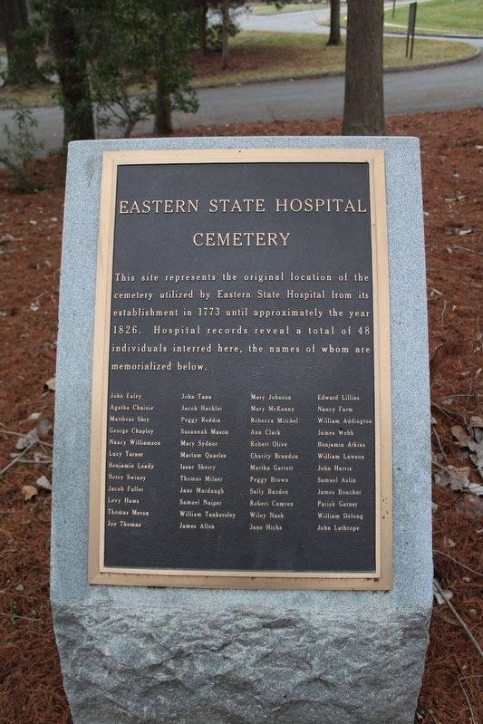
1. Eastern State Hospital Cemetery Marker
John Ealey • Agatha Chainie • Mattheas Shry • George Chapley • Nancy Williamson • Lucy Turner • Benjamin Leady • Betey Swiney • Jacob Fuller • Levy Haws • Thomas Meron • Joe Thomas • John Tann • Jacob Hackler • Peggy Reddin • Susannah Mason • Mary Sydnor • Martam Quarles • Issac Sherry • Thomas Milner • Jane Murdaugh • Samuel Napier • William Tankersley • James Allen • Mary Johnson • Mary McKenny • Rebecca Mitchel • Ann Clark • Robert Olive • Charity Brandon • Martha Garrett • Peggy Brown • Sally Bazden • Robert Camron • Wiley Nash • Jane Hicks • Edward Lillins • Nancy Farm • William Addington • James Webb • Benjamin Atkins • William Lawson • John Harris • Samuel Aslin • James Boucher • Parish Garner • William Delong • John Lathrope
Topics. This historical marker is listed in these topic lists: Cemeteries & Burial Sites • Charity & Public Work • Science & Medicine. A significant historical year for this entry is 1773.
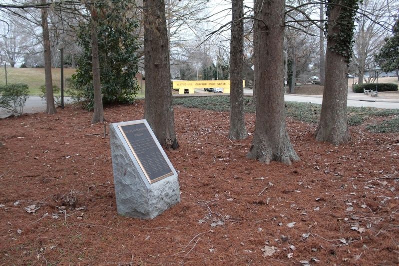
Location. 37° 16.002′ N, 76° 42.225′ W. Marker is in Williamsburg, Virginia. It is at the intersection of Newport Avenue and South Nassau Street, on the right when traveling east on Newport Avenue. Marker is across from South Nassau Street at the edge of the parking lot for The National Center for State Courts. Touch for map. Marker is at or near this postal address: 300 Newport Avenue, Williamsburg VA 23185, United States of America. Touch for directions.

Regionally, this marker is on Virginia’s Peninsula, in Coastal Virginia, and in the Hampton Roads Metropolitan Area. It is also in the American South, specifically
this page online
Other nearby markers. At least 8 other markers are within walking distance of this marker: Revolutionary War Patriots (about 400 feet away, measured in a direct line); Galt (about 400 feet away); The Public Hospital of 1773 (approx. 0.2 miles away); Williamsburg Bray School (approx. ¼ mile away); Travis House (approx. ¼ mile away); Site of First Baptist Church (approx. ¼ mile away); African American Baptist Meetinghouse Exhibit (approx. ¼ mile away); Hartwell Perry’s Tavern (approx. 0.3 miles away). Touch for a list and map of all markers in Williamsburg.
Another marker is no longer nearby. Williamsburg Confederate Monument (was about 400 feet away but has been permanently removed).
Photographed by Evan Dwyer, January 5, 2026
2. Eastern State Hospital Cemetery Marker
Credits. This page was last revised on February 2, 2026. It was originally submitted on February 1, 2026, by Evan Dwyer of Richmond, Virginia. This page has been viewed 83 times since then. Photos: 1, 2. submitted on February 1, 2026, by Evan Dwyer of Richmond, Virginia. • Bernard Fisher was the editor who published this page.
