
Wailuku in Maui County, Hawaii — Hawaiian Island Archipelago (Pacific Ocean)
Kūka'emoku - 'Īao Needle
Photographed by Darren Jefferson Clay, December 7, 2025
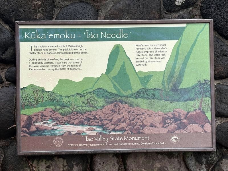
1. Kūka'emoku - 'Īao Needle Marker
The traditional name for this 2,250 foot high peak is Küka'emoku. The peak is known as the phallic stone of Kanaloa, Hawaiian god of the ocean.
During periods of warfare, the peak was used as a lookout by warriors. It was here that some of the Maui warriors retreated from the forces of Kamehameha I during the Battle of Kepaniwai.
Kúka'emoku is an erosional remnant. It is at the end of a ridge comprised of a denser dike stone. The softer rock around the dike stone was eroded by streams and waterfalls.
Topics. This historical marker is listed in these topic lists: Indigenous Peoples and Communities • Natural Features • Religion & Religious Structures • Wars, Non-US.
Location. 20° 52.831′ N, 156° 32.806′ W. Marker is in Wailuku, Hawaii, in Maui County. It can be reached from 'Iao Needle Lookout Trail and Ethnobotanical Loop west of Iao Valley Road. Touch for map. Marker is at or near this postal address: 898 Iao Valley Rd, Wailuku HI 96793, United States of America. Touch for directions.

Regionally, this marker is in Lahaina and West Maui. Globally,
this page online
Other nearby markers. At least 8 other markers are within walking distance of this marker: Nā Wai 'Ehā - The Four Waters of Maui (a few steps from this marker); Battle of Kepaniwai - Uniting the Islands (within shouting distance of this marker); Lā'au - The Plants of 'Īao (within shouting distance of this marker); Wahi Pana o Nā Ali'i (Sacred Place of the Chiefs) (about 400 feet away, measured in a direct line); Ka 'Ikena o 'Īao - Sites of 'Īao (about 400 feet away); Ka Wai Ola O Kāne (The Living Waters of Kāne) (about 400 feet away); Kūka‘emoku (about 500 feet away); Dedicated to the victims of the March 11, 2011 earthquake and tsunami in Japan (approx. 0.7 miles away). Touch for a list and map of all markers in Wailuku.

Photographed by Darren Jefferson Clay, December 7, 2025
2. Kūka'emoku - 'Īao Needle Marker
Credits. This page was last revised on February 5, 2026. It was originally submitted on February 1, 2026, by Darren Jefferson Clay of Duluth, Georgia. This page has been viewed 81 times since then. Photos: 1, 2. submitted on February 4, 2026, by Darren Jefferson Clay of Duluth, Georgia. • Devry Becker Jones was the editor who published this page.
