Wailuku in Maui County, Hawaii — Hawaiian Island Archipelago (Pacific Ocean)
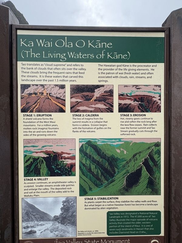
Ka Wai Ola O Kāne (The Living Waters of Kāne)
Photographed by Darren Jefferson Clay, December 7, 2025
1. Ka Wai Ola O Kane (The Living Waters of Kane) Marker
Iao translates as "cloud supreme" and refers to the bank of clouds that often sits over the valley. These clouds bring the frequent rains that feed the streams. It is these waters that carved this landscape over the past 1.5 million years.
The Hawaiian god Kane is the procreator and the provider of the life giving elements. He is the patron of wai (fresh water) and often associated with clouds, rain, streams, and springs.
Stage 1: Eruption
A shield volcano forms the foundation of the West Maui mountains. For a million years, molten rock (magma) fountains into the air and runs down the sides of the growing volcano.
Stage 2: Caldera
The loss of magma from the summit results in a collapse that forms a caldera. Erosion begins with the formation of gullies on the flanks of the volcano.
Stage 3: Erosion
Hot, steamy gases continue to rise and soften the rock long after the lava flow ceases. Rain collects near the former summit and Iao Stream gradually cuts through the softened rock.
Stage 4: Valley
As erosion continues, an amphitheater valley is sculpted. Smaller streams erode side gulches and
this page online
Stage 5: Stabilization
As plants carpet the surface, they stabilize the valley walls and floor. But what began as a native Hawaiian forest has become a landscape dominated by alien vegetation.
Iao Valley was designated a National Natural Landmark in 1972. The 47,000 acres of Iao Valley illustrate the major episode of volcanic activity that created the older, western portion of the island of Maui. It is one of seven such landmarks in Hawali that also includes Diamond Head on O'ahu.
Topics and series. This historical marker is listed in these topic lists: Environment • Natural Features • Parks & Recreational Areas • Religion & Religious Structures. In addition, it is included in the National Natural Landmarks series list. A significant historical year for this entry is 1972.
Location. 20° 52.841′ N, 156° 32.732′ W. Marker is in Wailuku, Hawaii, in Maui County. It can be reached from the intersection of Iao Needle Lookout Trail and Ethnobotanical Loop and Iao Valley Road, on the right when traveling west. Touch for map.
Photographed by Darren Jefferson Clay, December 7, 2025
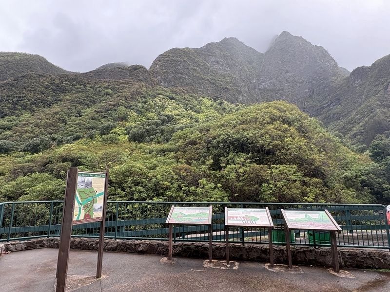
2. Ka Wai Ola O Kane (The Living Waters of Kane) Marker (marker on backside of tri-panel on left)

Regionally, this marker is in Lahaina and West Maui. Globally, it is in North America, Polynesia, the Pacific Ocean, North Pacific, the Pacific Rim, the Western Hemisphere, the Western World, and the Anglosphere.
Other nearby markers. At least 8 other markers are within walking distance of this marker: Ka 'Ikena o 'Īao - Sites of 'Īao (here, next to this marker); Wahi Pana o Nā Ali'i (Sacred Place of the Chiefs) (here, next to this marker); Kūka‘emoku (a few steps from this marker); Lā'au - The Plants of 'Īao (within shouting distance of this marker); Battle of Kepaniwai - Uniting the Islands (about 300 feet away, measured in a direct line); Nā Wai 'Ehā - The Four Waters of Maui (about 400 feet away); Kūka'emoku - 'Īao Needle (about 400 feet away); Dedicated to the victims of the March 11, 2011 earthquake and tsunami in Japan (approx. 0.6 miles away). Touch for a list and map of all markers in Wailuku.
Credits. This page was last revised on February 6, 2026. It was originally submitted on February 1, 2026, by Darren Jefferson Clay of Duluth, Georgia. This page has been viewed 84 times since then. Photos: 1, 2. submitted on February 4, 2026, by Darren Jefferson Clay of Duluth, Georgia. • Devry Becker Jones was the editor who published this page.
