Hopelawn in Perth Amboy in Middlesex County, New Jersey — The American Northeast (Mid-Atlantic)
Who Was Arthur Kill?
| — | Thomas Mundy Peterson Park | — |
Photographed by George Cortés, February 7, 2026
1. Who Was Arthur Kill? Marker
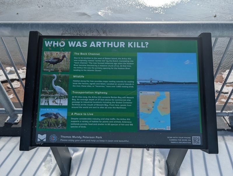
The Back Channel
Due to its location to the west of Staten Island, the Arthur Kill was originally named "achter kill" by the Dutch, translating into "back channel." The river formed millennia ago when the Hudson River became blocked by a massive chunk of ice. At that time, the Arthur Kill was the primary opening of the Hudson River leading to the Atlantic Ocean.
Wildlife
HAbitat along the river provides major nesting colonies for wading birds like herons, egrets and ibises. Located on several islands in the river, these sites, or "heronries," have over 1,400 nesting birds.
Transporting Highway
At 10 miles long, the Arthur Kill connects Raritan Bay with Newark Bay. An average depth of 37 feet allows for commercial ship passage to industrial locations including the Global Container Terminal at the mouth of Newark Bay. From here, goods from around the world are sent to sites all over the Northeast.
A Place to Live
Despite considerable industry and ship traffic, the Arthur Kill supports a variety of habitat for plants and animals. Extensive wetlands provide food and shelter to 60 species of fish and 195 species
this page online
Erected by Middlesex County; City of Perth Amboy.
Topics. This historical marker is listed in these topic lists: Colonial Era • Natural Features • Waterways & Vessels.
Location. 40° 30.789′ N, 74° 15.61′ W. Marker is in Perth Amboy, New Jersey, in Middlesex County. It is in Hopelawn. It can be reached from High Street north of Washington Street, on the right when traveling north. Touch for map. Marker is at or near this postal address: 26 Washington St, Perth Amboy NJ 08861, United States of America. Touch for directions.

Regionally, this marker is in New Jersey’s Central Jersey, in Greater Princeton, and in the New York City Metropolitan Area. It is also in the American Northeast, in the Mid-Atlantic, and on the Eastern Seaboard. Globally, it is in the North Atlantic Region, North America, the Western Hemisphere, the Western World, and the Anglosphere. Historically, it finds itself in what was once New Netherland and also one of the original Thirteen Colonies.
Other nearby markers. At least 8 other markers are within walking distance
Photographed by George Cortés, February 7, 2026
2. Who Was Arthur Kill? Marker
Credits. This page was last revised on February 8, 2026. It was originally submitted on February 7, 2026, by George Cortés of Arlington, Virginia. This page has been viewed 78 times since then. Photos: 1. submitted on February 7, 2026, by George Cortés of Arlington, Virginia. 2. submitted on February 8, 2026, by George Cortés of Arlington, Virginia. • Devry Becker Jones was the editor who published this page.
