Great Kills on Staten Island in Richmond County, New York — The American Northeast (Mid-Atlantic)
Crescent Beach Park
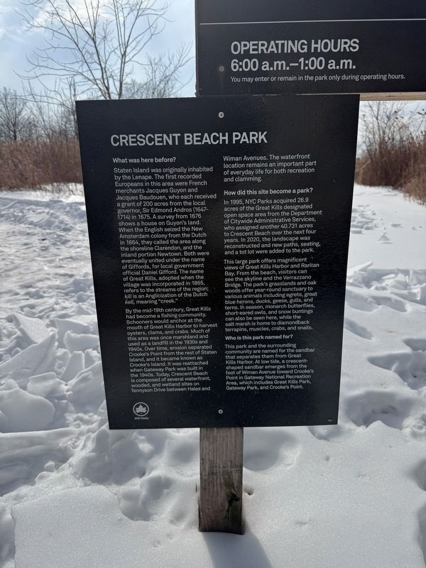
What was here before?
Staten Island was originally inhabited by the Lenape. The first recorded Europeans in this area were French merchants Jacques Guyon and Jacques Baudoeun, who each received a grant of 200 acres from the local governor, Sir Edmond Andros (1647-1714) in 1675. A survey from 1676 shows a house on Guyon's land. When the English seized the New Amsterdam colony from the Dutch in 1664, they called the area along the shoreline Clarendon, and the inland portion Newtown. Both were eventually united under the name of Giffords, for local government official Daniel Gifford. the name of Great Kills, adopted when the village was incorporated in 1865, refers to the streams of the region; kill is an Anglicization of the Dutch kell, meaning "creek."
By the mid-19th century, Great Kills had become a fishing community. Schooners would anchor at the mouth of Great Kills Harbor to harvest oysters, clams, and crabs. Much of this area was once marshland and used as a landfill in the 1930s and 1940s. Over time, erosion separated Crooke's Point from the rest of Staten Island, and it became known as Crooke's Island. It was
this page online
How did this site become a park?
In 1995, NYC Parks acquired 26.9 acres of the Great Kills designated open space area from the Department of Citywide Administrative Services, who assigned another 40.731 acres to Crescent Beach over the next four years. In 2020, the landscape was reconstructed and new paths, seating and a tot lot were added to the park.
This large park offers magnificent views of Great Kills Harbor and Raritan Bay. From the beach, visitors can see the skyline and the Verrazzano Bridge. The park's grasslands and oak woods offer year-round sanctuary to various animals including egrets, great blue herons, ducks, geese, gulls, and terns. In season, monarch butterflies, short-eared owls, and snow buntings can also be seen here, while the salt marsh is home to diamondback terrapins, muscles, crabs, and snails.
Who is this park named for?
This
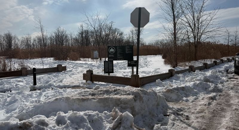
Erected by NYC Parks. (Marker Number 301.)
Topics and series. This historical marker is listed in these topic lists: Colonial Era • Parks & Recreational Areas • Settlements & Settlers • Waterways & Vessels. In addition, it is included in the NYC Parks series list. A significant historical year for this entry is 1675.
Location. 40° 32.221′ N, 74° 8.729′ W. Marker is on Staten Island, New York, in Richmond County. It is in Great Kills. It is at the intersection of Tennyson Drive and Crescent Beach Road, on the left when traveling west on Tennyson Drive. Touch for map. Marker is at or near this postal address: 252 Tennyson Dr, Staten Island NY 10308, United States of America. Touch for directions.

Regionally, this marker is in New York City. It is also in the American Northeast, in the Mid-Atlantic, and on the Eastern Seaboard. Globally, it is in the North Atlantic Region, North America, the Western Hemisphere, the Western World, and the Anglosphere. Historically, it finds itself in what was once New Netherland and also one of the original Thirteen Colonies.
Other nearby markers. At least 8 other markers are within 3 miles of this marker, measured as the crow flies: Seaside Wildlife Nature Park (approx. ¼ mile away); Lt. John H. Martinson (approx. 0.9 miles away); St. Alban’s Episcopal Church (approx. 0.9 miles away); The Great Kills Veterans Memorial (approx. one mile away); Veterans of All Wars (approx. 1.6 miles away); Roald Amundsen Memorial (approx. 2.1 miles away); Site of the Richmond County Jail (approx. 2.3 miles away); Rezeau-Van Pelt Family Cemetery (approx. 2.3 miles away). Touch for a list and map of all markers in Staten Island.
Credits. This page was last revised on February 8, 2026. It was originally submitted on February 8, 2026, by Devry Becker Jones of Washington, District of Columbia. This page has been viewed 56 times since then. Photos: 1, 2. submitted on February 8, 2026, by Devry Becker Jones of Washington, District of Columbia.
