Makena in Maui County, Hawaii — Hawaiian Island Archipelago (Pacific Ocean)
Volcanoes and Sand Beaches
Photographed by Darren Jefferson Clay, December 6, 2025
1. Volcanoes and Sand Beaches Marker
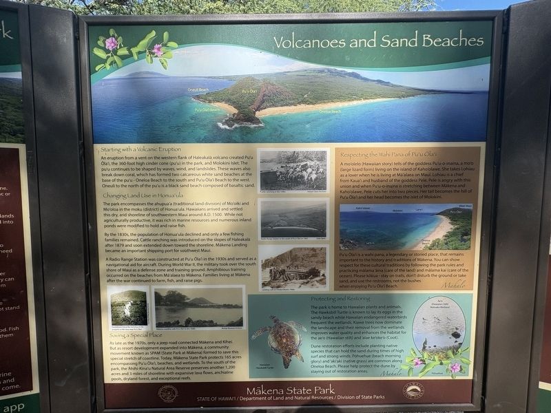
Starting with a Volcanic Eruption
An eruption from a vent on the western flank of Haleakala volcano created Pu'u Ola'i, the 360 foot high cinder cone (pu'u) in the park, and Molokini Islet. The pu'u continues to be shaped by waves, wind and landslides. These waves also break down coral, which has formed two calcareous white sand beaches at the base of the pu'u-Oneloa Beach to the south and Pu'u Ola'i Beach to the west. Oneuli to the north of the pu'u is a black sand beach composed of basaltic sand.
Changing Land Use in Honua'ula
The park encompasses the ahupua'a (traditional land division) of Mo'oiki and Mo'oloa in the moku (district) of Honua'ula. Hawaiians arrived and settled this dry, arid shoreline of southwestern Maui around AD. 1500. While not agriculturally productive, it was rich in marine resources and numerous inland ponds were modified to hold and raise fish.
By the 1830s, the population of Honua'ula declined and only a few fishing families remained. Cattle ranching was introduced on the slopes of Haleakala after 1879 and soon extended down toward the shoreline. Makena Landing became an important
this page online
A Radio Range Station was constructed at Pu'u Ola'i in the 1930s and served as a navigational aid for aircraft. During World War I, the military took over the south shore of Maul as a defense zone and training ground. Amphibious training occurred on the beaches from Ma'alaea to Makena. Families living at Makena after the war continued to farm, fish, and raise pigs.
Saving a Special Place
As late as the 1970s, only a jeep road connected Makena and Kihei. But a resort development expanded into Makena, a community movement known as SPAM (State Park at Makena) formed to save this special stretch of coastline. Today, Makena State Park protects 165 acres encompassing Pu'u Ola'i, beaches, and wetlands. To the south of the park, the Ahihi Kina'u Natural Area Reserve preserves another 1,200 acres and 3 miles of shoreline with expansive lava flows, anchialine pools, dryland forest, and exceptional reefs.
Respecting the Wahi Pana of Pu'u Ola'i
A mo'olelo (Hawaiian story) tells of the goddess Pu'u-o-inaina, a mo'o (large lizard form) living on the island of Kaho'olawe. She takes Lohiau as

Photographed by Darren Jefferson Clay, December 6, 2025
2. Volcanoes and Sand Beaches Marker
Pu'u Ola'i is a wahi pana, a legendary or storied place, that remains important to the history and traditions of Makena. You can show respect for these cultural traditions by following the park rules and practicing malama'aina (care of the land) and malama kai (care of the ocean. Please kokua stay on trails, don't disturb the ground or take sand, and use the restrooms, not the bushes when enjoying Pu'u Ola'i Beach.
Protecting and Restoring
The park is home to Hawaiian plants and animals. The Hawksbill Turtle is known to lay eggs in the sandy beach while Hawaiian endangered waterbirds frequent the wetlands Kiawe trees now dominate the landscape and their removal from the wetlands improves water quality and enhances the habitat for the ae'o (Hawaiian stilt) and 'alae ke'oke'o (Coot).
Dune restoration

Photographed by Darren Jefferson Clay, December 6, 2025
3. Volcanoes and Sand Beaches Marker
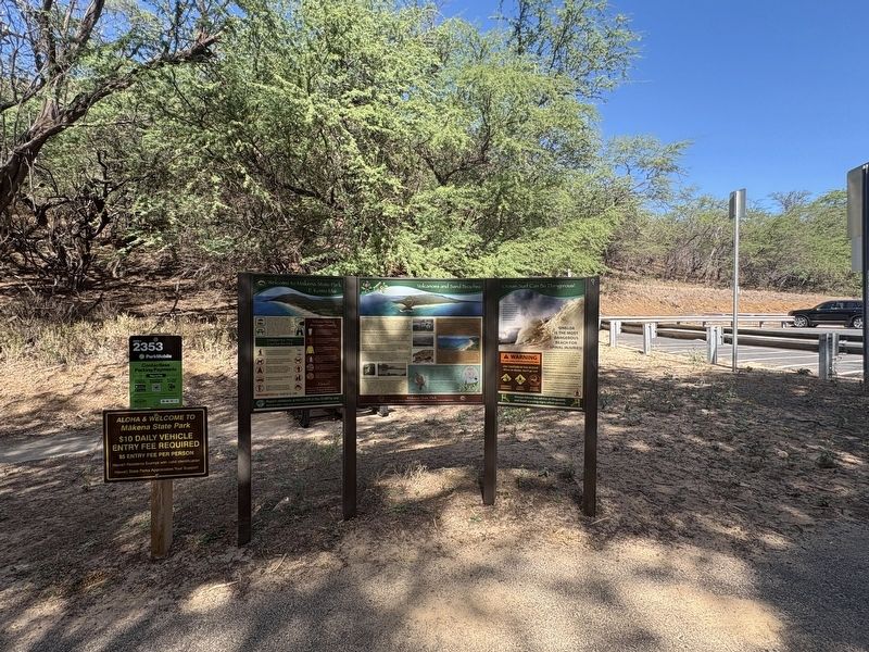
Ocean Surf Can Be Dangerous! Ocean waves in Hawai'i are powerful and can cause injury. The steep incline of the beach here creates stronger waves. Do not remain in the shorebreak zone. A WARNING For your safety, heed all posted park signs USE CAUTION IN THE OCEAN! When in doubt, don't go out DANGEROUS SHOREBREAK STRONG CURRENTS NO BODY- BOARDING ONELOA IS THE MOST DANGEROUS BEACH FOR SPINAL INJURIES! The shorebreak at Oneloa Beach can be very dangerous. Ocean swells approach rapidly from deep water and the waves crash directly on the sand. High surf, particularly during the spring and summer months, generates dangerous shorebreak waves and powerful rip currents. Always use caution and respect the ocean! Did you know? Small waves can be as dangerous as large ones. Waves in Hawaii travel at 35 miles per hour as compared to 12 mph in Florida
Photographed by Darren Jefferson Clay, December 6, 2025
4. Volcanoes and Sand Beaches Marker
Topics. This historical marker is listed in these topic lists: Anthropology & Archaeology • Indigenous Peoples and Communities • Parks & Recreational Areas • Settlements & Settlers. A significant historical year for this entry is 1500.
Location. 20° 38.056′ N, 156° 26.86′ W. Marker is in Makena, Hawaii, in Maui County. It can be reached from Makena Road south of Makena Keonopio Road, on the left when traveling north. Marker can be found along trail to the Makena Beach. Touch for map. Marker is at or near this postal address: 6450 Makena Road, Makawao HI 96768, United States of America. Touch for directions.

Regionally, this marker is in Upcountry Maui. Globally, it is in North America, in Polynesia, in the Pacific Ocean, in North Pacific, on the Pacific Rim, in the Western Hemisphere, in the Western World, and in the Anglosphere.
Other nearby markers. At least 8 other markers are within 14 miles of this marker, measured as the crow flies: Scandinavian Migration to Hawaii (approx. 11.1 miles away); Ko Lalo Kuilani Aloha (approx. 11.3 miles away); Guardian of Sea-Going People (approx. 11.7 miles away); Submarine Communications Buoy (approx. 11.7 miles away); Master Navigators (approx. 11.7 miles away); Holy Ghost Catholic Church (approx. 11.8 miles away); On Foot...By Horse... ...Then Carriages and Cars (approx. 13.2 miles away); Welcome to the Lahaina Pali Trail (approx. 13.2 miles away).
Credits. This page was last revised on February 11, 2026. It was originally submitted on February 9, 2026, by Darren Jefferson Clay of Duluth, Georgia. This page has been viewed 49 times since then. Photos: 1, 2, 3, 4. submitted on February 10, 2026, by Darren Jefferson Clay of Duluth, Georgia. • Devry Becker Jones was the editor who published this page.
