
Yorktown in York County, Virginia — The American South (Mid-Atlantic)
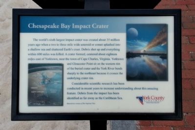
Chesapeake Bay Impact Crater
Photographed by Bernard Fisher, April 20, 2013
1. Chesapeake Bay Impact Crater Marker
The world’s sixth largest impact crater was created about 35 million years ago when a two to three mile wide asteroid or comet splashed into a shallow sea and shattered Earth’s crust. Debris shot up and everything within 600 miles was killed. A crater formed, centered about eighteen miles east of Yorktown, near the town of Cape Charles, Virginia. Yorktown and Gloucester Point sit on the western rim of the buried crater and the York River bends sharply to the northeast because it crosses the underlying crater rim.
Considerable scientific research has been conducted in recent years to increase understanding about this amazing feature. Debris from the impact has been identified as far away as the Caribbean Sea.
Erected 2010 by York County, Virginia.
Topics. This historical marker is listed in these topic lists: Science & Medicine • Waterways & Vessels.
Location. Marker is missing. It was located near 37° 14.134′ N, 76° 30.317′ W. Marker was in Yorktown, Virginia, in York County. It could be reached from Water Street west of Comte de Grasse Street, on the right
this page online

Regionally, this marker was on Virginia’s Peninsula, in Coastal Virginia, and in the Hampton Roads Metropolitan Area. It was also in the American South, specifically in the Upper South, and in the Tidewater. Globally, it was in the North Atlantic Region, North America, the Western Hemisphere, the Western World, and the Anglosphere. Historically, it found itself in what was once the territory of the Mississippian Culture, one of the original Thirteen Colonies, one of the Confederate States of America, and the Antebellum South.
Other nearby markers. At least 8 other markers are within walking distance of this location: An Archer House (within shouting distance of this marker); Remembering Ancestors (within shouting distance of this marker); Yorktown’s Waterfront (within shouting distance of this marker); York Under Siege 1781 (within shouting distance of this marker); York “Under The Hill” (within shouting distance of this marker); Yorktown Waterfront
Photographed by Bernard Fisher, April 20, 2013
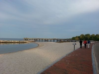
2. Yorktown's Riverwalk
Other markers no longer nearby. Pirates in Yorktown? (was here, next to this marker but has been confirmed missing); The Brig Betsy (was about 300 feet away but has been confirmed missing); Yorktown's Sunken Fleet (was about 300 feet away but has been confirmed missing).
Related marker. Click here for another marker that is related to this marker.
Credits. This page was last revised on February 16, 2026. It was originally submitted on April 21, 2013, by Bernard Fisher of Richmond, Virginia. This page has been viewed 1,368 times since then and 76 times this year. Last updated on February 15, 2026, by Evan Dwyer of Richmond, Virginia. Photos: 1, 2. submitted on April 21, 2013, by Bernard Fisher of Richmond, Virginia. • Devry Becker Jones was the editor who published this page.
