Padre Island near Corpus Christi in Kleberg County, Texas — The American South (West South Central)
One of a Kind
Photographed by Dave W, February 27, 2026
1. One of a Kind Marker

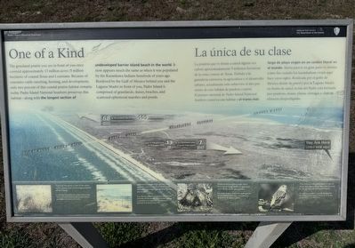
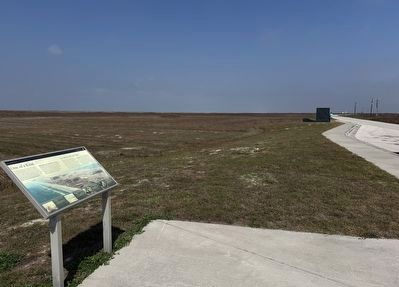
The grassland prairie you see in front of you once covered approximately 13 million acres (5 million hectares) of coastal Texas and Louisiana. Because of extensive cattle ranching, farming, and development, only two percent of this coastal prairie habitat remains today. Padre Island National Seashore preserves this habitat - along with the longest section of undeveloped barrier island beach in the world. It now appears much the same as when it was populated by the Karankawa Indians hundreds of years ago. Bordered by the Gulf of Mexico behind you and the Laguna Madre in front of you, Padre Island is comprised of grasslands, dunes, beaches, and scattered ephemeral marshes and ponds.
Picture 1 caption
Seacoast bluestem is one of the many native plants that covers large portions of the island.
Picture 2 caption
Ephemeral ponds form during rainy periods, nourish multiple plats and animals, and evaporate quickly during dry weather.
Picture 3 caption
Texas pocket gophers make their burrows in deep drifts of sand and feed off the roots and grasses.
Picture 4 caption
The yellow-rumped warble, is one of many migratory
this page online
Spanish Translation
Picture 1 caption
La hierba Schizachirtam scoparium es una de las muchas plantas nativas que cubren grandes estensiones de la isla.
Picture 2 caption
Las charcas edimeras se forman durante los periodos de llivia, nutren a muchas plantas y animales y se evaporan rápidamente durante la estacíon seca.
Picture 3 caption
Las túzas texanas hacen sus madrigueras
Photographed by Dave W, February 27, 2026
2. One of a Kind Marker
Picture 4 caption
El chine coronado es una de las muchas aves migratorias que pueden verse en las praderas de la Isla Padre.
Erected by Padre Island National Seashore / National Park Service.
Topics. This historical marker is listed in these topic lists: Agriculture • Environment • Indigenous Peoples and Communities.
Location. 27° 29.459′ N, 97° 16.807′ W. Marker is near Corpus Christi, Texas, in Kleberg County. It is on Padre Island. It is on Park Road 22 7½ miles south of Sea Pines Drive, on the right when traveling south. Touch for map. Marker is at or near this postal address: 20301 Park Rd 22, Corpus Christi TX 78418, United States of America. Touch for directions.

Regionally, this marker is on the American Gulf Coast. Globally, it is in North America, a Gulf of Mexico state, the Western Hemisphere, the Western World, and the Anglosphere. Historically, it finds itself in what was once New Spain, the Republic of Texas, and one of the Confederate States of America.
Other nearby markers. At least 8 other markers are within 11 miles of this marker, measured as the crow flies: They Came ... and Left (here, next to this marker); Padre Island National Seashore (within shouting distance of this marker); Novillo Line Camp (approx. 2 miles away); Padre Island and Padre Nicolas Balli (approx. 7.6 miles away); The Pat Dunn Ranch (approx. 10 miles away); Coastal Hide, Tallow and Packing Industries (approx. 10 miles away); Skirmish at Corpus Christi Pass (approx. 10 miles away); Duncan Cemetery (approx. 10.6 miles away). Touch for a list and map of all markers in Corpus Christi.
Credits. This page was last revised on March 2, 2026. It was originally submitted on February 28, 2026, by Dave W of Co, Colorado. This page has been viewed 44 times since then. Photos: 1, 2. submitted on February 28, 2026, by Dave W of Co, Colorado. • James Hulse was the editor who published this page.
