Padre Island in Corpus Christi in Nueces County, Texas — The American South (West South Central)
Novillo Line Camp

Photographed by Dave W, February 27, 2026
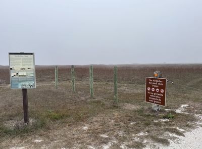
1. Novillo Line Camp Marker

The buildings you see in the distance are all that is left of the open range cattle ranching on Padre Island. Cowboys built Novillo Line Camp using materials taken from the beach. This was one of four camps placed at 15-mile intervals on the island.
Petroleum companies once explored here for oil and gas during the cattle ranching era. Now restored to a natural wetland, the area provides good habitat for birds.
A short trip to the end of the boardwalk offers you glimpses into cattle ranching, gas exploration, wetlands, and beach scavenging.
Keeping with Tradition
Just like the cowboys of yesteryear, we repair this line camp by picking up "free" building materials from the beach.
Oil in a National Park?
Standing here in the 1970s you would have seen a gas processing plant off in the distance. Oil and gas exploration still goes on today in the park.
Rest Stop Ahead
This short trail passes through a restored wetland that offers thousands of migratory birds a rest stop.
20th Century Cowboys with Sunglasses?
On this island cowboys or "vaqueros" herded cattle for over 100 years. Ranching continued
this page online
Spanish Translation
Antes, en la época cuando la ganadería dominaba la isla, las compañías petroleras sondaron aquí, buscando gas y petróleo. Ahora los humedales se han recuperado, proporcionando un hábitat excelente para las aves.
Un paseo hasta el fin de esta pasarela le ofrecerá unos vistazos a la historia de la ganadería, la exploración petrolera, los humedales y el rebuscar de materiales desde la playa.
Conservando la tradición
Igual como los vaqueros de antaño, reparamos este sitio histórico por la tradición de recoger las materiales gratis que encontramos en la playa.
Petróleo en un parque nacional?
Si hubiera estado aquí en los años 1970 hubiera visto una planta
Photographed by Dave W, February 27, 2026
2. Novillo Line Camp Marker
Parada de descanso delante
Este sendero corto pasa por un humedal restaurado que ofrece una parada de descanso a miles de las aves migratorias.
¿Ganaderos con lentes para sol en el siglo XX?
En esta isla los vaqueros han arreado manadas por más de 100 años. La crianza de ganado continuó hasta los años 1970. Estos jinetes, empleados de la familia Dunn, regresaron en 1976 aquí al Novillo Line Camp para representar las históricas prácticas de los vaqueros de la isla del Padre.
Erected by Padre Island National Seashore / National Park Service.
Topics. This historical marker is listed in these topic lists: Agriculture • Animals • Environment • Hispanic Americans. A significant historical year for this entry is 1970.
Location. 27° 27.795′ N, 97° 17.444′ W. Marker is in Corpus Christi, Texas, in Nueces County. It is on Padre Island. It is at the intersection of Bird Island Basin Road and Park Rd 22, on the right when traveling north on Bird Island Basin Road. Touch for map. Marker is at or near this postal
Photographed by Dave W, February 27, 2026
3. Novillo Line Camp Marker
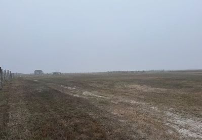
Approaching the Novillo Line Camp from the trail.

Regionally, this marker is in the American South and on the Gulf Coast. Globally, it is in North America, a Gulf of Mexico state, the Western Hemisphere, the Western World, and the Anglosphere. Historically, it finds itself in what was once New Spain, the Republic of Texas, and one of the Confederate States of America.
Other nearby markers. At least 8 other markers are within 13 miles of this marker, measured as the crow flies: Padre Island National Seashore (approx. 2 miles away); They Came ... and Left (approx. 2 miles away); One of a Kind (approx. 2 miles away); Padre Island and Padre Nicolas Balli (approx. 9.6 miles away); The Pat Dunn Ranch (approx. 12 miles away); Coastal Hide, Tallow and Packing Industries (approx. 12 miles away); Skirmish at Corpus Christi Pass (approx. 12 miles away); Duncan Cemetery (approx. 12½ miles away). Touch for a list and map of all markers in Corpus Christi.
Credits. This page was last revised on March 2, 2026. It was originally submitted on March 1, 2026, by Dave W of Co, Colorado. This page has been viewed 51 times since then. Photos: 1, 2, 3. submitted on March 1, 2026, by Dave W of Co, Colorado. • James Hulse was the editor who published this page.
