South Side in San Antonio in Bexar County, Texas — The American South (West South Central)
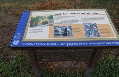
Yturri-Edmunds House and Mill
Photographed by Dave W, March 8, 2026
1. Yturri-Edmunds House and Mill Marker
After Mission Conceptión, located downstream from this site, was secularized beginning in the 1790s, the surrounding fields were distributed to Indians and other local residents. Manuel Yturri de Castillo received property here along the river in 1823, which he farmed until his death. Yturri's widow, Maria Josefa, died in 1849 after a brief marriage to stonemason Thomas Whitehead, and he then managed the property for the Yturri children. Whitehead dammed the river and built a small mill and house here in the late 1850s. After he Yturri's daughter Vicenta married Ernest Edmunds, the couple raised their three children here. The children never married and remained in the family home. The youngest, Miss Ernestine as she was called, bequeathed the house and mill ruins to the San Antonio Conservation Society when she died in 1961. The Society restored the property, added three historic buildings from other parts of the city, and opened the site for educational programs and public tours.
[Captions:]
Ernestine Edmunds complete this painting of the old mill adjoining her house in 1934. The mill was in ruins by the 1960s and was reconstructed by the San Antonio Conservation Society with assistance from engineer and mill historian Ernst Schuchard.
Ernestine Edmunds's career as an elementary school teacher spanned fifty years. Miss Ernestine is seen here with her horse, Gunpowder, that she rode sidesaddle to work early in her career.
The San Antonio River once traveled very close to the Yturri-Edmunds house (red point) as shown in this aerial view circa 1955. The river was channelized in the 1960's and its natural path to the house was filled in with dirt. The channelization diverted flow to the river's current path 165 yards away from its original path.
Erected by San
this page online
Topics. This historical marker is listed in these topic lists: Agriculture • Education • Waterways & Vessels • Women. A significant historical year for this entry is 1823.
Location. 29° 23.93′ N, 98° 29.32′ W. Marker is in San Antonio, Texas, in Bexar County. It is in the South Side. It is on South River Walk west of Mission Road, on the right when traveling west. Touch for map. Marker is at or near this postal address: 2 Mission Rd, San Antonio TX 78210, United States of America. Touch for directions.

Regionally, this marker is in South Texas. It is also in the American South. Globally, it is in North America, a Gulf of Mexico state, the Western Hemisphere, the Western World, and the Anglosphere. Historically, it finds itself in what was once New Spain, the Republic of Texas, and one of the Confederate States of America.
Other nearby markers. At least 8 other markers are within walking distance of this marker: Edgewood Independent School District (a few steps from this marker); Mill on the Pajalache Acequia (within shouting distance of this marker); San Antonio River Flood Control Tunnel
Photographed by Dave W, March 8, 2026
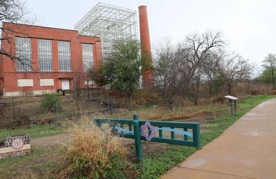
2. Yturri-Edmunds House and Mill Marker
Credits. This page was last revised on March 12, 2026. It was originally submitted on March 10, 2026, by Dave W of Co, Colorado. This page has been viewed 23 times since then. Photos: 1, 2. submitted on March 10, 2026, by Dave W of Co, Colorado. • Devry Becker Jones was the editor who published this page.
